

Official X account for the National Weather Service in Jackson, KY. Details: https://nitter.cf/t.co/VRIGBjGw8P
- Tweets40.4K
- Following256
- Followers13.7K
- Likes18.1K




ALT A National Weather Service graphic titled "Forecasting for The Road Ahead.” Today: highs 65°–70°, lows 42°–50°, Rain Late, with a 10% to 70% chance of precipitation. Monday: highs 52°–58°, lows 24°–36°, Rain tapers off, with a 30% to 0% chance of precipitation. Tuesday: highs 46°–56°, lows 27°–36°, Sunny and Cool, with a 0% to 10% chance of precipitation. Wednesday: highs 50°–56°, lows 32°–43°, PM Rain, with a 50% to 80% chance of precipitation. Thanksgiving Day: highs 48°–54°, lows 26°–40°, Cool and Rainy, with a 60% to 20% chance of precipitation.

ALT Weather infographic issued by NWS Jackson, KY at 4:41 PM EST and titled "Eastern KY Thanksgiving Weather Outlook". Lows tonight 38° - 51°. Sunday: Precipitation Chances 10 → 50%, Rain Chances Mainly at Night, Highs 65° - 71°, Sunday night Lows 44° - 51°. Monday: Precipitation Chances 40 → 0%, AM Rain Chances Mainly in the Southeast, Highs 53° - 59°, Monday night lows 28° - 35°. Tuesday: Precipitation Chances 0 → 20%, Rain Chances at Night Mainly in the Southwest, Highs 46° - 56°, Tuesday night lows 28° - 37°. Wednesday: Precipitation Chances 40 → 60%, Rain Chances Especially afternoon and at Night, Highs 49° - 55°, Wednesday night lows 35° - 43°. Thanksgiving Day: Precipitation Chances 30 → 20%, Chance of Rain, Highs 50° - 54°, Thursday night lows 32° - 39°. Footer: weather.gov/jkl - @nwsjacksonky.

ALT Eastern Kentucky Weather Outlook graphic. Today: Partly cloudy, highs 65°–70°, lows 38°–51°. Sunday: Slight chance of rain in far southeastern Kentucky, highs 64°–68°, lows 43°–50°. Monday: Chance of rain, highs 53°–60°, lows 26°–36°. Tuesday: Sunny and cooler, highs 46°–56°, lows 28°–37°.

ALT Low pressure traveling along the southeast coast will bring an increase in clouds for the area during the weekend, and perhaps some light rain in extreme eastern Kentucky.

ALT National Weather Service Jackson, KY (@nwsjacksonky) 3-Day Outlook graphic issued 11/20/26 at 5:21 AM. Today (sun and fog icon): Highs 65° to 71°, lows 31° to 43°, precipitation 0%. Saturday (sunny icon): Highs 66° to 71°, lows 34° to 47°, precipitation 0%. Sunday (sunny icon): Highs 66° to 70°, lows 41° to 48°, precipitation 10% to 40%. More details at weather.gov/jkl.

ALT Clear skies continue into this weekend with above normal daytime temperatures. A cold front Sunday night into Monday brings low rain chances but also will bring a pattern change to below normal temperatures that will stick around through next week.

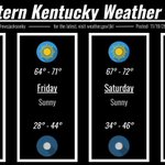
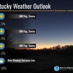
ALT Graphic titled "Eastern Kentucky Weather Outlook," posted November 19, 2026, at 6:07 AM. Four-day forecast: Thursday: AM Fog, Sunny; highs 64–69°F, lows 27–44°F, 0 to 0% rain chance. Friday: AM Fog, Sunny; highs 65–70°F, lows 33–44°F, 0 to 0% rain chance. Saturday: AM Fog, Sunny; highs 66–72°F, lows 38–47°F, 0 to 0% rain chance. Sunday: Rain Chances Increase Late; highs 64–70°F, lows 42–49°F, 10 to 30% rain chance. Includes the NOAA National Weather Service logo and weather.gov/jkl.

ALT Clear skies will continue to prevail, with just some occasional thin high clouds through Saturday. Some patchy fog is possible late tonight in river valleys and near lakes. Daytime temperatures will continue to slowly rise each day, while nighttime lows will see a sharper increase heading into the weekend.

ALT An infographic from the National Weather Service (NWS) Jackson, KY, on a dark blue background with a radio tower illustration on the left and the NWS logo at the bottom right. Top text reads, "It's That Time Again – Today Around 11am: The Weekly Weather Radio Test". In the center is the "NWS Jackson, KY NOAA Weather Radio Coverage Map" featuring the NOAA All Hazards Weather Radio logo. It color-codes counties across eastern and southcentral Kentucky by transmitter coverage—South central (pink), Northern (blue), Southeast (yellow), and overlapping zones (green and orange)—along with red dots marking transmitter locations. Surrounding lists detail frequencies (162.400–162.550 MHz) and call signs for 20 regional transmitters, including Somerset, Morehead, Hazard, Jackson, and Pikeville. Bottom text reads: "for more info, go to weather.gov/jkl/weatherradio".

ALT National Weather Service Jackson, Kentucky graphic titled "The Forecast Ahead." Forecast from Wednesday through Sunday: Wednesday: Sunny, highs 63° to 68°, lows 28° to 40°, 0% chance of precipitation. Thursday: Sunny, highs 64° to 69°, lows 29° to 40°, 0% chance of precipitation. Friday: Sunny, highs 64° to 70°, lows 34° to 46°, 0% chance of precipitation. Saturday: Sunny, highs 66° to 70°, lows 43° to 49°, 0% chance of precipitation. Sunday: Partly sunny with a chance of rain, highs 63° to 69°, lows 38° to 47°, 20% to 30% chance of precipitation. Footer text reads: @NWSJacksonKY, weather.gov/jkl, posted 11/18/26 at 5:27 AM.

ALT Clear skies are expected through the end of the week as the jet stream remains well displaced from the area and high pressure remains in control. Valley fog can be expected each late night into morning in the river valleys and near lakes.


ALT White text on blue background reads 'This is only a TEST' with FEMA logo below.

ALT Description: A weather graphic over a photo of fog in forested mountains displays a five-day forecast and key messages. Transcription: The header reads @nwsjacksonky and weather.gov/jkl. Key Messages as of 11/17/26 7:00 AM state: High pressure yields dry weather and a warming trend through the work week. Expect valley fog at night, lingering into mornings. Rain chances return this weekend. The Today forecast shows mostly sunny skies with fog, highs of 56 to 63, lows of 27 to 42. Wednesday shows mostly sunny skies with fog, highs of 62 to 66, lows of 28 to 43. Thursday shows sunny skies, highs of 64 to 68, lows of 30 to 44. Friday shows sunny skies, a 0 to 5 percent precipitation chance, highs of 65 to 71, lows of 34 to 45. Saturday shows partly sunny skies, a 20 percent precipitation chance, highs of 66 to 71, lows of 44 to 49 degrees.

ALT "Near-Term Weather Outlook" graphic by NWS Jackson, KY (@nwsjacksonky - weather.gov/jkl). Posted: 11/16/26 5:20 PM. Forecast details: • Tonight: 26°-36°. CLEAR; PATCHY RIVER VALLEY FOG. • Tuesday: 56° - 63°. PATCHY RIVER VALLEY FOG EARLY; MOSTLY SUNNY. • Wednesday: 62° - 67°. MOSTLY SUNNY. • Thursday: 63° - 69°. MOSTLY SUNNY. Photo: A calm lake bordered by wooded hills with late-autumn foliage under a blue sky with wispy clouds, framed by nearly bare branches in the foreground.

ALT National Weather Service Jackson, Kentucky weather graphic titled "mild days and chilly nights ahead." Today: AM fog, sunny; highs 53° to 60°, lows 24° in valleys to 35° on ridges. Tuesday: AM fog, sunny; highs 58° to 64°, lows 27° in valleys to 40° on ridges. Wednesday: AM fog, sunny; highs 62° to 68°, lows 28° in valleys to 43° on ridges. Posted 11/16/26 at 9:06 AM; weather.gov/jkl, @nwsjacksonky.

ALT Special Weather Statement issued by National Weather Service Jackson KY until 900 AM EST Mon Nov 16 2026. PATCHY DENSE FREEZING FOG WILL IMPACT PARTS OF THE AREA NEAR RIVERS AND LAKES EARLY THIS MORNING. Product valid for Knox, Estill, McCreary, Owsley, Lee, Pulaski, Powell, Whitley, Clay, Jackson, Wayne, Bell, Laurel, and Rockcastle Counties in Kentucky. Product text: At 400 AM EST, Satellite imagery is starting to indicate a potential for patchy dense freezing fog near the larger rivers and lakes. This could lead to slick spots on area roads, particularly bridges and overpasses along with railings, ramps, and elevated decks. Visibilities may be reduced to a quarter mile or less in fog. PRECAUTIONARY/PREPAREDNESS ACTIONS... Use low beam headlights in areas of fog and slow down. Monitor the weather situation and be alert for slick spots when you venture out this morning.


ALT Patchy fog can surprise you: Be ready for sudden changes in visibility. Turn on your low-beam headlights when approaching fog. Drive slowly, and keep your distance from other vehicles. Use extra caution on bridges and in valleys. weather.gov

ALT A satellite image of Eastern Kentucky. There are clouds north and east of a line extending from Powell to Breathitt and then back down to Bell Counties. West of that line, fog is noted in McCreary, Pulaski, Laurel, and Rockcastle Counties, especially along the rivers in those counties.

ALT Special Weather Statement Graphic. Valid through 9 AM EST on 11/15/26. PATCHY DENSE FREEZING FOG WILL IMPACT PARTS OF LAUREL, OWSLEY, ROCKCASTLE, LEE, ESTILL, JACKSON, PULASKI, WAYNE, WHITLEY, CLAY, KNOX, AND MCCREARY COUNTIES. This could lead to slick spots on area roads, particularly bridges and overpasses along with railings, ramps, and elevated decks. Visibilities may be reduced to a quarter mile or less in fog. Use low beam headlights in areas of fog and slow down. Monitor the weather situation and be alert for slick spots when you venture out this morning.

ALT "THE FORECAST AHEAD" graphic by NWS Jackson, KY (@NWSJACKSONKY - WEATHER.GOV/JKL). Posted: 11/15/26 6:01 PM. Forecast details: • Tonight: Partly cloudy (PoPs: 0%). Lows: 21° - 36°. • Monday: Fog early, mostly sunny (PoPs: 0%). Highs: 53° - 60°, Lows: 23° - 32°. • Tuesday: Sunny (PoPs: 0%). Highs: 56° - 62°, Lows: 25° - 34°. • Wednesday: Sunny (PoPs: 0%). Highs: 62° - 67°, Lows: 30° - 36°. • Thursday: Partly cloudy (PoPs: 0%). Highs: 63° - 69°, Lows: 33° - 40°. Photo: Bare deciduous trees silhouetted against a twilight sky overlooking wooded hills.

ALT National Weather Service graphic titled "Looking Out At The Forecast." The five-day forecast reads: Today: Slight chance rain (Far Eastern KY), highs 46°–54°, lows 21°–36°, precipitation 20% to 0%. Monday: AM fog, then sunny, highs 53°–61°, lows 23°–36°, precipitation 0%, with an alert that freezing fog is possible in valleys. Tuesday: Sunny, highs 57°–64°, lows 24°–39°, precipitation 0%. Wednesday: Sunny, highs 61°–67°, lows 27°–35°, precipitation 0%. Thursday: Mostly sunny, highs 63°–69°, lows 31°–39°, precipitation 0%.
ALT Patchy fog can surprise you: Be ready for sudden changes in visibility. Turn on your low-beam headlights when approaching fog. Drive slowly, and keep your distance from other vehicles. Use extra caution on bridges and in valleys. weather.gov
ALT A satellite image of Eastern Kentucky. There are clouds north and east of a line extending from Powell to Breathitt and then back down to Bell Counties. West of that line, fog is noted in McCreary, Pulaski, Laurel, and Rockcastle Counties, especially along the rivers in those counties.
ALT Special Weather Statement Graphic. Valid through 9 AM EST on 11/15/26. PATCHY DENSE FREEZING FOG WILL IMPACT PARTS OF LAUREL, OWSLEY, ROCKCASTLE, LEE, ESTILL, JACKSON, PULASKI, WAYNE, WHITLEY, CLAY, KNOX, AND MCCREARY COUNTIES. This could lead to slick spots on area roads, particularly bridges and overpasses along with railings, ramps, and elevated decks. Visibilities may be reduced to a quarter mile or less in fog. Use low beam headlights in areas of fog and slow down. Monitor the weather situation and be alert for slick spots when you venture out this morning.