

Alaska's earthquake monitoring agency, headquartered at the University of Alaska Fairbanks Geophysical Institute.
Fairbanks, AK
Joined October 2013
- Tweets4.4K
- Following285
- Followers28.7K
- Likes596


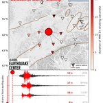


We have reviewed a magnitude 3.5 earthquake that occurred at 05:46 AM AK time. This earthquake was located 16 miles NNW of Cooper Landing and 21 miles deep. This earthquake was felt throughout Kenai Peninsula. For more information, visit: earthquake.alaska.edu/event/…

We have reviewed a magnitude 4.0 earthquake that occurred at 10:45 AM AK time. This earthquake was located 126 miles SE of Unalaska and 17 miles deep. No felt reports had been received as of the time of this post. For more information, visit: earthquake.alaska.edu/event/…

We have reviewed a magnitude 4.4 earthquake that occurred at 05:35 PM AK time. This event was located 106 miles S of King Cove and 13 miles deep. No felt reports had been received as of the time of this post. For more information, visit: earthquake.alaska.edu/event/…

We have reviewed a magnitude 4.3 event that occurred at 02:04 PM AK time. This event was located 108 miles S of King Cove and 17 miles deep. No felt reports had been received as of the time of this post. For more information, visit: earthquake.alaska.edu/event/…

We reviewed a magnitude 1.2 mining blast that occurred at 12:07 PM AK time. This event was located 7 miles NNW of Fairbanks and 0 miles deep. This mining blast was widely felt in the Goldstream neighborhood of Fairbanks. For more information, visit: earthquake.alaska.edu/event/…

November 3rd was the anniversary of the 1994 Skagway Harbor Landslide, which triggered a tsunami that killed one person and caused about $25 million in damages. While earthquakes trigger most tsunamis, some are generated by landslides at or below water in coastal areas. Alaskans are becoming more aware of landslide tsunamis, particularly following the Tracy Arm Landslide and tsunami of August 2025.
The Skagway landslide took the community by surprise. At about 7 pm, an extreme low tide destabilized an underwater slope that was overburdened by construction fill for a railway dock and cruise ship wharf. The sudden collapse of 22 million cubic yards of sediment created local waves up to 30 feet high, pulling docks loose and snapping steel sheet piles.
At the Alaska Earthquake Center, we’ve been working with coastal communities since the late 1990s to help them define their tsunami hazard. Learn more at tsunami.alaska.edu, where you will see that Skagway is now an officially tsunami-ready community.


We have reviewed a magnitude 4.2 event that occurred at 10:22 AM AK time. This event was located 20 miles S of Adak and 44 miles deep. No felt reports had been received as of the time of this post. For more information, visit: earthquake.alaska.edu/event/…

We have reviewed a magnitude 4.3 event that occurred at 2:30 AM AK time, located 15 miles ESE of Cohoe and 44 miles deep. Felt reports are coming in from throughout the Kenai peninsula and Anchorage.
For more info, please visit:
earthquake.alaska.edu/event/…

Ever wondered what happens to our previous field engineers? 💀🎃
They can't escape their final station .... ever watching, looking for that data flow.
And we thought we had issues with bears! 🐻
(No engineers were harmed in the making of this post. We are grateful for every long day and cold install.) Happy Halloween from our team to yours! 👻
#Halloween #FieldSeason #FieldWork

We have reviewed a magnitude 4.4 event that occurred at 11:11 AM AK time. This event was located 25 miles E of Glacier View and 12 miles deep. Felt reports are coming in from Anchorage, Wasilla, Valdez, and several spots along the Glenn Highway.
For more info please visit:
earthquake.alaska.edu/event/…

Take a stroll with Alaska reporter Emily Schwing through the Girdwood Ghost Forest 🪦 👻 as she explains how an earthquake created a tree cemetery 🌲 🌊 Link to her original post: facebook.com/share/v/1J4YEVT…

It’s that time of year, for a seismic spine-tingler… Not far from Girdwood rise the pale, skeletal pillars of a ghost forest. Small branches long gone, the fingers of drowned tree trunks poke the sky.
This tree cemetery is a memento of the 1964 magnitude 9.2 Great Alaska Earthquake. Before the quake, the forest grew in a freshwater area safely above high tide. But the ground beneath the trees dropped six-and-a-half feet during the tectonic jolt. Salt water from Turnagain Arm flooded the area at high tide, killing all vegetation. The ghost trees remained standing, and to this day they protrude through decades of silt carried in on the tides.
This is a haunted area—scientists digging through layers of soil found the stumps of two previous ghost forests entombed in the silt, and deciphered that large earthquakes occurred here 900 and 1,600 years ago.
Read the full story earthquake.alaska.edu/ghost-… under the Resources tab on earthquake.alaska.edu.


We have reviewed a M3.5 earthquake that occurred at 4:48 PM AK time. This event was located 17 miles W of Hope and 27 miles deep. This earthquake was widely felt around Anchorage.
For more info, visit
earthquake.alaska.edu/event/…

We have reviewed a magnitude 3.6 earthquake that occurred at 09:16 AM AK time. The quake was located 23 miles ESE of Talkeetna and 18 miles deep. Felt reports were sent in from Talkeetna, Susitna North, and Anchorage. For more information, visit: earthquake.alaska.edu/event/…

A M4.8 earthquake occurred about 60 miles southeast of Akutan at 12:34pm AKDT tonight. It doesn't seem to have stirred anyone from bed, but it was loud and clear across the network. Details: earthquake.alaska.edu/event/…

As we enter the season of spooky, this is a first: Alaska made the list of top 10 "most cursed" states for natural disasters. 👻 Um...thanks? At least the Earthquake Center got a shout-out for earthquake monitoring! legaluspokersites.com/blogs/…

What’s Shaking Alaska?!
Seismic instruments can tell us about more than earthquakes. Earlier this fall, Belgian researchers Koen Van Noten and Philippe Roux visited the Earthquake Center before heading to Eight Mile Lake, near Denali National Park. There they deployed about 100 seismic nodes as part of a project called CRISP.
Their goal is to understand how thawing permafrost affects the carbon stored in Alaska’s soils. When frozen ground thaws, water can carry some of that carbon into nearby rivers, and eventually the ocean. But we still know surprisingly little about what happens during the long Alaskan winter, when water keeps flowing under the ice and through unfrozen pockets in the soil, carrying carbon with it.
By detecting small vibrations beneath the surface, seismic sensors can track the freezing and thawing of permafrost in real time, and help determine the amount and timing of pathways for carbon to make its way to river systems.
This project highlights just one of the ways researchers from around the world utilize Alaska’s seismic data to further our understanding of a variety of Earth’s processes.
You can track the project’s progress at seismology.be/crisp.

ALT The title is What's Shaking Alaska?! Week of October 14-21, 2026. A map of Alaska in the background shows dots where earthquakes occurred. Text reads: About 600 earthquakes were detected, and 4 earthquakes were reported felt. The largest earthquake was a magnitude 5.6 northwest of Lake Minchumina on October 15.
We have reviewed a magnitude 5.4 earthquake that occurred at 2:40 AM AKDT on October 20, 2026. It was located 55 miles South of Sand Point and reported felt in nearby communities.
buff.ly/RNcluri

We have located a magnitude 4.8 that occurred at 11:14 AKDT and 42 miles East of Homer. At this time we have not received any reports of this earthquake being felt.
buff.ly/h5Lmloc

We have reviewed a magnitude 3.6 that occurred at 6:49 NW of Chugiak. The event was felt in nearby communities such a Palmer, Anchorage, and Wasilla.
buff.ly/EUHUmUS
