Photo 29 (@775firealerts) header
Photo 29 (@775firealerts) profile picture

📸🔥Photographer w/ @TrafficNewsLA

Reno, NV
Joined December 2021
Photo by Photo 29 (@775firealerts)Photo by Photo 29 (@775firealerts)Photo by Photo 29 (@775firealerts)Photo by Photo 29 (@775firealerts)Photo by Photo 29 (@775firealerts)Photo by Photo 29 (@775firealerts)Photo by Photo 29 (@775firealerts)Photo by Photo 29 (@775firealerts)Photo by Photo 29 (@775firealerts)
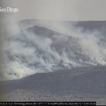
#ParkFire still burning, nearing structures.
9
71
4
261
18,411
#HawkFire is now 15,051 acres per the most recent perimeter update. Fire activity appears to have decreased as firefighters still work on containment and hot spots. Current image looking east via the Babbitt Peak camera. #Reno #Nevada #Fire #Wildfire
1
7
549
#HawkFire burning just north of #Reno is now 10,523 acres per the most recent perimeter update. Below is a current image via the Upper Peavine Peak camera. #Reno #Nevada #Fire #Wildfire
5
28
1,656
#BugFire is now 88,421 acres and 15% contained per CalFire. Attached is a current image via the Constantia camera. #Reno #Nevada #California #Fire #Wildfire #WX
1
17
982
#BugFire same camera, 1 1/2 hour difference... Image via the Constantia camera. #California #Nevada #Fire #Wildfire #WX
#BugFire has reportedly jumped Highway 395, just north of Hallelujah Junction in #LassenCounty Below is a current image of the area via the Babbitt Peak and Constantia cameras. #California #Nevada #Fire
1
2
10
1,298
#BugFire has reportedly jumped Highway 395, just north of Hallelujah Junction in #LassenCounty Below is a current image of the area via the Babbitt Peak and Constantia cameras. #California #Nevada #Fire
5
2
20
2,337
#BugFire Current image via the Chilcoot camera, looking east over Highway 395. #Reno #Nevada #Fire #Wildfire – at Reno, NV
2
1
14
609
#BugFire was mapped last night at 66,505 acres per the most recent perimeter map uploaded to NIFC. Below is a current image of western portion of the fire via the Babbitt Peak camera. #Reno #Nevada #Fire #WX – at Reno, NV
2
1
13
936
#BugFire has now been mapped at 59,664 acres per the most recent perimeter map uploaded to NIFC. Below is a current view of the northeast part of the fire, where the majority of growth is being seen. Image via the Fort Sage camera. #Reno #Nevada #Fire #Wildfire – at Reno, NV
3
19
991
#BugFire is making a run back into California, just north of the point origin. Activity can be seen just east of Highway 395 via the Babbitt Peak camera. #Reno #Nevada #Fire #WX
2
15
737
#EagleFire burning just north of #TopazLake is reportedly 5-10 acres with a moderate rate of spread per units on scene. Here is a current image via the Bald Mountain camera. #Nevada #Fire
1
2
13
430
#BugFire has been mapped at 57,363 acres per the most recent perimeter map. Attached is a current image via the Bug Fire Mobile Camera in #SpanishSprings #Reno #Nevada #Fire
1
3
12
1,412
NEW START #EagleMtnFire can be seen just north of Topaz Lake via the Bald Mountain camera. #Nevada #Fire
3
90
#StallionFire is continuing to push south along SR-447 via the Eagle Peak camera. #Reno #Nevada #Fire
1
18
766
#FloodWatch WEATHER Per @NWSReno Thunderstorms push north toward I-80 this afternoon through Friday, bringing the potential for new lightning-caused fires and gusty outflow winds of 45–55+ mph. #Reno #Nevada #WX #Fire
1
4
16
1,108
#BugFire showing activity in the Bird Springs Rd area via the Bug Fire Mobile camera in #SpanishSprings #Reno #Nevada #Fire – at Reno, NV
2
14
1,223
#BugFire appears to have woken up with activity seen in the Fred Mountain area. Image via the Upper Peavine Peak camera. #Reno #Nevada #Fire #Wildfire
2
4
16
1,260
Good morning from the #BugFire once again. Last night size and perimeter maps were updated as the #BugFire burned up to the perimeter of the #FredMtnFire. The updated size is 44,304 acres per NIFC. Current image via the Upper Peavine Peak camera. #Reno #Nevada #Fire – at Reno, NV
2
2
1
17
894