

An @AuburnWater, @ACESedu, and Office of the State Climatologist program dedicated to documenting drought’s agricultural impacts across Alabama.
- Tweets269
- Following95
- Followers109
- Likes286

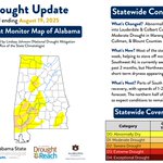




ALT Abnormally dry (D0) conditions have shifted slightly across the western half of the state. D0 expanded throughout Lauderdale & Colbert Counties and worsened to D1 Moderate Drought across Marengo County. Some areas around Birmingham, however, actually saw D0 removal and are now back to near-normal conditions. Most of AL saw 1-3 inches of rain last week, which is largely why most conditions have stayed the same. SW AL is still seeing the largest 2 month rain deficits, but NW AL is also showing signs of increasing dryness in short-term (30 day) metrics. The forecast is split this upcoming week, with parts of South AL potentially seeing 1-2 inches of rain and parts of North AL seeing less. Because of this, South AL could potentially see some drought recovery, while North AL will likely remain the same.

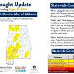
ALT D0 Abnormal Dryness is expanding across NW Alabama from Lauderdale down through Morgan Counties. Conditions in SW Counties continue to worsen towards D1 Moderate Drought. Longer-term drought metrics are still showing near-normal conditions for much of the state, but shorter-term metrics are showing signs of rapid decline. There are a few streams in NW Alabama that are starting to see low flow, and there are also areas of SW Alabama that are seeing 4+ inches of rain deficits over the past 30 days. The forecast for next week shows localized, scatter showers across the state which is typical for this time of year. That being said, parts of Central and South AL could see an 1 inch of rain, while North AL could see less. Expect many conditions to remain the same.

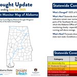
ALT Rainfall across the state ranged from 0-10 inches last week, with some areas even experiencing flash flooding. Because of the inconsistent precipitation, some counties saw drought relief while others saw drought intensify. Abnormally dry conditions improved in parts of NE, SE, & Central AL but also worsened to Moderate Drought across Jefferson County and the SW region. Forecasts for this upcoming week are varied - South AL may see 1 inch of rain, Central may see a 1/4 inch, and North AL may see even less. Expect conditions to hold steady or improve slightly where rainfall is sufficient.

ALT Nearly 1/3 of the state is experiencing abnormal dryness, and pockets of Moderate Drought are expanding across Clarke County and within the tri-state area. We had a relatively wet early summer, but much of the state is rapidly drying out now. Short-term metrics show increasing signs of dryness, which is exacerbated by increased temperatures and scattered rainfall. There are, however, some incoming systems this week that could stave off worsening conditions. Many areas (outside of a few NW counties) could receive 1-1.5 inches of rain.

ALT Abnormal dryness expanded across the tristate region and around Clarke & Cherokee Counties. Some conditions near Dale & Henry Counties also worsened to D1 Moderate Drought. Although moisture deficits continue to build in these areas, most of the state remains in near-normal conditions. The ongoing high temperatures, however, could bring rapid dryness to areas that miss out on beneficial rain. Luckily, there is 1-2 inches of forecasted rain across the state this week that could diffuse dry pockets.

ALT Abnormal dryness expanded across the tri-state area this week, including Clarke County. South Alabama is showing increasing signs of dryness, with below-normal precipitation over the past 1–2 months and declining streamflow levels. Without adequate rainfall, these areas could slip into moderate drought. However, rain is likely over the next five days, which may help stabilize or slightly improve conditions.

ALT After a month of near-normal conditions, D0 Abnormal Dryness has returned to Dale & Henry Counties. Much of the state is actually starting to see a slight drying trend, but streamflow and soil moisture levels are still holding steady. This is the time of year, however, where a few missed thunderstorms could lead to a dry spell, so conditions could remain steady in the coming days or dry out slightly depending on how much rain we get.

ALT It's been 5 weeks of 100% near-normal conditions according to the U.S. Drought Monitor. Despite above average rainfall, the ongoing high temperatures are causing some early signs of abnormal dryness in the far Southeast corner of the state and in Clarke Co. on the Southwest side. There is little rain in the forecast for the upcoming week, so expect conditions to either remain the same or degrade to abnormal dryness in some of those drier areas.

ALT Another week of 100% drought-free conditions in Alabama! Statewide short and long-term drought indicators are all showing near normal conditions. There are, however, a few parts of far Southeast counties that are starting to see below-normal rainfall. The Alabama Office of the State Climatologist is keeping an eye on these areas, especially with the above-average temperatures we are currently experiencing.

ALT Rain totals and USGS streamflow levels are at or above normal across the state, leading to another week of 100% drought-free conditions according to the U.S. Drought Monitor. Forecasts show varying amounts of rain across the state this week, so it is likely that conditions will remain the same.

ALT Most of the state received at least 0.5 inch of rain last week, with portions of Central and Southern Alabama seeing significant rainfall events. Because of this, the state remains drought-free. More rainfall is expected in the coming week, so expect conditions to remain the same.

ALT After another week of normal conditions and mild temperatures, the Alabama USDM is officially paint free! This means that the entire state is experiencing normal or wetter than normal conditions for this time of year. With another 0.5-1.5 inches of rain in the forecast this week, expect conditions to remain the same.

ALT Most of the state received anywhere from 0.5 - 6 inches of rain over the past week, with only some areas along the Florida border missing out on meaningful precipitation. Because of this, long-term metrics in Dale & Henry counties are still showing slightly dryer than normal conditions for this time of year. Forecasts show the potential for an inch or more of rain in South AL in the coming days.

ALT After several weeks of normal or above normal rainfall, Alabama is almost entirely paint free on the USDM, which means no abnormal dryness or drought. A sliver of abnormal dryness still remains on the Dale/Henry County border where long-term trends still show slight deficits, but the rest of the state is almost back to hydrologic equilibrium. Forecasts for the next 5-7 days also show significant rainfall across much of the state, but especially in North and Central Alabama.

ALT It was another wet week for Alabama, with many areas receiving upwards of 6 inches of rainfall. There were even some CoCoRaHS reports that showed 7-9 total inches in Mobile County! CoCoRaHS (Community Collaborative Rain, Hail & Snow Network)is a national program that enables citizen-based rainfall reporting. Due to the ongoing rain, D1 Moderate Drought was fully removed from Southeast Alabama and most of the state remains at or above normal conditions for this time of year. 2% of abnormal dryness still lingers in the tri-state area. Forecasts for the next week are a mixed bag in terms of precipitation. North AL may see upwards of 1 inch, while South AL may see 0-0.25 inches.

ALT Most of Alabama received above average precipitation last week, with the exception of a few counties across South AL. Because of this, abnormal dryness remains along the MS border and has worsened to D1 Moderate Drought across Dale & Geneva Counties within the tri-state area. Rainfall has been consistently lackluster within these areas over the past few weeks. Forecasts show the possibility of significant rainfall across much of AL in the coming days, but especially in the Southeast corner. Hopefully this will bring drought improvement to those areas.

ALT Despite rainfall totals being near normal for the month of April, the last two weeks have been very dry for many South and Southeastern counties. D0 Abnormal Dryness still remains in parts of West AL along the MS border, in parts of Baldwin County, and across Southeast Counties within the tristate area. The AL Office of the State Climatologist continues to watch these drying trends as we enter May, especially for our producers and home gardeners who are starting summer crops. Most of the state is predicted to get at least 0.5 inch of rain in the coming days, so expect conditions to either remain the same or potentially improve.

ALT Last week was mostly warm and dry, but statewide rainfall totals are still near normal for this time of year. North Alabama has received several inches of precipitation over the past week, but South Alabama has been missing out on some recent showers. Because of this, abnormal dryness was re-introduced along the Mississippi border and in SE counties within the tri-state area. Ongoing and expected precipitation over the next 5 days could bring 1+ inches of rain to North Alabama and nearly a quarter inch in South Alabama.

ALT Severe weather across North & Central Alabama brought upwards of 6 inches of rain last week. This significantly alleviated abnormally dry conditions in those counties, but more rain is needed across the board to address statewide deficits. 45% of the state is still drier than normal, and a splash of Moderate Drought still persists in Southwest AL. Forecasted rain amounts (1+ inches) should bring continued relief this week.