

Creating Sonoma Style before it was a thing! Producer & host of events that contribute to community.Founder of https://nitter.cf/t.co/IDvT0rJNlU
Sonoma, CA
Joined March 2011
- Tweets3.1K
- Following1.6K
- Followers1.1K
- Likes688




Julie Atwood Events retweeted

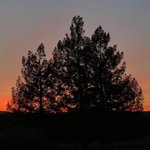
My motto has always been to carry a camera. It gets me into trouble, but not this evening. A brief break between cloud decks allows the setting sun to illuminate a parting storm above Cloverleaf Ranch in Santa Rosa, Sunday evening. @NorthBayNews @NWSBayArea

Julie Atwood Events retweeted

The morning view near 8,000’ to Half Dome/Yosemite via @YoseConservancy cams ❄️ #CAwx

Julie Atwood Events retweeted

With mountain snow making its way into the higher elevations of the Sierra/Cascades tomorrow evening into Monday morning, please make sure to check your local forecast & road conditions before you travel!
Weather:
weather.gov/sto
Roads:
quickmap.dot.ca.gov
#CAwx

Julie Atwood Events retweeted
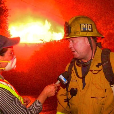
#Alisal Fire - Turkey vultures soar Saturday afternoon over the charred landscape above the Baron Ranch. The ranch is near the Tajiguas landfill along the Gaviota Coast. Meanwhile, a Sikorsky S-64 Skycrane helicopter douses a hot spot near W. Camino Cielo.


Julie Atwood Events retweeted

Julie Atwood Events retweeted

UPDATE: @CALFIRECZU says the #EstradaFire has died down and fire retardant surrounds the flames.
Get the latest here:
ksbw.com/article/prescribed-…
Photo courtesy: Felix Alfaro

Julie Atwood Events retweeted

#AlisalFire is at 16,901 acres and 41% containment. Evac Order for residences on Arroyo Quemada Ln, and the Evac Warning for area east of El Capitan Beach State Park, west of Dos Pueblos Canyon Rd, and south of West Camino Cielo has been cancelled.
Visit ReadySBC.org
Julie Atwood Events retweeted
From surplus to record lows… the difference the current 2 year drought has made on regional reservoirs. Top 3 (Shasta/Oroville/Trinity) have declined to 23.6% capacity & 38% historical avg. Note San Luis Reservoir at just 11% capacity. #CAwx


Julie Atwood Events retweeted
A Fire Weather Watch has been issued for much of #NorCal Sunday-Monday. With the very dry fuels, any thunderstorm has the potential to ignite new fire starts.

Julie Atwood Events retweeted

We are thinking of all the #firefighters, first responders, and residents in the Western United States currently battling numerous forest fires, including the widely unpredictable #BootlegFire in Oregon. Be safe, and thank you for all you do. #ThankEveryHero

Julie Atwood Events retweeted
Updated Drought Information Statement has been issued. Read here: forecast.weather.gov/product…

Julie Atwood Events retweeted
KMUX radar and lightning detection (ending at 3:24 PM) showing an impressive cell just east of Ukiah.
#CAwx
Julie Atwood Events retweeted
5:40 Radar📡 Update:
Scattered showers and a few isolated thunderstorms continue to impact portions of NorCal. Expect these showers/thunderstorms to continue into the evening hours. #CAwx 🌦️⛈️

Julie Atwood Events retweeted
⚠️ NEW: The Red Flag Warning has been extended through 6 PM Tuesday for the western portions of the Valley, Delta and Coastal Range.
Breezy winds continue through the day Tuesday with very dry conditions. Be sure to practice fire weather safety! #cawx

Julie Atwood Events retweeted
🔥 Critical fire weather conditions will continue into Tuesday. Avoid using equipment that creates sparks and make sure no vehicle parts drag on the ground. #cawx #OneLessSpark

Julie Atwood Events retweeted

Burn Decision (for 05/09/2021):
CAL FIRE and the Tehama County Fire department have declared a No Burn Day in all state and local response areas of Tehama County due to high fire danger.

Julie Atwood Events retweeted
The Red Flag Warning has been extended until 6 PM PDT Tuesday due to continued dry and breezy conditions.
#CAwx

ALT The Red Flag Warning has been extended until 6 PM PDT Tuesday due to continued dry and breezy conditions. N to NE winds 15-30 mph with gusts of 40-50 mph in the hills, locally higher. Peak winds Monday night into Tuesday morning. Expect poor humidity recoveries. Any new fire starts will likely show moderate to rapid growth.