Billy Forney 3 (@BillyForney3) header
Billy Forney 3 (@BillyForney3) profile picture

Keynote speaker on risk, money & uncertainty 9/11 survivor | Financial strategist | Storm chaser Helping leaders turn uncertainty into clarity & decisive action

West University Place, TX
Joined August 2007
Photo by Billy Forney 3 (@BillyForney3)Photo by Billy Forney 3 (@BillyForney3)Photo by Billy Forney 3 (@BillyForney3)Photo by Billy Forney 3 (@BillyForney3)Photo by Billy Forney 3 (@BillyForney3)Photo by Billy Forney 3 (@BillyForney3)Photo by Billy Forney 3 (@BillyForney3)Photo by Billy Forney 3 (@BillyForney3)Photo by Billy Forney 3 (@BillyForney3)Photo by Billy Forney 3 (@BillyForney3)
1996: soccer moms will decide this election 2026: mahjong moms will decide this election
Replying to @cd_hooks
Ken Paxton is a type of guy many Texans know
5
23
1
204
19,504
Billy Forney 3 retweeted
Writing this in my personal capacity, but I have been flying these types of aircraft for more than 20 years, with over 8,000 hours, and have reasonable familiarity with how the charter world operates. I feel compelled to post after seeing commentary about the Lear 60 crash, from missile strikes to DEI to critiquing this poor woman’s final radio calls. That last part is what I find most troubling. She was the second-in-command (SIC), and while she was empowered to point out mistakes as part of good crew resource management, she was doing her job, communicating with ATC right to the end in a terrifying situation. She likely knew before many of those calls that she was going to die. I have heard final calls from friends, from military pilots with thousands of hours in fighter aircraft, and they are just as heartbreaking because they know the end is approaching. I understand the public interest given the footage and audio. But you do not know the aircraft’s maintenance history, whether there was a structural failure, if any failure was induced by turbulence, overspeed, or overcontrol, or everything happening in that cockpit. I am sure weather will be part of the investigation, but beyond that, it is speculation. The charter industry routinely hires commercial pilots very early in their careers to gain experience alongside an ATP-qualified captain before they move up to the airlines. She would still have the appropriate training, qualifications, and checkouts by an FAA examiner or designee. Let people investigate, learn, and share the facts. Be respectful to those who perished and the families who carry their memories. God bless them and their loved ones.
2,505
11,007
894
118,866
8,765,242
Billy Forney 3 retweeted
Holy sh*t. That’s a missile
BREAKING: New footage captures the aircraft crash in Greenacres, Florida. Preliminary information suggests the aircraft that crashed is a business jet.
37
7
1
132
15,755
Billy Forney 3 retweeted
Many have been asking: "Does this at least help with the Colorado Basin water crisis?" Well, the answer is complicated. Serious costs from historic flooding vs sharp Lake Powell water level rise. Yet Powell, while rising, is still 13 feet lower than this time last year!
Yet another extreme rainfall event is currently unfolding across Arizona and the Four Corners portion of AZ, NM, UT, and CO--and very serious major to locally catastrophic/record-breaking flooding is unfolding. Some areas will see *even worse* flooding than last week by tomorrow.
13
22
2
200
23,201
Billy Forney 3 retweeted
I don’t think the hydrological event in southwest Colorado is getting enough attention. This flooding event is historic and that is not hyperbole. The San Juan River at Pagosa Springs is now expected to crest at 19.38 feet; nearly 4.5 feet higher than the historic flood just last week and almost 2 feet above its all-time record. Successive events of similar magnitudes compound impacts given that infrastructure has previously been weakened. I expect this event to cause significant damage to infrastructure across much of Southwest CO.
45
266
19
1,191
100,513
Billy Forney 3 retweeted
I feel like given all the talk about stratospheric warming and polar vortex disruption some things need to be clarified: 1. A SSW(sudden stratospheric warming) and potential subsequent reversal in winds associated with the stratospheric polar vortex DO NOT guarantee wave reflections back to the troposphere or coupling. It can have significant impacts should coupling/reflections to the lower atmosphere occur, but that is something that is still an unknown and will need to be observed in coming days and weeks. Wave reflection can have impacts sooner, coupling can take longer. 2. Notice how I said weeks… there is usually a lag period between the actual disruptive warming event/reversal itself and subsequent downward reflection and/or potential coupling. This can take time, and is still not a guarantee. 3. With the above being said this may have impacts on our pattern at 500 MB down the road come mid/late November, but right now that is TBD. In any case the Nino enhanced sub tropical jet will lead to increased storminess, with wetter and cooler potential for the southern tier of the United States as we move deeper into November, that’s just Nino climo. So while this may be exciting for winter weather enthusiasts and while this event is extraordinary given the environment and time of year it is occurring, nothing is set in stone as of yet. Could this lead to a colder pattern later into November? Yes. Could wave propagation simply be absorbed by the stratosphere leaving a weakened vortex with little downward propagation/surface effects? Also yes. (The second scenario still doesn’t preclude downward coupling later down the road) We know this will more likely than not significantly disrupt the polar vortex, but we still need to have some patience and observe downward coupling/wave propagation over the next 2-4 weeks. Canada is also going to remain quite warm during this time, so any true cold will need to originate via cross polar flow should we get enough polar blocking. Just several things to think about before we get either too hyped up, or too dismissive of this event at the moment.
5
17
4
102
24,907
Billy Forney 3 retweeted
This is amazing. Radial shear and vortex rossby waves shaping the eyewall of champi into a hexagonal shape. Similar vortex dynamics can be seen at the poles Saturn. Incredibly intense vortex represented here.
1
4
533
Billy Forney 3 retweeted
What a specimen #Champi t 7.5-8 dvorak should be somewhat weaker once it affects Taiwan to Japan’s but much larger size. But for now what a textbook super typhoon
2
6
490
Billy Forney 3 retweeted
These winds along our coast are still strong enough to elicit a High Risk of Rip Currents for our Gulf-facing beaches. Risk continues through Sunday morning. #TXwx
1
5
31
6,515
Billy Forney 3 retweeted
Here comes the "giant eraser" ... powerful mid-October cold front with dry Canadian Arctic air into this weekend. It might be chilly for some folks! Florida is not participating, of course.
35
128
13
1,041
120,595
Billy Forney 3 retweeted
We’re about 24 hours if not less from fall finally arriving in Houston. Gusty winds and temps falling off quickly by late tomorrow afternoon will likely need a light jacket by Friday evening. Will be somewhat of a shock to the system after we have had highs in the 90s all week. Enjoy!
3
2
1
8
490
Billy Forney 3 retweeted
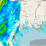
That’s definitely the sub tropical jet starting to really fire as we move towards Halloween. Going to start getting very rainy in the southern tier of the U.S. it seems.
13
15
117
4,452
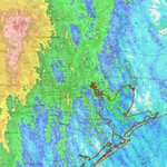
Notice that gap in the clouds down wind of Galveston Bay? It is a “bay shadow!” Cooler bay water stabilizes the air, shutting down the rising thermals that create cloud streets. This creates clear skies stretching for miles until the air warms up again. #houwx #txwx @NWSHouston
3
5
197
Billy Forney 3 retweeted
Looks like this front is shaping up to be the first "real" fall front of the season🍂 The front is expected to pass over our region on Friday, bringing cooler, drier, and breezier weather. Hazardous marine conditions are likely with this frontal passage. Mariners, stay safe!
3
37
5
217
14,117
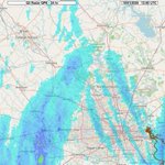
“SUMMARY...A few slow moving showers/thunderstorms are expected to impact portions of southeastern TX into western LA through the afternoon. Slow movement and high rain rates may result in Isolated flash flooding through 23Z.” #houwx #txwx
1
1
206
Allow me to geek out for a moment. I took a timelapse of sunrise this morning in Houston, & I think I captured a mesoscale low at altitude. Watch the high-based cirrocumulus clouds at ~22,000' at the top-quarter of the video’s screen. Watch their movement. Pinging: @NWSHouston
1
184
You can see large scale areas of low pressure rotating counter clockwise in the northern hemisphere on satellite, such as with a hurricane or a nor’easter. You can see microscale lows, such as tornadoes or dust devils. But, it isn’t often one can see a meso-low from the ground.
1
55
If I am correct, this is a really cool capture from the ground (and not from satellite)! This is the type of thing the naked eye would never have been able to discern in real time. But, in timelapse, this 36-second video, covering ~40 minutes in real time, caught it. Enjoy!
56