

Official account for weather enthusiasts in PR/Caribbean/USA. Cuenta oficial de aficionados a meteorología en PR/Caribe. Nuestra misión es informar/orientar.
- Tweets75.3K
- Following2.3K
- Followers55K
- Likes40.4K


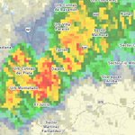




ALT National Weather Service San Juan graphic showing a Flood Advisory for Luquillo and Río Grande, valid until Fri Nov 6, 4:30 PM AST. The highlighted area identifies where minor flooding is possible or occurring, especially on roads and in urban, low-lying, or poor-drainage locations. | Gráfico del Servicio Nacional de Meteorología en San Juan que muestra una Advertencia de Inundaciones para Luquillo and Río Grande, vigente hasta vie, 6 nov, 4:30 p. m. AST. El área resaltada identifica dónde son posibles o están ocurriendo inundaciones menores, especialmente en carreteras y áreas urbanas, bajas o de pobre drenaje.

ALT National Weather Service San Juan graphic showing a Flood Advisory for Bayamón and Toa Alta, valid until Fri Nov 6, 2:45 PM AST. The highlighted area identifies where minor flooding is possible or occurring, especially on roads and in urban, low-lying, or poor-drainage locations. | Gráfico del Servicio Nacional de Meteorología en San Juan que muestra una Advertencia de Inundaciones para Bayamón and Toa Alta, vigente hasta vie, 6 nov, 2:45 pm AST. El área resaltada identifica dónde son posibles o están ocurriendo inundaciones menores, especialmente en carreteras y áreas urbanas, bajas o de pobre drenaje.

ALT National Weather Service San Juan graphic showing a Flash Flood Warning for Cabo Rojo, Hormigueros, Lajas, Las Marías, Maricao, Mayagüez, and San Germán, valid until Fri Nov 6, 3:15 PM AST. The highlighted area identifies where dangerous flash flooding is occurring or expected, with possible rapid stream rises and flooded roads. | Gráfico del Servicio Nacional de Meteorología en San Juan que muestra un Aviso de Inundaciones Repentinas para Cabo Rojo, Hormigueros, Lajas, Las Marías, Maricao, Mayagüez, and San Germán, vigente hasta vie, 6 nov, 3:15 pm AST. El área resaltada identifica dónde están ocurriendo o se esperan inundaciones repentinas peligrosas, con posibles aumentos rápidos en quebradas y carreteras inundadas.

ALT National Weather Service San Juan graphic showing a Flood Advisory for Cabo Rojo, Hormigueros, Lajas, Las Marías, Maricao, Mayagüez, and San Germán, valid until Fri Nov 6, 3:15 PM AST. The highlighted area identifies where minor flooding is possible or occurring, especially on roads and in urban, low-lying, or poor-drainage locations. | Gráfico del Servicio Nacional de Meteorología en San Juan que muestra una Advertencia de Inundaciones para Cabo Rojo, Hormigueros, Lajas, Las Marías, Maricao, Mayagüez, and San Germán, vigente hasta vie, 6 nov, 3:15 pm AST. El área resaltada identifica dónde son posibles o están ocurriendo inundaciones menores, especialmente en carreteras y áreas urbanas, bajas o de pobre drenaje.


ALT National Weather Service San Juan graphic showing a Special Weather Statement for San Juan Metro, North Central, and Central Interior PR, valid until Thu Nov 5, 5:00 PM AST. The highlighted area identifies where locally hazardous weather may occur; the graphic describes the specific threat. | Gráfico del Servicio Nacional de Meteorología en San Juan que muestra un Comunicado Especial del Tiempo para Área Metropolitana de San Juan, Norte Central, and Interior Central PR, vigente hasta jue, 5 nov, 5:00 p. m. AST. El área resaltada identifica dónde pueden ocurrir condiciones localmente peligrosas; el gráfico describe la amenaza específica.


ALT Este gráfico muestra la localización en el mapa de un aviso de inundación repentina. El aviso estará en efecto hasta las 4:45 PM AST. El aviso incluye a Caguas PR, Hacienda San Jose PR, Las Carolinas PR. El aviso incluye Caguas en Puerto Rico. ¡Evite caminar o manejar su vehículo a través de áreas inundadas! ¡Muévase a un terreno más alto inmediatamente! Hay 133,010 personas bajo este aviso incluyendo 51 escuelas y 2 hospitales.

ALT This graphic displays a special weather statement plotted on a map. The statement is in effect until 3:00 PM AST. The statement includes Bayamón PR, Caguas PR and Guaynabo PR. The threats associated with this storm are wind gusts up to 30 MPH and no hail is expected. Seek shelter in a sturdy structure until the storm passes.


ALT Bilingual weather graphic titled "Flood Advisory / Advertencia de Inundaciones" issued by the National Weather Service San Juan, valid until 7:00 PM AST on Tuesday, Nov 3 (created at 5:10 PM AST). Key advisory details on the right panel include:Population / Población: ~99,000 in / en 149.9 mi² Roads / Carreteras: PR-129, PR-2, PR-111, PR-119, PR-22, PR-124 Rivers / Ríos: Prieto, Camuy, Blanco, Guajataca, Ángeles, Piedras, Juncal, Culebrinas Observed Rain / Lluvia Observada: 1–2 inches Additional Rain / Lluvia Adicional: 1 inch A flood safety reminder at the bottom reads: "Turn around at flooded roads. Never drive into floodwater; your vehicle is not a boat. / Dé la vuelta ante carreteras inundadas. Nunca entre al agua; su vehículo no es una lancha."