

¯\_(ツ)_/¯
East Coast
Joined May 2015
- Tweets25K
- Following3.3K
- Followers3.2K
- Likes171K






Pinned Tweet
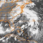
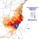
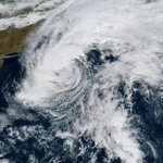
Since we’re at the 14th anniversary of Sandy, the modernized graphics are online at the usual place.
wpc.ncep.noaa.gov/tropical/r…

DRmetwatch retweeted

Here is the latest totals on the 3 Day Florida Heavy Rainfall

ALT Here is the latest totals on the 3 Day Florida Heavy Rainfall
DRmetwatch retweeted

Several unofficial sites in the Flash Flood Warning area now at 10-12" for the day, most of this in the last 3 hours. Do not venture outside as many streets are impassable in the FL Turnpike/Military Trail/I-95 corridor between Okeechobee Blvd and Bee Line Highway.

DRmetwatch retweeted

We mourn the passing of Patrick Stewart, who inspired countless individuals at NASA (and beyond) to boldly go where no one has gone before.

ALT Image description: A packed, sparkling starfield captured by our Hubble telescope — with strange new worlds potentially awaiting. Credit: ESA/Hubble and NASA, R. Cohen
This is the first NHC TCR to use the modernized rainfall graphics. I’ve played with the shade of tan used since, switching from tan to wheat in Python since as it’s a closer match to what I used in the original color filled graphics.

NHC has completed the Tropical Cyclone Report and post-analysis for Tropical Storm #Bertha (July 19-23, 2026). Bertha brought gusty winds, rough surf, and some coastal flooding to portions of the northern Gulf Coast.
Full report: nhc.noaa.gov/data/tcr/AL0220…


Mitch, Floyd, and Wilma were updated as well. Wilma and Mitch have more data in Florida, both from xMACIS2 and SFWMD.
The convective frontal hybrid slop is taking shape. We’ve had some truly ugly early October hybrids in the Gulf historically.

Extratropical transition completed rapidly overnight, with a sting jet to its west not long after sunset. Post-T.C. Isaias continues moving inland.


This somewhat convective occluded or hybrid low has been leading to the South FL coastal flooding as of late. While it’s over very warm water, guidance keeps it shallow warm core, which is supposed to be at the warmest of its life cycle at the present time.

As part of the TC/non-TC heavy rain event website renovation, I realized that I missed doing the rainfall for this intriguing late August 2000 hybrid that struck NC. At least one forecast office considered it a tropical storm — subtropical seemed like a better description.


DRmetwatch retweeted
The Virginia Key (VAFK1) tidal gauge recorded a preliminary peak of 2.54' (MHHW) between 10-11am this morning. Since consistent records began at the site in 1994, this is the 3rd highest peak value recorded behind Hurricane Wilma (#2 - 2.55') and Hurricane Irma (#1 - 3.63').





The deep cyclone offshore the Southeast Sat onward is of interest. The 00z GFS has -18C air at 500 hPa moving offshore NC early Sunday over warm SSTs. It should have periods of deep convection (Canadian shown). No other cyclone nearby & it could stay there for days. 🐻⌚️


DRmetwatch retweeted

Here it is…my yearly picture of the same tree taken on October 20th 🍃🍁🍂 2020-2026
📸 Taken in Metuchen, New Jersey


