

Certified Broadcast & Consulting TV Meteorologist. I love weather & everything about it. I report on all things Meteorology, Astronomy, Geology & Geography.
Salt Lake City, Utah
Joined July 2014
- Tweets34.3K
- Following788
- Followers2K
- Likes32.5K




Big Storm Tonight & Tomorrow
Lots of clouds and isolated showers possible through Trick or Treat Time. Rain and Thunderstorms likely after midnight and continuing through early Monday morning. Heavy mountain snow above 9,000 feet. Another storm moves through on Wednesday. Then it looks quiet, with seasonal temperatures for early November. Expect sunny to partly cloudy skies as well. @weathercaster #utwxd

New event. Flood Watch from 11/1/2026 6:00 AM to 11/2/2026 12:00 PM MDT for San Juan County, UT, Grand Count... inws.ncep.noaa.gov/a/a.php?i…
New event. Flood Watch from 11/1/2026 6:00 AM to 11/2/2026 12:00 AM MDT for Sevier County, UT, Emery County,... inws.ncep.noaa.gov/a/a.php?i…
New event. Flood Warning from 10/30/2026 1:13 PM to 9:00 PM MDT for Washington County, UT. inws.ncep.noaa.gov/a/a.php?i…
New event. Flood Advisory from 10/30/2026 5:27 PM to 10:30 PM MDT for Washington County, UT. inws.ncep.noaa.gov/a/a.php?i…
Snowfall Above 9,000 Feet Could Be Substantial
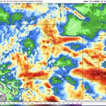
The high resolution USA computer model shows upwards of 20 inches of snow in the highest peaks of the Wasatch Mountains, while the Uinta Mountains above 9,000 feet will get dumped on, with 1 to 2 feet. The white area on the South upslope of the Uinta mountains shows a potential of 33 inches. Most areas above 9,000 feet will see 6 to 12 inches, perhaps a little more. Snow levels will briefly drop to near 6,000 feet on Sunday night and Monday morning. @weathercaster #utwx

There will be flooding in the washeAnother Widespread Rain Event is Setting up...
Very heavy rain will come in two surges. From now throough midday Saturday. A break during Halloween evening. Then the Heaviest batch comes in Saturday night through Monday morning. Red me ans over 2 inches, and in some cases over 3 inches. Orange is 1 to 2 inches. Yellow is .5" to 1".
There will be flooding in the washes, slot canyons and other flood prone areas, including burn scars. Additional river flooding is possible again. Along the Wasatch Front, the normal areas that have recorded flooding in the past will once again see much of the same kind of flooding.
Take evasive action before potential flooding comes your way. This is a serious series of storms, and shouldn't be taken lightly. Flooding and flash flooding of slot canyons and other flood prone areas, including burn scars is likel. Additional river flooding is possible again. Along the Wasatch Front, the normal areas that have recorded flooding in the past will once again see much of the same kind of flooding again.
Snowfall will be 8 to 15 inches or more above 9,000 feet, with some snow down to 6,000 feet by late Sunday night into Monday morning.
Take evasive action before potential flooding comes your way. This is a serious series of storms, and shouldn't be taken lightly. @weathercaster #utwx


Heavy Rain Event Along The Wasatch Front
This comes in two parts. One right now through Saturday midday. Then a break in the evening for Trick or Treaters, followed by a stronger surge of heavy rain & Thunderstorms Late Saturday through Early Monday.
Red means 2 inches or more. Orange means 1 inch or more.
The Wasatch Montains and Uinta mountains above 9,000 feet will be seeing 8 to 15 inches, or more of accumulation. Snow levels drop to near 6,000 feet late Sunday night and early Monday. @weathercaster #utwx


Sunrise to Sunset Coloration
Red Skies in the morning, sailors warning. Well yesterday that was the case, and we have showers today, with a stronger storm coming tomorrow late night (after trick or treat time) into Monday morning. The last three are from yesterday's sunset. All carry a plethora of colors. The Wasatch Front has the some of the best sunrises and sunsets in the world. @weathercaster #utwx
📸Scott Taylor & Chris Williams


Two Storms, One Bigger Than The Other
A weak storm will bring rain showers today, tonight and Saturday morning. There will be a break for Trick or Treat Time, then the big one, with heavy rain arrives late Saturday through early Monday. Heavy rain and mountain snow are likely.
Some flooding over burn scars and normally flood prone areas. Flash flooding is likely in the slot canyons and dry washes of Central, Eastern and Southern Utah. Then, nice for a couple of days, with another storm coming in at the end of next week. @weathercaster #utwx

Recent Beautiul Views on the Backside of the Wasatch
How about these views of the morning fog and the snow cover of Mt. Timpanogos. Thanks to @Grallon (Scott Taylor) for sharing these videos and photos. @weathercaster #utwx


Big Wild Halloween Weekend Precipitation Outlook
Two separate storms will hit the Wasatch Front and Northern Utah this weekend. One late Friday & Saturday Morning. The next & wettest will arrive late Halloween night and last through Monday morning. There appears to be a break during Trick or treat time Halloween evening.
Amounts of precipitation vary by computer models, but one thing is almost certain, amounts will exceed one inch in many areas, & approch nearly two inches in spotty regions. It is good news for the prolonged drought, but is also bad news for burn scars & those locations that flood during high intensity rainfall events. Make preparations as necessary now if you have flooded in the past.
BTW, heavy mountain snowfall will occur above 9,000 feet. Probably 8 to 18 inches, with locally higher amounts possible. Snow levels will drop to near 6,000 feet on Monday morning. @weathercaster #utwx


