David Middlecamp retweeted
One person dies in SLO County E. coli outbreak, Public Health says sanluisobispo.com/news/local…
David Middlecamp retweeted
Santa Barbara County Fire helicopter 964, Santa Barbara City Harbor Patrol, the U.S. Coast Guard, and Santa Barbara County Water Rescue responded to a reported boat fire approximately three miles off the coast of El Capitan. A single occupant was forced to leave the boat, has been rescued from the water, and is uninjured. Santa Barbara City Harbor Patrol will transport him to Santa Barbara Harbor for further evaluation. The cause of the fire is under investigation. #SBCFire #WaterRescue #ElCapitan
David Middlecamp retweeted
Elevated to High surf for area beaches through early next week, with large, damaging surf possible over the weekend. Use caution at the beach as strong rip currents and long shore currents will be commong, along with large shore pound and sneaker waves. #CAwx #SoCal #LAWeather

ALT Elevated to High Surf expected for SW California beaches through early next week. High surf along the Central Coast with waves of 7 to 10 feet through Thursday, then potentially increasing significantly Friday through the weekend. Elevated Surf expected for most remaining beaches, then increasing to High surf levels Friday into the weekend. There is potential for large, damaging surf on Saturday for exposed west facing beaches, including portions of the Central Coast and Ventura County. Minor tidal overflows will be possible during morning high tides, especially over the weekend.
David Middlecamp retweeted
🌊🌡️ An Extraordinary Ocean Temperature Record: Nearly 50 Years in the Making!
Something remarkable has happened beneath the waves along California’s Central Coast. This October, Station 19-10, a subtidal seawater temperature monitoring station in Patton Cove, south of the Diablo Canyon Power Plant, recorded an astonishing 69.53°F at a depth of about 10 feet!
That's the warmest seawater temperature recorded at this location since monitoring began in 1976, nearly half a century ago!
To put this extraordinary reading in perspective, the previous record was 67.7°F, set in September 2015 during another very strong El Niño event.
This October's reading shattered that record by nearly 2°F. Even more remarkable, the average annual seawater temperature here is just 55.3°F. During autumn, temperatures typically reach their seasonal maximum, averaging around 62.5°F. This October's reading was a staggering 7°F above that typical seasonal maximum!
🥶 From Bone-Chilling Cold to Record-Breaking Warmth 🌡️
This station's historical temperature records tell a fascinating story about the extraordinary variability of our coastal ocean.
During April 2008, relentless gale-force northwesterly winds drove intense coastal upwelling, bringing exceptionally cold, nutrient-rich water from the ocean's depths toward the surface. On April 22, 2008, Station 19-10 recorded a bone-chilling 47.35°F! That month, the Diablo Canyon Ocean Lab measured an average seawater temperature of just 49.52°F, the coldest April average in its records dating back to 1976.
Now, compare that icy 47.35°F reading with this October's remarkable 69.53°F. That's a difference of more than 22°F at the very same monitoring station!
🔬 A Little Personal History Beneath the Waves
For 31 years, I worked at Diablo Canyon Power Plant, where one of my responsibilities involved monitoring seawater temperatures along the beautiful, rugged Pecho Coast as part of the plant's environmental monitoring program.
This fascinating work relied on electronic, waterproof temperature recorders, some about the size of a large Sharpie, secured inside protective steel canisters at fixed locations in the intertidal and subtidal zones.
Every few months, marine biologists would venture into the rocky tide pools to exchange the recorders. During the summer, some of the lowest tides occurred in the darkness before dawn.
I still remember those remarkable conditions: scientists working by flashlight or moonlight, navigating slippery rocks as waves crashed nearby. Occasionally, bioluminescent plankton illuminated the water, creating an almost otherworldly experience along this remote coastline.
The team returned the recovered instruments to the Diablo Canyon Ocean Lab, where they downloaded, checked, and archived the temperature measurements.
Since 1976, this extraordinary monitoring program has produced millions of temperature measurements, including more than 800,000 observations from Station 19-10 alone.
That remarkable continuity is what makes this October's new record so meaningful. We're not comparing just a few years of measurements. We're comparing nearly five decades of observations at the same location.
🌎 What's Behind This Extraordinary Warmth?
The unusually warm seawater is consistent with reduced coastal upwelling and the arrival of anomalously warm water (Kevin Wave) moving northward along the California coast, associated with the ongoing very strong El Niño condition and climate change.
These conditions can dramatically alter seawater temperatures, coastal sea levels, marine ecosystems, and even the weather we experience along the Central Coast.
For someone who has spent more than 35 years studying the weather and oceanographic conditions along California's Central Coast, this is a truly remarkable observation. Perhaps most importantly, this record reminds us why long-term environmental monitoring matters.
Without the dedication of generations of marine biologists, oceanographers, and technicians who have maintained these instruments since 1976, we might never have recognized just how extraordinary this event really is.
🌊 Nearly 50 years of observations. More than 800,000 temperature measurements. And now, a new record of 69.53°F!
The ocean is telling us an extraordinary story, and thankfully, we've been listening since 1976.
I took this photo of Frankie Mellow and Randy Price on horseback near Patton Cove, where station 19-10 is located. – at Los Osos, CA
David Middlecamp retweeted
El Niño brings dangerous high tides, chance of flooding to SLO County ahead of rain sanluisobispo.com/news/weath…
David Middlecamp retweeted
El Niño’s first ‘atmospheric river’ could bring California a month of rain in just a few days sanluisobispo.com/news/natio…
David Middlecamp retweeted
Coastal flooding concerns, high surf, & strong rip currents will continue into Tuesday as a large westerly swell moves into the region. Meanwhile tides are expected to continue to peak over 7 feet. Stay safe, always swim near a lifeguard, & heed advice of local officials! #CAwx
David Middlecamp retweeted
𝑺𝑷𝑶𝑻 𝑪𝑳𝑰𝑵𝑪𝑯𝑬𝑫🔒
Big West Championships, we’re ready for ya!🏆🐎
#RideHigh
David Middlecamp retweeted
5 SLO County teams advance in first round of high school football playoffs sanluisobispo.com/sports/hig…
David Middlecamp retweeted
Not to alarm anyone, but to raise awareness and encourage preparedness for what could be an exceptionally stormy winter across California.
As the late, great Rea Strange of Pacific Weather Analysis often said, one of the most reliable indicators of a wet weather pattern for California is the development of strong, persistent upper-level westerlies stretching across the North Pacific Ocean.
In my more than 35 years of forecasting weather along California's Central Coast, I've learned to pay particular attention when upper-air charts and numerical weather models indicate the development of a powerful, persistent Pacific jet stream. In fact, I consider this one of the most important atmospheric indicators of a potentially wet and stormy winter for California, especially during a very strong El Niño condition.
The latest projections from the European Centre for Medium-Range Weather Forecasts (ECMWF) suggest that an exceptionally powerful subtropical jet stream could develop across the Pacific Ocean and extend across much of the United States this winter and into early spring.
Remarkably, these projections indicate the potential for record-strength subtropical jet-stream winds extending from California to Florida.
If these long-range ECMWF projections verify, we could be looking at a remarkably active winter storm pattern, with the potential for well-above-normal precipitation across portions of California, particularly from late December through January, February, and March.
Of course, there is an important distinction between favorable atmospheric conditions and actual rainfall. These are long-range projections, not guarantees. Even during powerful El Niño events, California's precipitation can vary considerably depending on the position of the jet stream/storm tracks and other atmospheric influences.
Nevertheless, the potential development of such an unusually strong and persistent Pacific jet stream is a significant atmospheric signal that deserves our attention.
My message is not one of alarm, but of awareness and preparedness. Now is an excellent time to clear drainage systems, inspect roofs and gutters, review emergency plans, and prepare for the possibility of an unusually wet and stormy winter.
Please visit ReadySLO.org for preparedness, emergency, and recovery information.
I'll continue closely monitoring the upper-air patterns and numerical weather models as we approach the heart of California's rainy season.
Special thanks to meteorologist Ben Noll for sharing this ECMWF analysis and highlighting the potential significance of this developing atmospheric pattern. – at Los Osos, CA
New ECMWF data shows the *strongest subtropical jet stream* in its forecast history blowing across the Pacific and U.S. this winter into next spring, with record-strength winds predicted from California to Florida.
There's even a connection to Europe.
El Niño fuels more thunderstorms near the equator, which release heat high into the atmosphere.
That extra warmth strengthens the Hadley circulation and steepens the temperature gradient between the tropics and the mid-latitudes, which strengthens the subtropical jet.
And that's why such a stormy winter is anticipated across the western, southern and eastern United States.
David Middlecamp retweeted
5 SLO County teams advance in first round of high school football playoffs sanluisobispo.com/sports/hig…
David Middlecamp retweeted
2 Cal Poly students injured in Spain train crash that killed 69 people sanluisobispo.com/news/local…
David Middlecamp retweeted
Mission Prep beats Arroyo Grande 24-21. See the photos sanluisobispo.com/sports/hig…
David Middlecamp retweeted
How SLO County horseshoer became western singer — and snagged an album, movie credits sanluisobispo.com/news/local…
David Middlecamp retweeted
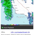
Rain will be increasing in coverage later this afternoon - peaking tonight. There is a chance that the rain will hold off or stay light through the early evening, but plan for a wet evening. Light to moderate rain expected during the peak, with isolated heavy showers. #cawx
David Middlecamp retweeted
Here's the updated forecast for our weekend storm. Overall totals are trending a little lower, but there is still a fair amount of uncertainty in the exact storm track, so we have a 20% chance for double or half these amounts. #CAwx #SoCal #LAWeather