

This is Donegal's first and top weather channel for all your weather forecast and weather updates we cover all of Donegal, and Ireland and cover Northern lights
Donegal, Ireland
Joined January 2012
- Tweets24.3K
- Following1.6K
- Followers12.7K
- Likes2.2K
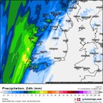


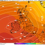


Friday will see plenty of dry weather again away from Atlantic coastal counties, there will be some outbreaks of rain during the afternoon and evening particularly across Donegal, Sligo,North Leitrim Mayo, Galway, Clare and Kerry. Most of the rain will stay out over the sea during the afternoon and evening.
Friday night and Saturday morning the rain should slowly move southeast with outbreaks of rain across the northwest, west and southwest. The rain will then clear to the southeast during Saturday afternoon with clear spells following from the northwest during the later afternoon and evening.
👻 later into evening and Halloween night should turn dry for all areas making it good for trick or treating. 🎃
High pressure will then be in places for the next 5 to 7 day's keeping things mostly dry with sunny spells at times.
Kenneth from the Donegal Weather Channel
☕You can also support my updates by buying me a coffee. By buying a coffee you are helping secure the future of the page which helps in the maintenance and running costs 👉 buymeacoffee.com/donegalweat…
#halloween #ireland #weather – at Leitrim, Ireland

🎃 HIGH PRESSURE BUILDING THIS WEEKEND WITH PLENTY OF SUNSHINE IN THE MIX☀️
Good news for Halloween! High pressure builds this weekend, bringing improved weather from Saturday. Early Saturday might see light rain in the west and northwest, but it clears up by evening, with clear spells developing across western and northern counties – perfect for trick-or-treating! 🎃
Sunday, leading into the first week of November (up to the 7th), looks mostly dry with very little to no rain expected. Expect plenty of sunshine mixed with some cloud at times.
Looking ahead: The second and third weeks of November show a return to unsettled conditions, with above-normal rainfall and a potential for storms, especially around the third week. Frost and fog are also possible next week under the high pressure.
Kenneth from the Donegal Weather Channel
☕You can also support my updates by buying me a coffee. By buying a coffee you are helping secure the future of the page which helps in the maintenance and running costs 👉 buymeacoffee.com/donegalweat…
#weather #ireland #highpressure #sunshine #europe #temperature – at Leitrim, Ireland

🥶 Potential Polar Stratospheric Warming: What could it mean for Ireland and Europe?🥶
As we head into winter 2026–27, we'll be keeping a close eye on a potential Polar Stratospheric Warming (PSW) event for Ireland and wider Europe.
This is something you going to hear alot about over the coming weeks and please do take with a pinch of salt what you here.
European forecast models are indicating a significant weakening of winds in early November, with some solutions even showing a complete wind reversal.
If this warming gets strong enough to disrupt the polar vortex, it could raise the chances of colder winter weather reaching parts of Europe.
It's important to remember, though: a stratospheric warming doesn't automatically mean a cold spell or snow for Ireland. The impact depends on how strong the warming is, how the polar vortex reacts, and if these stratospheric changes eventually influence the jet stream and lower atmospheric pressure patterns.
If this does occur as models are projecting and the weakening occurs of the polar vortex over the first week of November it would be the earliest one on record which is interesting. Some models including the European model show the sudden stratospheric warming (SSW) occuing and a reversal of the zonal winds.
**note the its only classed as sudden stratospheric warming only when there is a reversal of the zonal winds. **
**There has been many attempts over the year where we see a weakening of the polar vortex but it doesn't manage a reversal**
STAGES TO A SSW
Ireland's Weather and Stratospheric Warming: A 3-Stage Process
2018 is a good example of when we seen a SSW and how it ended up impacting Ireland
🌬️ Stage 1: Stratospheric warming develops. The polar stratosphere warms, causing the vortex to weaken or become distorted. At this point, there might not be any immediate changes to Irish weather.
🔄 Stage 2: Atmospheric circulation responds. Over the following days or weeks, these changes can move downwards, influencing the jet stream and high-pressure blocking patterns.
❄️ Stage 3: Possible surface weather impacts. If the resulting weather pattern favors Ireland, we could see a colder spell, frost, ice, or even snow. However, it's also possible that the weather remains mild and unsettled.
SSWs do increase the chance of colder wonder but are never a garnetee
WHAT ABOUT El NIÑO
El Niño could be one of the contributing factors, but it is not directly causing a polar stratospheric warming by itself.
As this is the strongest El Niños on record and one like this has never been seen we can't look back at previous records to compare. Normal El Niño winters start of with a increasing risk of stormy and wet weather with El Niño winters tending to end with a higher chance of colder conditions around February into March.
Maybe this record El Niño will not follow the text book and do it's own thing.
I will monitor this over the coming weeks and update further but as mentioned above there will be alot about this in the media over the coming week or weeks.
Kenneth from the Donegal Weather Channel
☕You can also support my updates by buying me a coffee. By buying a coffee you are helping secure the future of the page which helps in the maintenance and running costs 👉 buymeacoffee.com/donegalweat…
#weather #ireland #polarvortex #suddenstratosphericicwarming #ssw #cold #snow #winter #europe #uk – at Donegal, Ireland

Good morning, outbreaks of rain will clear this morning with brighter and drier weather developing this afternoon and evening, Temperatures will range between 12C to 15C.
Only a small chance of a isolated shower tonight it will be mostly dry with a mix of clear spells and cloud. Temperatures will range between 9C to 12C.
Kenneth from the Donegal Weather Channel
☕You can also support my updates by buying me a coffee buymeacoffee.com/donegalweat…
#weather #ireland #dry #sunny #showers – at Leitrim, Ireland

Good morning folks some bright and sunny spells today but some heavy blustery showers also. Some of the showers will be heavy with the risk of some hail and isolated thunderstorms especially in the northwest. Temperatures will range between 9C to 12C.
Outbreaks of rain will move into Atlantic coastal counties overnight some of this rain might be heavy for a time across Donegal.
#weather #ireland #thunderstorm #sunny #showers #rain #cloud – at Leitrim, Ireland

🎃 HIGH PRESSURE BUILDING FOR HALLOWEEN WITH DRIER WEATHER☀️
Higher pressure now looks set to build through next weekend with the forecast looking much better than this weekend.
Friday morning will see some early morning rain clear and will be followed by drier weather as high pressure builds. Through Saturday and Sunday the area of high pressure will build further and sit right Ireland with good sunshine also. Max day time temperatures will range between 11C to 14C coolest in the northwest.
Saturday night Halloween will be dry with clear skies, it will be a cool night with some frost and fog forming by morning with temperatures as low as -1C in the northwest, west and north.
High pressure looks set to stay until midweek at least next week, the latest model guidance is for a potential breakdown to unsettled conditions from the following weekend and potentially colder also.
Kenneth from the Donegal Weather Channel
☕You can also support my updates by buying me a coffee. By buying a coffee you are helping secure the future of the page which helps in the maintenance and running costs 👉 buymeacoffee.com/donegalweat…
#weather #ireland #cold #highpressure #sunny – at Leitrim, Ireland

🌡️At least the rain is warm 😂
Warmer than recent today with a brief warmer airmass over Ireland today with temperatures up to 18C in Central parts of Ireland. Still on the cooler side in the northeast.
#weather #ireland #temperature #October #autumn – at Leitrim, Ireland

Good morning everyone rain continues to clear to the east this morning and showers will follow some heavy. It will also be windy today with strong winds in southeast, southwest, west and northwest gusting between 70km/hr to 100km/hr.
Later this evening and tonight another period of rain will move up from the southwest with the potential for some flooding in the west and northwest especially over Donegal and Galway.
Kenneth from the Donegal Weather Channel
☕You can also support my updates by buying me a coffee. By buying a coffee you are helping secure the future of the page which helps in the maintenance and running costs 👉 buymeacoffee.com/donegalweat…
#weather #ireland #rain #wind #warning – at Leitrim, Ireland


Rain will move into the southwest after midnight spreading northeastwards across Ireland on Monday morning, this will clear later tomorrow morning with heavy showers following. On Monday evening and night another band of rain will push up from the southwest and west moving northeastwards again and will be heavy on place especially in the northwest of Ireland on Monday night and Tuesday morning with a risk of flooding occurring. No rainfall warnings have been issued for the northwest region by Met Éireann but these could be issued tomorrow morning especially for Donegal with a potential for 50mm in places especially across South and southwest Donegal.
Flooding risk Donegal
Main risk areas that could see anywhere between 30 to 50mm include Killybegs, Donegal Town, Kilcar, Ardara, Glenties, Mountcharles, Barnesmore, Ballybofey, Stranorlar, Letterbarrow, Fintown and areas surrounding these general areas.
Highest rainfall totals will be over the Bluestack mountains and run of water from the mountains will lead to a increase in river levels and swollen stream with the potential for some flooding at lower levels.
Amounts elsewhere across Donegal will vary between 15mm to 25mm.
Monday will also be a windy with some strong winds but thankfully the strongest of this storm is set to stay out over the sea and doesn't undergo a very rapid cyclogenesis like storm Boelo did.
I will continue to monitor the forecast particularly tomorrow night when the main risk of flood could be across parts of Donegal above mentioned.
Kenneth from the Donegal Weather Channel
☕You can also support my updates by buying me a coffee buymeacoffee.com/donegalweat…
#weather #ireland #rain #flooding #storm #bankholiday – at Leitrim, Ireland


🟡 NEW WARNINGS FOR MONDAY & TUESDAY - NEW STORM UPDATE 🟡
🟡🍃 Status Yellow - Wind warning for Carlow, Clare, Cork, Donegal, Galway, Kerry, Kilkenny, Mayo, Waterford, Wexford, Wicklow, Derry, Down, Antrim
🟡☔ Status Yellow - Rain warning for Cork, Galway, Kerry, Mayo
Another area of low pressure will track just to the northwest of Ireland on Monday into Tuesday. This low pressure system is not set to bring as strong as winds as storm Boelo to Ireland but winds will still be strong with the ongoing risk of some trees and branches falling especially due to weakened ones from storm Boelo and the combination of leafs still on trees and saturated ground due to heavy rainfall.
There is a possible chance this could be named at some point most likely by the UK Met office due to higher impacts across Scotland and stronger winds expected there.
*TIMELINE *
Monday morning to Monday night
The storm / low pressure system will arrive on Monday morning just after midnight tonight with heavy rainfall and the outer band of rain moving into the southwest of Ireland spreading to all areas through bank holiday Monday. The bulk of the heavy rainfall will clear by midday Monday and will be followed by heavy showers.
There will be a ongoing risk of flooding especially due to the amount of rain that has falling since Friday, especially across the southwest, west and northwest so some surface and local flooding will be possible on Monday.
Winds will also increase especially on Monday Afternoon and evening with strong gusts potentially leading to some power outages and tree down.
Monday afternoon another band of heavy rain will move into the southwest and west spreading across Ireland clearing into early Tuesday morning. Again there will be a increasing risk of surface and local flooding especially across the southwest, west and northwest.
Between 15mm to 40mm could fall in parts of the southwest, west and northwest.
Winds will ease through Tuesday morning again and as mentioned above will not be as strong, heavy showers will continue on Tuesday especially in the northwest and west with the best of any drier weather away from there with some brighter or sunny spells.
View the latest warnings here 👉 donegalweatherchannel.ie/wea…
Kenneth from the Donegal Weather Channel
☕You can also support my updates by buying me a coffee. By buying a coffee you are helping secure the future of the page which helps in the maintenance and running costs 👉 buymeacoffee.com/donegalweat…
#weather #ireland #storm #rain #wind #europe #uk – at Leitrim, Ireland

As the sun came up over Rossnowlagh, Donegal this morning with the beautiful Donegal Bay in the background the damage was also visible of the Car which was beaten up against the rocks yesterday evening and overnight.
Nobody was injured and the car ended up getting stuck on the sand before the tide came in yesterday
Video from James at @RossnowlaghSurf
If you are ever in Rossnowlagh and want to surf or learn to surf no better person to contact
#weather #ireland #stormboelo #wind #storm #europe #surf #rossnowlagh
STORM BOELO UPDATE 11:00hrs
Winds remain strong this morning across western and northern parts of Donegal, northern parts of Derry and northern parts of Antrim but these will ease over the later morning stages but it will remain gusty through the afternoon hours.
Malin Head,Donegal recorded a even strong gust this morning of 137km/hr
Strongest gusts from storm Boelo in the last hour 10:50hrs
🟡 101km/hr - Malin Head, Donegal.
🟡 94km/hr - Finner Donegal
🟡 94km/hr - Magilligan, Derry
🟡 91km/hr - Donegal Airport, Donegal
🟡 91km/hr - Giants Causeway, Antrim
🟡 90km/hr - Mace Head, Galway
Strongest gusts from storm Boelo over the past 24 hours 🍃
🔴 137km/hr - Malin Head, Donegal.
🔴 133km/hr - Mace Head Galway
🟠 126km/hr - Finner Donegal
🟠 117km/hr - Magilligan, Derry
🟠 110km/hr - Ballypatrick Forest, Antrim
🟡 108km/hr - Lough Fea Tyrone
🟡 108km/he - Belmullet, Mayo
If you have any reports of roads closed, trees down or any other relevant information that will helo people this morning pleae so message the page.
You can also send on any photos or videos you might have in relation to Storm Boelo.
Kenneth from the Donegal Weather Channel
☕You can also support my updates by buying me a coffee. By buying a coffee you are helping secure the future of the page which helps in the maintenance and running costs 👉 buymeacoffee.com/donegalweat……
#weather #ireland #stormboelo #wind #storm #europe – at Leitrim, Ireland

STORM BOELO UPDATE - ESTIMATED 51,000 POWER OUTAGES
Around 41,000 homes and businesses on the ESB Networks are currently without power as off 10am.
There are an additional estimated 10,000 power NI customers with no power in Northern Ireland.
Donegal has been the worst impacted country.
Sligo, Leitrim, Mayo, Derry, Fermanagh, Tyrone and Antrim have also been hit hard by outages.
ESB and power NI crews have been working throughout the morning to connect people.
Thanks to the ESB crews for the amazing work they do in these storms. A large number of these people with no power should be back connected today.
Kenneth from the Donegal Weather Channel
☕You can also support my updates by buying me a coffee. By buying a coffee you are helping secure the future of the page which helps in the maintenance and running costs 👉 buymeacoffee.com/donegalweat…
#weather #ireland #stormboelo #wind #storm #europe #power – at Leitrim, Ireland

🚢 CONTACT ESTABLISHED WITH TANKER OF THE NORTHWEST OF IRELAND
Contact was established last night with the Myra, a Russian-linked tanker sailing under the Cameroon flag. HM Coastguard confirmed that assistance was not required.
An RAF 'Sub-Hunter' Poseidon aircraft, with callsign 'RESCU39', located the Myra, which had 21 people aboard. The crew reported that a distress signal activated as they departed an area of large swells from storm Boelo . After assessment, the vessel continued its passage.
Kenneth from the Donegal Weather Channel
☕You can also support my updates by buying me a coffee. By buying a coffee you are helping secure the future of the page which helps in the maintenance and running costs 👉 buymeacoffee.com/donegalweat…
#SAR #Mayday #Coastguard #storm #weather #ireland #uk – at Leitrim, Ireland

WARNINGS UPDATED STORM BOELO
🟠 Status Orange/Amber - Wind warning for Donegal, Antrim, Derry - Warning ends at 9am in Donegal and 10am for Derry and Antrim
🟡 Status Yellow - Wind warning for Connacht, Ulster , Louth
Yellow wind warning for Donegal does not end until 3pm this afternoon.
Kenneth from the Donegal Weather Channel
☕You can also support my updates by buying me a coffee. By buying a coffee you are helping secure the future of the page which helps in the maintenance and running costs 👉 buymeacoffee.com/donegalweat…
#weather #ireland #stormboelo #wind #storm #europe – at Leitrim, Ireland

STORM BOELO UPDATE 05:30hrs
Good morning everyone winds remain strong this morning and should start to ease over the later morning stages but it will remain gusty through the afternoon hours.
Malin Head,Donegal recorded a even strong gust this morning of 137km/hr
Strongest gusts so far 🍃
🔴 137km/hr - Malin Head, Donegal.
🔴 133km/hr - Mace Head Galway
🟠 126km/hr - Finner Donegal
🟠 117km/hr - Magilligan, Derry
🟠 110km/hr - Ballypatrick Forest, Antrim
🟡 108km/hr - Lough Fea Tyrone
🟡 108km/he - Belmullet, Mayo
POWER ⚡
There is now 44,000 homes and businesses with no power on the island or Ireland with, Donegal, Sligo, Leitrim, Derry, Tyrone, Fermanagh and Antrim worst effected
If you have any reports of roads closed, trees down or any other relevant information that will helo people this morning pleae so message the page.
You can also send on any photos or videos you might have in relation to Storm Boelo.
Kenneth from the Donegal Weather Channel
☕You can also support my updates by buying me a coffee. By buying a coffee you are helping secure the future of the page which helps in the maintenance and running costs 👉 buymeacoffee.com/donegalweat…
#weather #ireland #stormboelo #wind #storm #europe

STORM BOELO UPDATE 22:17hrs - 133KM/HR RECORDED IN DONEGAL
Winds continuing to peak and a new high gust the highest for far from storm Boelo recorded at Malin Head, Donegal of 133km/hr which is in the red warning criteria threshold.
Winds will remain strong throughout the rest of tonight and into early Sunday morning before somewhat easing by midday Sunday but not fully easing until Sunday evening.
A massive well done to the ESB crews who have been out restoring power to people over the past few hours.
#weather #ireland #stormboelo #wind #storm #europe – at Leitrim, Ireland

UPDATE - ON MAJOR RESCUE MISSION OF THE NORTHWEST COAST
The rescue operation is still ongoing but unfortunately sea conditions are to poor at the moment and the location of the tanker or outside the range for a SAR helicopter to reach it. Even of a helicopter could reach it the current conditions it would not be able to fly.
The RAF earlier send 1 of their 'Sub-Hunter' Poseidon aircraft towards that location with the callsign 'RESCU39' this had since returned back to Scotland.
A US Military aircraft has just passed north of Donegal in the past few minutes heading in the same direction toward the.
There is no change to the situation at those stage.
The MYRA is visible to the northwest.
#SAR #Mayday #Coastguard #storm #weather #ireland #uk – at Leitrim, Ireland

BREAKING MAJOR RESCUE OPERATION UNDERWAY OF THE NORTHWEST OF IRELAND
A major search and rescue operation is underway of the northwest coast of Ireland around the center of #stormboelo this evening following distress calls from big Russian tanker carrying diesel.
The UK Coastguard is coordinating a response to an Inmarsat-C Distress Alert from vessel MYRA.
This potentially one of the Russian ships heading to the USA with Diesel . I hope there is no leaks as it would be a environmental disaster.
The Irish air corps and Coastguard don't have the capabilities to provide cover due to the range the tanker is out
𝗢𝗣𝗘𝗥𝗔𝗧𝗜𝗢𝗡𝗔𝗟 & 𝗦𝗔𝗥 𝗔𝗦𝗦𝗘𝗦𝗦𝗠𝗘𝗡𝗧
Given the extreme distance from mainland coastal stations (beyond typical shore-based rotary SAR operational radius without offshore refueling) and current sea states, direct surface intervention by coastal rescue craft is technically constrained.
Standard Search and Rescue protocol in this scenario relies on:Alerting nearby commercial traffic via GMDSS broadcast.Deploying long-range fixed-wing maritime patrol aircraft (such as RAF P-8A Poseidon) for top-cover monitoring and communications relay if required.
This rescue operation is ongoing as off 20:57
#SAR #Mayday #Coastguard #storm #weather #ireland #uk – at Leitrim, Ireland

Readers added context they thought people might want to know
A distress alert from tanker MYRA led UK Coastguard to alert nearby vessels for assistance but no major rescue was underway; the ship continued sailing and trackers reported it in ballast (empty), not carrying diesel, en route to Egypt.
theins.ru/news/298705
vesselfinder.com/vessels/detail…
vesseltracker.com/en/Ships/Myra-…