

Mehr als Code: Wir verbinden Geospatial AI mit Business Innovation – für die Welt von morgen.
Germany
Joined November 2016
- Tweets1.2K
- Following39
- Followers389
- Likes1.6K


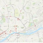
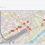
Persistent spatial patterns provide the evidence needed for explainable recommendations, trustworthy AI systems, and ultimately better decisions. Read our blog post about "From Traffic Accidents to Persistent Risk".
community.esri.com/en/discus…
14
Ask Mapfred the AI agent lowering the entry hurdle for geospatial intelligence from @EnBW
33

🚀 Big news for geospatial developers!
The new ArcGIS Agentic Developer Toolkit lets AI coding agents (Claude, GitHub Copilot, OpenAI Codex & more) use MCP to pull live docs, samples & opinionated skills.

61
The Agentic Experience is here.
People set goals & guide critical decisions.
Agents plan, decide & act on their behalf.
ArcGIS provides the powerful capabilities they use.
Connected through MCP, APIs, SDKs & CLI.

22
AI is transforming software from click → ask → delegate.
At ArcGIS:
• Natural language assistants inside apps
• AI-first experiences like Data Explorer
• ArcGIS agents in Claude, Copilot & ChatGPT via MCP & plugins
Same trusted GIS. New ways in. 🚀

2
50


Enhance traffic safety showcase with multi-year hotspot risk workflow and filtering capabilities; update notebook for end-to-end demonstration
github.com/EsriDevEvents/spa…

22
Detecting traffic safety hotspots using the public available traffic accidents dataset. Map view shows Frankfurt am Main, Germany.
github.com/EsriDevEvents/spa…

26
Rebuilding GIS for the Energy Transition with AI
How EnBW transformed GIS from an expert tool into a platform for every user.
linkedin.com/posts/jan-tscha…

22
We don’t want polished demos; we want the community’s real problems. Tell us in one sentence: what single geospatial problem should we solve live at the European Dev & Tech summit?
Register here: go.esri.de/l/284952/2026-09-…

13
We're building a showcase that starts with AI detecting airplanes, or even drones, from satellite imagery and ends with transparent, human-centered decisions.
Register here: go.esri.de/l/284952/2026-09-…


21
Vom Digital Twin zur Spatial Decision Intelligence?
community.esri.com/de/discus…

19
Check out: From Traffic Accidents to AI Agents: What an Urban Digital Twin Can Teach Us About Spatial Decision Intelligence
linkedin.com/pulse/from-traf… via @LinkedIn


AI agents are becoming increasingly capable of reasoning and acting.
But what geospatial capability should every AI agent understand?
0%Spatial relationships
0%Network analysis
0%Location intelligence
0%Something else
0 votes • Final results 25
We're exploring a simple but important question:
What should an AI agent actually be capable of deciding?
Many AI systems today are built around tools, APIs, and function calls.
github.com/EsriDE/spatial-de…

24
Most AI agents can call tools.
Very few can make decisions.
Maybe the next evolution is:
APIs → Tools → Agents → Decision Skills
What would be the first spatial decision skill you'd build?
go.esri.de/l/284952/2026-09-…
