

Maps, GIS, and the occasional geographical oddity.
Planet Earth
Joined September 2008
- Tweets21.7K
- Following249
- Followers51.4K
- Likes5.4K

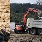
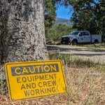



Calling the public names instead of caring about abused horses is something I never expected to see an elected official do.
Midpen directors then voted to remove the requirement that they be respectful to the public.
Read why that matters:
sanjosespotlight.com/dempsey…

These are the serious health and safety issues those “pugnacious people” were actually raising with Midpen: youtube.com/shorts/xBEdRVFSs…

Why do phalaropes spin in circles while feeding? Their rapid movements create a small vortex that draws tiny aquatic prey toward the surface.
youtube.com/watch?v=9QMz-L2L…
#FluidDynamics #BirdGeography #Phalarope #BirdMigration #WetlandEcology
Alaska has the longest U.S. coastline, but its length varies depending on how closely the coast and shoreline are measured.
#geography
geographyrealm.com/alaskas-c…

Learn how to tell California scrub jays from Steller's jays by their appearance, calls, behavior, and habitat.
buff.ly/DzNBg9d

How many continents are there? Explore the four to seven continent models and compare the world's continents by size, population, and geography.
buff.ly/D0VRVuJ

The San Juan Islands support one of the highest densities of breeding bald eagles in the contiguous United States. Here's why.
#geography
buff.ly/SpcFCbm

Why is X longitude and Y latitude in GIS? Understand how geographic coordinates work and discover simple ways to remember the difference.
#geography #GIS
buff.ly/v3HDTIP
From Alaska's Arctic coastline to Delaware's colonial hundreds, discover the geographic features and characteristics that make every U.S. state unique.
#geography
buff.ly/ENAdYRz

Why don't tree branches touch? Crown shyness is the natural phenomenon that creates the gaps between neighboring tree canopies.
buff.ly/Ko7gTbG

Discover where turkey vultures, black vultures, and California condors live across the United States and what shapes their distribution.
buff.ly/ejTiAew

From Maine to California, see how all 50 U.S. states are grouped by the number of syllables in their names and discover which syllable count is most common.
#geography #UnitedStates
buff.ly/9es4Ack
States in Order of Admission to the United States of America buff.ly/R3ik6VN

Grounding lines mark where glaciers begin floating, making them one of the most important indicators of ice sheet stability and sea-level rise.
#geography
buff.ly/KsEkT9d

Learn how to create a continuous surface from point data in QGIS using interpolation, then generate contour lines for visualization and analysis.
geographyrealm.com/interpola…

The geology of Lake Chapala reveals how faulting and volcanic activity shaped Mexico's largest freshwater lake.
#geography
buff.ly/Y0SkJF5

Waves do more than shape coastlines. New research shows they also influence how much carbon dioxide the ocean absorbs, providing new insights into blue carbon storage and the global carbon cycle.
buff.ly/7uL5KWG

NatureServe has released a 30-meter ecosystem map covering the contiguous United States and adjacent areas. The dataset provides a detailed view of regional ecosystems and is a valuable resource for conservation, land management, and ecological research.
buff.ly/7kJekJX
Glacial flour, the fine dust created as glaciers move over land, turns lakes a turquoise color by reflecting blue and green light.
#geography
buff.ly/CpZqdbX

Explore the GIS data behind John Snow's famous cholera map and discover how spatial analysis helped transform public health. buff.ly/6mx4Wi1
