🚨NATIONWIDE ALERT TEST TODAY🚨
The Federal Emergency Management Agency (FEMA), in coordination with the Federal Communications Commission (FCC), will conduct a nationwide test of the Emergency Alert System (EAS) TODAY, Tuesday, Nov. 17, at approximately 1:20 p.m. Central Time.
📺 Television and radio programming across the country will be briefly interrupted by a test message.
⏰ The test is expected to last approximately one minute.
📱 No cellphone alerts will be sent as part of this test.
👍 No action is required!
Regularly scheduled tests ensure critical alerts reach people when it matters most.
Remember, if you hear or see the message, don't be alarmed. It's only a test!
The Federal Emergency Management Agency (FEMA), in coordination with the Federal Communications Commission (FCC), will conduct a nationwide test of the Emergency Alert System (EAS) tomorrow, Tuesday, Nov. 17, at approximately 1:20 p.m. Central Time.
📺 Television and radio programming across the country will be briefly interrupted by a test message.
⏰ The test is expected to last approximately one minute.
📱 No cellphone alerts will be sent as part of this test.
👍 No action is required!
Regularly scheduled tests ensure critical alerts reach people when it matters most.
Remember, if you hear or see the message TOMORROW, don't be alarmed. It's only a test!
105
☔️RAIN TONIGHT & SUNDAY☔️
Rain and some thunderstorms will move in today and become more widespread overnight. These showers and scattered storms are expected to continue through Sunday. We could see 0.5-1.5 inches of rain over the course of the weekend with this system.
While the severe threat is low, always have multiple ways to receive warnings, never try and cross flooded roads, and stay weather aware!
Images depict rain chances Saturday, Sunday, and Monday.
102
☔️GRAB YOUR UMBRELLA SAT.-SUN.☔️
A strong storm system will bring widespread rain and a few thunderstorms to our region late Saturday into Sunday along with considerably cooler temperatures.
Highs on Sunday will be in the 40s and lower 50s. Rainfall amounts of 1 to 2 inches will be possible through Sunday.
Stay weather aware. Never try and cross flooded roads!
2
164
On Veterans Day, we honor the brave men and women who have served our nation.
To all of our veterans, thank you for your service, strength, and sacrifice. We are always grateful and would not be here without each and every one of you.
4
107
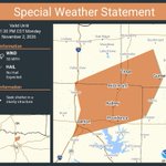
SPSFWD from 11/2/2026 10:59 PM to 11:30 PM CST for Grayson County, TX: Strong thunderstorms will impact portions of northeastern Denton, northwestern Collin, southeastern Cooke and southwestern Grayson Counties
⛈️SEVERE WEATHER TIMING TONIGHT⛈️
Timing still looks to be between 6:00pm-1:00am.
Main hazards:
•Damaging Winds
•Embedded Tornado within the line of storms
Make sure to have multiple ways to receive warnings, and ensure alerts will wake you up if a warning is issued for your area.
Images depict severe weather forecast area and severe weather tips during the night.
Move over or slow down when you see flashing lights on the side of the road. Lives are on the line. During Crash Responder Safety Week, we're asking everyone to help protect roadside workers and first responders. #CRSW2026 #EndTheStreakTX #DriveLikeATexan
Grayson County OEM retweeted
Deer friends, don’t forget to wear your seat belt! 🦌
Day or night, front seat or back, buckle up for every trip.
#BeSafeDriveSmart #DriveLikeATexan
Grayson County OEM retweeted
Share your input! The Paris District Bicycle Plan interactive map closes Friday, Nov. 6. Explore TxDOT’s recommendations and let us know what you think. 💭
Access the interactive maps here:
🔗 txdot.gov/projects/hearings-…
Grayson County OEM retweeted
Staying sharp around big trucks means driving smart. You may have limited visibility and less
room to navigate around road hazards, so put your phone away, drive at a safe speed, give
trucks plenty of space and always buckle up.
#BeSafeDriveSmart #DriveLikeATexan
⛈️SEVERE WEATHER TIMING MONDAY NIGHT⛈️
Showers and thunderstorms are likely tonight for our area from 6:00pm tonight - 1:00am Tuesday morning.
Possible Hazards:
💨Damaging winds
🧊Hail
🌪️A tornado
Stay weather aware and have multiple ways to receive warnings!
The graphic outlines the general timing for the highest rain and storm chances across the area.
1
218
Grayson County OEM retweeted
⏰Clocks have fallen back. Take that extra time to prepare for the next disaster:
🔦Test flashlights
🔋Replace batteries
📻Test your weather radio
🎒Restock your go-kit
🚨Sign up for local emergency alerts
Check your supplies. Review your plan. Be ready.
#DaylightSavingTime
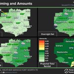
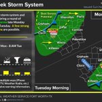
⛈️POSSIBLE SEVERE WEATHER MONDAY NIGHT⛈️
An upper level storm system and cold front will bring a round of showers and storms late Monday through early Tuesday. A few strong to severe storms are possible, bringing with them damaging wind gusts, hail, and the potential for a tornado.
Stay weather aware, have multiple ways to receive warnings, and stay safe.
Image depicts storm coverage area
116
Dense Fog Advisory from 11/1/2026 6:50 AM to 10:00 AM CST for Grayson County, TX.
If driving, slow down, use your low beam headlights, and leave plenty of distance between you and others.
Image depicts fog advisory area
1
134
🎃HAPPY HALLOWEEN🎃
Light rain today will gradually exit to the northeast this afternoon and evening, leaving decent weather in place for evening Halloween festivities. Otherwise, patchy fog may reduce visibility at times overnight into Sunday morning.
Don't forget to set clocks back an hour before going to bed!
Images depicts Halloween day forecast and setting your clocks back one hour tonight!
1
90
Grayson County OEM retweeted
With daylight savings time approaching, now is a great time to check the batteries in your smoke alarm! Remember, when you change your clocks, check your batteries!
More info on smoke alarms can be found here: nfpa.org/en/education-and-re…
Image depicts clock and smoke alarm with text saying “Change your clocks, check your batteries.”
Grayson County OEM retweeted
A Wind Advisory has been issued for all of North and Central Texas for Friday. Please take precautions to secure outdoor items such as lawn furniture, decorations, and other lightweight objects, and exercise extra caution when boating on area lakes.

ALT A Wind Advisory has been issued for all of North and Central Texas for Friday. Following the passage of a strong cold front tonight and tomorrow, sustained winds will reach 20 to 30 mph, with gusts up to 45 mph during the day Friday. Please take precautions to secure outdoor items such as lawn furniture, decorations, and other lightweight objects, and exercise extra caution when boating on area lakes.