

Handry Outlook aims to share the latest weather forecasts and graphics for the UK. Storm Forecaster with @ConvectiveUK https://nitter.cf/t.co/iHUTvQsEhP
Bristol
Joined August 2021
- Tweets4.6K
- Following128
- Followers3.2K
- Likes3.1K




Pinned Tweet
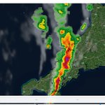
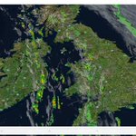
RadarLoop UK has just been updated to include:
- Better Radar oading algorithm🗺️
- Better Thunderstorms Nowcasting algorithm🌩️
- New Satellite Imagery layer 🛰️
- New Isobar layer🌀
- New Wind Direction layer🌬️
... and so much more for you to discover!!!
handry-outlook.github.io/Rad…

Scattered thunderstorms are developing across NW England now. handry-outlook.github.io/Rad…

Radar + Satellite animation of #StormAustin last night
via handry-outlook.github.io/Rad…

#StormAusten's strongest gusts along its southwestern flank will affect SW England and Wales soon, with gusts of 55-65 mph in places, locally 75-85 mph across exposed coasts and hills.
handry-outlook.github.io/Rad…

Scattered thunderstorms are possible across the south as #StormAustin moves eastward later today

The Met Office has issued a yellow wind warning for Friday across SW England, S Wales and parts of SE England.
Gusts of 50- 60 mph are possible, locally 70 mph.

Scattered thunderstorms are currently affecting western parts of UK and Ireland. Additionally, a band of heavy rainfall is moving across Kent.
View the live radar loop here: handry-outlook.github.io/Rad…

Radarloop of Typhoon Suriage approaching Okinawa.
handry-outlook.github.io/Rad…
Here is an animation of the severe thunderstorms that delivered large hail and flooding in places on 26 May 2026, generated using the archive tools from RadarLoop.
handry-outlook.github.io/Rad…
Convective outlook has been UPDATED ⛈️
Valid: Now - WED 05:59
A rare HIGH risk has been issued.
handry-outlook.github.io/Thu…

Some intense downpours and isolated lightning are developing across Scotland.
handry-outlook.github.io/Rad…
Scattered thunderstorms have developed across eastern parts of Scotland in the early morning.
handry-outlook.github.io/Rad…
A few isolated thunderstorms are developing across East Anglia.
handry-outlook.github.io/Rad…

Check out the latest RadarLoop update:
handry-outlook.github.io/Rad…
RadarLoop will be getting a new update soon:
- Significantly smoother animation
- Significantly faster loading speed
- More mobile friendly
- 3d mode
Here is a small animation of the thunderstorms across the Midlands on the 27th of August.
RadarLoop UK has just been updated to include:
- Better Radar oading algorithm🗺️
- Better Thunderstorms Nowcasting algorithm🌩️
- New Satellite Imagery layer 🛰️
- New Isobar layer🌀
- New Wind Direction layer🌬️
... and so much more for you to discover!!!
handry-outlook.github.io/Rad…
Verification:
Realtivly poor forecast comparing to our recent high-quality forecast. Thunderstorms are not as active across the SW and SE due to saturation. The ENH across Northern England and the Midlands preformed as expected, but could be extended futher northward.

Convective outlook has been issued ⛈️
Valid: TMR 06:00 - Monday 05:59
Frequent lightning, risk of hail, and localised flooding are possible, with a risk of a few funnel clouds over tomorrow afternoon into early night.
handry-outlook.github.io/Thu…

Thanks to everyone for using HOCO over this summer. I hope you all enjoy the website and the forecasts so far 😀

THE WAIT IS OVER. 🛰️
HOCO 2.0 is now avaliable .
- New Ensemble Engine
- Multi-Map Comparison Layouts
- Custom Scenario Builder
Check it out now:
handry-outlook.github.io/HOC…


Convective outlook has been issued ⛈️
Valid: TMR 06:00 - Monday 05:59
Frequent lightning, risk of hail, and localised flooding are possible, with a risk of a few funnel clouds over tomorrow afternoon into early night.
handry-outlook.github.io/Thu…
Verification

Convective outlook has been issued ⛈️
Valid: Now - Sunday 05:59
Occasional thunderstorms are expect to develop over the afternoon along the slight risk area.
handry-outlook.github.io/Thu…

Convective Outlook for tomorrow will be issued later tonight; expect widespread showers, pulse-type thunderstorms, hail, and some gusty wind. A funnel cloud or two is also possible given the strongly sheared profile.
Here is the latest HOCO ensemble.
handry-outlook.github.io/HOC…

Handry Outlook- UK Weather Forecast retweeted

@Met4CastUK @MetJam_ @TorroUK @Hudsonweather Small but persistent funnel observed over the Humber. Taken from Hessle looking east.

Convective outlook has been issued ⛈️
Valid: Now - Sunday 05:59
Occasional thunderstorms are expect to develop over the afternoon along the slight risk area.
handry-outlook.github.io/Thu…