
Drones à destination des Géomètres-Experts et du monde de la topographie
Nantes, France
Joined February 2015
- Tweets424
- Following299
- Followers435
- Likes574


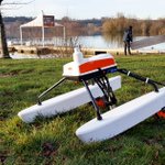



The Heliceo SuperBathy performed on Chalain Lake in France ! Thanks to the SuperBathy and its PA500 depth sounder, it was possible to carry out a #bathymetric #survey over an area of 42 acres, for future re-sanding of beaches.


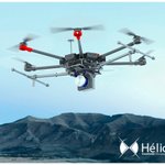
Our distributor Geomatic Instruments in full demonstration with our Fusion and SuperFox6 in Malaysia !
#VTOL #aircraft #multirotor #UAV #drones #demonstration


Heliceo made its #LiDAR pod compatible with the #DJI #Matrice600 pro, don't wait to be equipped ! Any questions ? We're here to help you. https://nitter.cf/t.co/6kiZYKNklD

1
Discover the Heliceo SuperBathy in action on the banks of the Erdre in France !
To find out more about this product, feel free to consult our website : https://nitter.cf/t.co/EzJexgjyPr
#superbathy #bathymetric #drone
Découvrez en un clin d’œil les toutes dernières évolutions de la #réglementation sur les #drones en France.
Envie d'aller plus loin ? C'est par ici !
ecologique-solidaire.gouv.fr…

Following the bathy mission to Loperec (France) for the BRGM SA Company, discover the results obtained with the FoxBathy Heliceo and the dual-frequency sounder M195.
#drone #bathymetry #data


Pour enrichir son catalogue de drones #multirotors, Hélicéo devient distributeur pour la solution Entreprise de @DJIGlobal ! Découvrez dès aujourd'hui les tous derniers #drones #DJI destinés aux professionnels : https://nitter.cf/t.co/Akh4oJd0OW

Thanks to its FoxBathy with M195 dual-frequency sounder, Heliceo measured the thickness of the sediment deposit in groundwater settling basins in Lopérec (France), for BRGM SA.
Need to know more about our #aquatic #drones and #bathymetric solutions? https://nitter.cf/t.co/Z4C2ZrmFvu


Heliceo and all his team whishes you all an happy new year 2020. Very joyful holiday season to all !

3
Heliceo made a #photogrammetric survey of the Gree marsh (France) for the Arrondel survey firm. Have a look to the points cloud and mission data on our website: https://nitter.cf/t.co/gIeLl7STFA
#photogrammetry #survey #drone


We get a lot of questions about the differences between #LiDAR technology and #drone #photogrammetry. What to choose ? What are their specificities and their possible applications? Check out all of this in our latest article here: https://nitter.cf/t.co/aE4sgcGvXL

Ce matin, lors d'une réunion organisée par le Campus des métiers de l'aéronautique Pays de la Loire, notre spécialiste en #photogrammétrie et #LiDAR, présentait les avantages et applications de ces 2 technologies. Une matinée riche en enseignement et en échanges, merci à tous !


2

Découvrez le 1er bulletin Alphatango de la DSAC (Direction de la Sécurité de l’Aviation Civile) consacré à la #sécurité des vols de #drones à proximité des aéroports.
C'est par ici 👉 mailchi.mp/aviation-civile/a…

L'@IGNFrance vous propose une nouvelle exposition « La Terre est un géoïde », disponible jusqu’au 31 janvier 2020 au Géoroom à Saint-Mandé, à deux pas du château et du bois de Vincennes.
Du mardi au vendredi, de 13h30 à 17h30, entrée gratuite !
#exposition #geodesie #france

Et vous, êtes-vous à jour concernant votre attestation d'aptitude de télépilote ? La législation sur les drones évolue constamment, consultez https://nitter.cf/t.co/16IWUema4v pour en savoir plus !
#drone #legislation #telepilote