

Meteorologist (CBM) 20+yrs TV, Baltimore, College Prof, weather geek,dad and outdoor lover. #FITF, Founder of The Maryland Trek, Just In Power Kids
Baltimore, MD
Joined January 2008
- Tweets38K
- Following1.3K
- Followers54.8K
- Likes18.4K



Pinned Tweet
Winner!
Crescent sunrise ☀️🌙🌎❤️
#PartialSolarEclipse
over Baltimore from my friend
Tim Shahan
#SolarEclipse

Good Morning it’s FRIDAY OCTOBER 30
🌵12 Days since the last rain…. CHANGE ABOUT TO HAPPEN
🌤️ 🌡️ Warm Again Today
👻🎃 Halloween Brings More Clouds And Cooler
⏰ 2 Days Until The Clock Change (back one hour) Sunday Morning
🌀 Coastal Storm Possible By Next Thursday
READ MORE 🔗 👉 Full Morning Report
justinweather.com/2026/10/30…


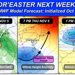
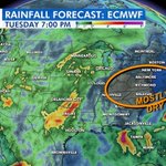
🌀 Nor'easter One Week From Today?
🖥️ The ECMWF Model is showing it Thursday Nov 5 with a Deep Negatively Tilted Trough...
🥶 Then Followed by COLDER air Next Weekend.
November will start warm, but this may get fun for a change and keep up the trend for more Coastal Storms
#Weather
#November
#Maryland
#mdwx

🌱🍂 FINAL DROUGHT MONITOR & LAWN HEALTH INDEX REPORT OF 2026
As we wrap up our weekly Lawn Health reports for the season, the dry weather has returned, and our long-term rainfall deficit continues to grow.
📊 FINAL LAWN HEALTH INDEX: 63/100 — GOOD
⬇️ Down 4 points from last week.
💧 11 DAYS WITHOUT RAIN!
After some substantial rainfall earlier this month, we have now gone 11 consecutive days without measurable rain at BWI.
The benefits of that earlier soaking have started to fade, and the lack of additional rainfall is taking a toll on soil moisture.
The good news? Temperatures remain favorable for our cool-season grasses, helping lawns hold on to their GOOD rating.
💧 RAINFALL UPDATE AT BWI
• October: 2.61” — 0.97” BELOW average
• Since September 1: 5.86” — 2.16” BELOW average
• 2026: 31.96” — 5.84” BELOW average
• Since January 1, 2024: 22.75” BELOW average!
That last number is especially concerning. We’ve accumulated a rainfall deficit equivalent to more than half of our typical annual precipitation over nearly three years.
🗺️ DROUGHT MONITOR: LITTLE CHANGE
The latest map shows little meaningful improvement across Central Maryland.
Abnormally Dry and Moderate Drought conditions remain across portions of the region.
Even with the substantial rain earlier this month, the longer-term moisture deficit has not disappeared.
☀️ WEATHER OUTLOOK: SEASONABLE TO MILD & MOSTLY DRY
🌡️ High temperatures generally in the mid-60s to near 70°F.
🌤️ Plenty of dry weather ahead.
🌧️ Only a small chance of showers around the middle of next week.
🍂 FINAL LAWN DOCTOR TIP: DON’T LET FALLEN LEAVES SMOTHER YOUR LAWN!
A thick layer of fallen leaves can block sunlight, trap moisture, and damage your grass, especially newly seeded lawns.
🍁 Mulching leaves is a great way to return nutrients and organic matter to the soil, but too many leaves can do more harm than good.
🌱 THE KEY: Mulch leaves finely or remove heavy buildup so your grass continues receiving the sunlight and airflow it needs.
❤️ A SPECIAL THANK YOU TO LAWN DOCTOR!
As we close out this year’s Lawn Health Index, I want to extend my sincere appreciation to our friends at Lawn Doctor, serving homeowners throughout Central Maryland.
Their partnership made this weekly series possible, allowing us to combine weather science, drought monitoring, rainfall statistics, and professional lawn-care advice into one report.
Throughout the summer and fall, we’ve tracked extreme heat, drought, heavy rainfall, and the changing conditions affecting our lawns.
Lawn Doctor contributed valuable weekly tips to help homeowners understand how to care for their grass through it all.
Thank you to the entire Lawn Doctor team for supporting Just In Weather, sharing your expertise, and helping us provide this information to our community.
And thank YOU for following along each Thursday!
🌱 THE FINAL WORD: Our lawns are ending the season in GOOD condition, but the growing rainfall deficit is something we’ll continue watching as we head toward winter.
Presented by @LawnDoctor
Serving All of Central Maryland
Healthy Lawn. Happy Home.

😢 Not Captain Jean Luc Picard
🖖 Sir Patrick Stewart (1940–2026) did live long and prospered.
The legendary actor died Wednesday at his Los Angeles home at age 86, after a battle with Alzheimer's and Lewy body dementia.
🚀 Captain Jean-Luc Picard: Star Trek: The Next Generation and Picard
🧠 Professor Charles Xavier in the X-Men films
🎭 A Royal Shakespeare Company stage giant
👑 Knighted in 2010
He made a generation fall in love with the stars. "Make it so." ❤️
#PatrickStewart #StarTrek #XMen #RIP
Photo: Beth Madison, CC BY 2.0, via Wikimedia Commons

🌀❄️ POLAR VORTEX SPLIT NEXT WEEK? A POTENTIALLY HISTORIC EVENT!
Something remarkable is developing nearly 20 miles above the Arctic, and the European weather models are showing extraordinary agreement!
📊 50 OUT OF 50 MODEL MEMBERS!
ALL 50 members of the traditional ECMWF ensemble forecast a reversal of the stratospheric winds by November 12.
👉Even the newer AI ensemble has 39 of 50 members showing a reversal.
That is strong support for a major disruption, although not every member necessarily predicts a complete split.
📅 HOW HISTORIC?
The European model suggests the event could begin around November 5–7. If verified, this could be the earliest major Sudden Stratospheric Warming in the modern record, roughly THREE WEEKS earlier than previous events!
🌀 WHAT IS A POLAR VORTEX SPLIT?
The Polar Vortex is a large circulation of very cold air and strong winds high above the Arctic. Powerful atmospheric waves can weaken and distort this circulation, sometimes separating it into two smaller vortices.
This is happening in the stratosphere, not where our daily weather develops.
❄️ DOES THIS MEAN SNOW FOR MARYLAND?
NO! A split does not automatically bring Arctic cold or snowstorms to Baltimore.
⏳ THE DELAY MATTERS!
When these disruptions influence the jet stream, the effects can take 1–3 weeks or longer to reach our weather.
That puts the second half of November into early December on my radar for a possible shift toward cooler and more active weather. The location of the cold air and storm track will determine what we actually experience.
🔄 THEN WHAT?
The stratospheric Polar Vortex may begin reorganizing and strengthening again within roughly a week after the disruption. That doesn’t mean any effects on our weather will end immediately.
🌨️ LOOKING AHEAD TO WINTER
This may not be the last disruption we see. Additional weakening or warming events are possible later in winter, when a favorable atmospheric response could bring a greater opportunity for Arctic cold and snowstorms in the eastern United States.
⚠️ BOTTOM LINE: The potential early-November event is remarkable for its timing, but it is NOT a snow forecast. I’m watching for a possible cooler, more active pattern later in November and into December—not promising a winter storm.
Faith in the Flakes! ❄️
#FITF
#polarvortex
#weather
#mdwx
#Maryland
#Pennsylvania
Maps: ECMWF forecast, October 29, 2026. Analysis and graphics by Andrej Flis / @severeweatherEU

Good Morning it’s THURSDAY OCTOBER 29
☁️ 🌤️ More Morning Fog; Afternoon Sun And Warm Up
🌡️ Friday: Warmest Day Of The Week
👻🎃 Halloween Looks Mild and Dry
🌵11 Days since the last rain, Chance For Rain Next Week!
⏰ 3 Days Until The Clock Change (back one hour) Sunday Morning
READ MORE 🔗 👉 Full Morning Report
justinweather.com/2026/10/29…


🧵2 of 2
OUTLOOK NEXT WEEK
READ MORE 🔗 👉 Full Morning Report
justinweather.com/2026/10/29…


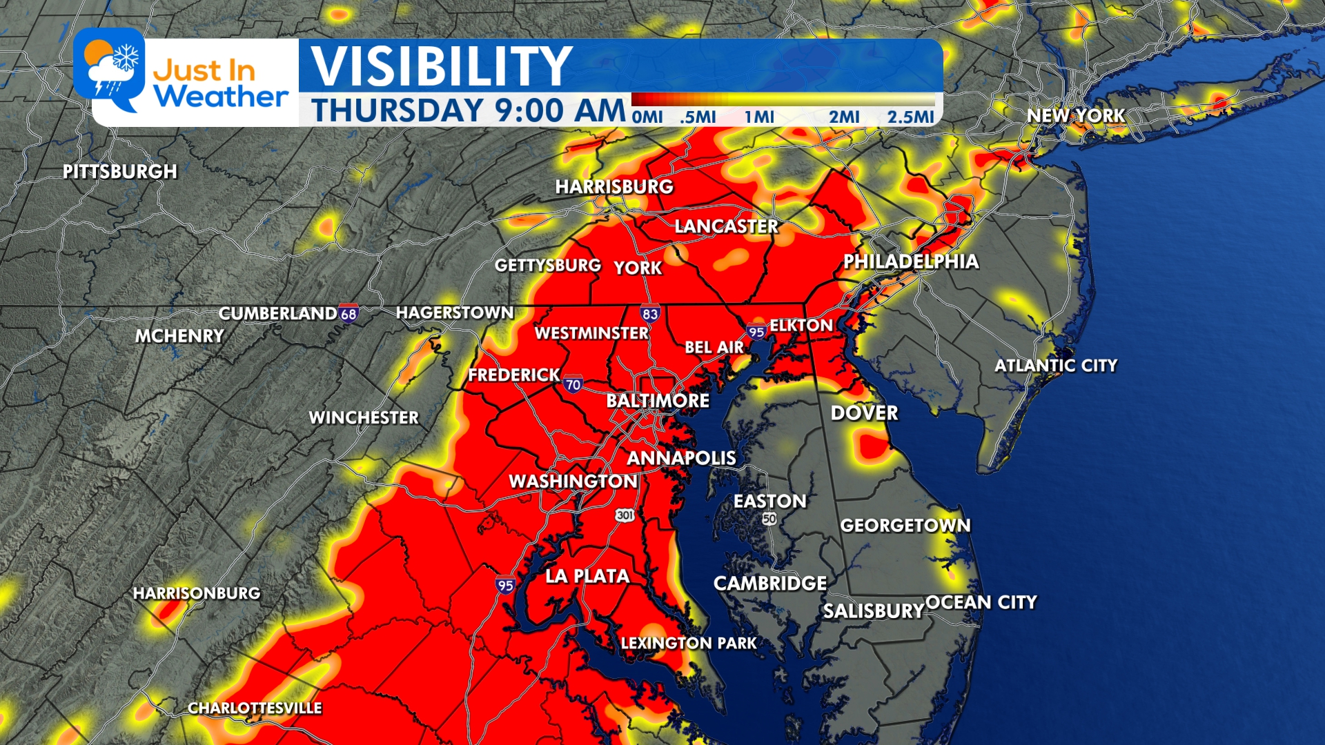
It is Fog Season around here...
🌙 ☁️ Some clearing
💨⬅️ Light Wind From The East...
Fog will form after midnight..
👀 Visibility Forecast Maps Thursday Morning...
🌤️For some areas It may take until Noon for the fog to 'lift and burn off'


This was our morning moon and a mackerel sky.
Those are altocumulus clouds.
Did you get to see something like this?
#morning
#sky
#weather
#mackerel
@nurse_jackie13

Good Morning it’s WEDNESDAY OCTOBER 28
⏰ 4 Days Until The Clock Change (back one hour) Sunday Morning
🧵1 of 2
☁️ Patchy Morning Fog, More Clouds Today
More Fog Likely Tomorrow Morning
👻🎃 Halloween Looks Mild and Dry
🌵10 Days since the last rain, Chance For Rain Next Week Is Low!
READ MORE 🔗 👉 Full Morning Report
justinweather.com/2026/10/28…

🧵2 of 2
🌵10 Days since the last rain, Chance For Rain Next Week Is Low!
READ MORE 🔗 👉 Full Morning Report
justinweather.com/2026/10/28…


🍁😍 High Color!
That’s what the latest Foliage Report shows in York PA.
We drove to Lake Redman after work this afternoon and it lived up to the hype.
How are the leaves by you?
This is among the best October weather stretches I’ve seen to help make the most of the what we’ve got.
#fallfoliage
#october
#autumn
#ilovethis


Epic photo!!!
🌕😍

Last night's Full Hunter's Moon rises over the Sandy Point Shoal Lighthouse in the Chesapeake Bay near Annapolis, Maryland.
Nikon Z8 & 600mm f/6.3 S, single frame
#HuntersMoon #fullmoon #moonphotography #ChesapeakeBay #lighthouse @capitalweather @JustinWeather

Peak Fall Foliage along the shore in f Lake Redman in York PA today.
@NWSStateCollege
@SunnySkyMEP
@BrettThackABC27
Tuesday October 27: 3 PM Smoke Map
🤔Have you noticed a haze in front of the sun today?
🔥 🌤️Light wildfire smoke is drifting into Maryland and the Mid-Atlantic today from fires across the Mississippi River Valley region.
🛰️Recent NOAA satellite analysis has confirmed smoke plumes from Arkansas, Missouri, Mississippi, and other parts of the Southeast, with light-density smoke covering much of the Mississippi Valley and drifting northeastward.
👉The maps show the general west-to-east / northwest-to-southeast flow carrying the smoke our way.
Thickest smoke ALOFT appears to be across metro Washington, Baltimore, Annapolis and through Southern Maryland to Delmarva.
🟢🟡Air quality remains mostly in the Good to Moderate range for now, but the haze is noticeable.
🌵Dry conditions continue to fuel fires across the region.
#Maryland #WildfireSmoke #AirQuality


I know it has been GREAT for many, but 9 days without rain and we may go another week...
Legitimate rainfall expectations near Zero through next Monday.
👻🎃 Halloween Still Looking Warm AND Dry!
🌥️ More Clouds Sunday as we turn the clocks back.
🌧️ Rain Chance On Monday is LOW for a few showers... but should increase after that.
🌡️ This WARM set up looks to dominate into the first Two Weeks of November. Remember we are watching for an unprecedented EARLY Polar Vortex weakening AND Potential Split. IF that happens, there is still a delay for cold air to reach us up to 3 weeks later.


Good Morning it’s TUESDAY OCTOBER 27
🧵1 of 2
🌡️ Slightly Cooler Today
☁️ Clouds Return Tonight And Tomorrow, But Dry!
🌵9 Days since the last rain AND the earliest I see anything may be Sunday or Monday
READ MORE 🔗 👉 Full Morning Report
justinweather.com/2026/10/27…

🧵2 of 2
🌵9 Days since the last rain AND the earliest I see anything may be Sunday or Monday
👻🎃 Halloween Looks Warm and Dry
⏰ 5 Days Until The Clock Change (back one hour) Sunday Morning
READ MORE 🔗 👉 Full Morning Report
justinweather.com/2026/10/27…


🌎 EL NIÑO 2026 VS. 1997: IT’S NOT JUST HOW STRONG, BUT WHERE!
We know this year’s El Niño is exceptionally strong. But there is something else that has caught my attention, and it may be important as we head toward winter.
The location of the unusually warm water could be just as interesting as the actual temperatures.
Take a look at these two ocean-height maps comparing October 1997 with October 2026.
🌡️ FIRST, THE NUMBERS
El Niño is measured using ocean temperature anomalies, or how much warmer the water is compared to average.
TWO REGIONS (marked on the globes) are particularly important:
🔸 Niño 3.4: The most commonly used region for measuring El Niño strength.
🔸 Niño 1+2: The easternmost region, just off the coast of South America.
Recent October 2026 weekly measurements show:
🔥 Niño 3.4: +3.3°C (+5.9°F)
🔥 Niño 1+2: +5.2°C (+9.4°F)
These are extraordinary anomalies, especially in the eastern Pacific.
The numbers are SST anomalies, while the accompanying maps show sea surface HEIGHT anomalies. The elevated ocean levels are associated with warmer water and changes in ocean circulation.
👀 🌎 NOW LOOK FARTHER NORTH!
‼️ This is the feature that really caught my attention.
Compare the two globes, especially the area west of Mexico and Baja California.
👉🏻Notice the extensive area of elevated sea levels extending farther north in 2026.
This feature is outside the traditional El Niño monitoring regions, but it could be relevant to the larger Pacific weather pattern.
🌀 REMEMBER THE EASTERN PACIFIC HURRICANES?
We’ve already experienced an unusually active eastern Pacific hurricane season.
Several tropical systems have affected Mexico, with tropical moisture reaching the southwestern United States.
Hurricane Polo was one example in September. It crossed Baja California, made another landfall in mainland Mexico, and helped transport tropical moisture into the Southwest.
This doesn’t mean the elevated ocean levels caused those storms. But the location of these ocean anomalies is something worth investigating alongside this season’s tropical activity.
🌧️ WHY THIS INTERESTS ME FOR WINTER
El Niño influences the tropical Pacific atmosphere, including where large clusters of thunderstorms develop.
That tropical convection can influence the jet stream thousands of miles away.
During many strong El Niño winters, the southern branch of the jet stream becomes more active, bringing Pacific storms across the southern United States.
But what if the strongest tropical convection develops farther east or north than during other major El Niño events?
Could that alter the position or strength of the southern storm track?
That is the question I’m exploring.
❄️ WHAT ABOUT SNOW IN MARYLAND?
A more active southern storm track can provide moisture for East Coast winter storms.
But moisture alone doesn’t produce snow.
We still need the right combination of cold air, storm timing, and atmospheric blocking.
That is why I’m also watching the polar vortex, the North Atlantic pattern, and other factors that can influence winter temperatures.
📌 MY TAKEAWAY
The extraordinary strength of this El Niño is getting plenty of attention.
But I’m particularly interested in WHERE the ocean anomalies are located and how the atmosphere responds.
The unusual feature farther north, near Mexico, adds another piece to the puzzle.
It doesn’t guarantee a particular winter outcome, but it gives us something important to investigate as I continue preparing my full Winter Outlook.
More to come!
❄️ Faith in the Flakes!
#ElNino
#weather
#winteroutlook
#FITF

Full Hunter’s Moon rising this evening.
🔭 This was the view with @nurse_jackie13’s new telescope Vs my iPhone 17 pro.
👀 Did you see it yet?
🌳 There may still be trees or other obstructions so some areas can have a delayed sunrise.
📝 It ‘looks’ larger simply because of perspective with the trees or buildings on the horizon. When it’s high in the sky it will be the same size, but not have the same ‘pop’.
🤔 Were the kids or pets a little crazy today? Might be in for a long night.
#fullmoon
#huntersmoon
#october
#eveningsky


