

Just a sheepdog watching over the flock. CANWARN severe weather spotter, Leafs /Jays fan, International man of mystery. https://nitter.cf/t.co/mmMoTxgjGO
Ontario, Canada
Joined January 2014
- Tweets4.4K
- Following878
- Followers819
- Likes16.2K






Kirk MacDonald retweeted

🚨NATIONWIDE GROUND STOP: FLIGHTS HELD ACROSS THE U.S. AFTER AIR TRAFFIC CONTROL OUTAGE
Flights across the country are being held on the ground this afternoon following a reported nationwide air traffic control communications outage.
A Minneapolis controller confirmed the outage is nationwide, with the ground stop in place until at least 4 p.m. CT. Radio frequencies are reportedly down at Boston Center, New York Center, Chicago Center and New York Approach. Pilots in Seattle and Los Angeles have also reported being held on the ground.
The FAA has confirmed ground stops at Chicago O'Hare and Midway through at least 3:30 p.m. CT due to an equipment outage and activated diversion procedures for all U.S. airports.
As of 2:52 p.m. CT, the FAA had not posted an official nationwide advisory.
The cause of the outage has not been determined.
If you are flying today, check with your airline before heading to the airport.

Winter tires on yet? On and off flurries today in Wellington County. This is north of Fergus 2:30pm. #onwx @weathernetwork
6
486
Kirk MacDonald retweeted

48 years ago tonight, October 30, 1978, ‘WKRP in Cincinnati’(CBS) featured ‘Turkey Drop’ episode in which Mr. Carlson took a more hands-on managerial approach by doing the greatest Thanksgiving promotion in radio history - dropping live 🦃 from a 🚁


Kirk MacDonald retweeted

#DEVELOPING: Police are actively rescuing people from flooded cars across Toronto after a heavy downpour of rain left 65,000 residents without power #ONstorm
Live updates here: cp24.com/local/toronto/2026/…


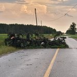
Widespread wind damage around Gads Hill, Poole, and Wellesley area . Several trees down over roads. #Onstorm @NTP_Reports – at Perth East, Ontario

This was a possibly a weak wall cloud with some rising scud appox 2pm near Alma #Onstorm #ShareYourWeather @weathernetwork @IWeatherON – at Centre Wellington, Ontario


Kirk MacDonald retweeted
#ONStorm #ONwx ‼️🌪️ BREAKING: Environment Canada Forecasting HIGH Risk for Severe Thunderstorms Including Tornado Risk for Southern Ontario on Wednesday
As we highlighted this morning, Wednesday is shaping up to bring potentially the strongest severe thunderstorm risk we’ve seen in Southern Ontario so far this year.
Environment Canada has just released its latest thunderstorm forecast for tomorrow, showing a widespread ‘high’ risk across portions of Southwestern and Central Ontario, along with the Golden Horseshoe.
Hazards within the high-risk zone include 110-130 km/h wind gusts, up to golf ball-sized hail, 30-50 mm of rainfall and a tornado risk.
Locations within this zone include Sarnia, London, Goderich, Kincardine, Owen Sound, Collingwood, Orangeville, Guelph, Kitchener, Woodstock, Hamilton, Niagara, Mississauga, Toronto, Newmarket, Barrie, Orillia, Peterborough and Oshawa.
Surrounding areas, including Deep Southwestern Ontario, northern portions of Central Ontario and southern portions of Eastern Ontario, are under a ‘moderate’ risk for severe thunderstorms.
Hazards within the moderate-risk zone include 100-120 km/h wind gusts, up to golf ball-sized hail, 30-50 mm of rainfall and a tornado risk.
Locations within this zone include Windsor, Leamington, Chatham, Muskoka, Bancroft, Belleville, Kingston and Brockville.
For the Ottawa Valley, there is a ‘minor’ severe risk tomorrow, where we could still see some isolated marginally severe thunderstorms. However, the strongest severe weather threat is expected to remain south and west of the region.
Hazards within the minor-risk zone include 70-90 km/h wind gusts, up to toonie-sized hail and 20-40 mm of rainfall.
The main window for severe thunderstorms tomorrow is expected to be during the afternoon and early evening.
However, there is also the potential for storms during the early morning hours, particularly across Southwestern Ontario. Some of these morning storms could also pose a severe weather risk.
We are working on a detailed forecast that will break down the timing, locations and threats in more detail, and we’ll have that posted later today.
Stay tuned!
- Brennen

Kirk MacDonald retweeted
#ONStorm #ONwx Do you have any important plans on Wednesday? If so, please pay very close attention to the forecast.
Significant severe thunderstorm outbreak for southern Ontario is looking increasingly likely for Wed, Sept 2nd, 2026.
Destructive damaging wind gusts, very large hail, flooding, intense lightning, and possibly several tornadoes, with a risk for strong tornadoes in southwestern Ontario.
On paper, this is the strongest severe thunderstorm and tornado risk we’ve had this season. If the environment remains as strong as a majority of models are suggesting, and the storm timing comes together just right, we could possibly be dealing with a tornado outbreak. Here’s hoping that’s not the case.
Isolated supercells will be working with an astonishingly strong environment on Wednesday, especially in the afternoon and evening. This risk extends from southwestern Ontario, through central Ontario in the afternoon/evening, extending to the GTHA, Niagara and eastern Ontario. There may be two or three separate rounds of storms throughout the morning, afternoon and evening for some of us.
Please review your emergency plan.
There’s a strong storm environment in southern Ontario today, Tuesday, Sept 1st, as well but storm development is very questionable. If storms do pop-up however, especially in southwestern Ontario, they could get quite strong. We’ll be monitoring radar closely throughout the day into the overnight.
More details and our preliminary forecast map for Wednesday will be out later today.
And, for those wondering, we’ll most certainly be live-streaming.
Remember, don’t be scared, be prepared. We got this. 💪
- Adam & the IW team


Kirk MacDonald retweeted

This tornado was anomalous not only because of its strength, (SW Ontario hasn't seen another F3+ since Goderich!) but also because of the synoptic and mesoscale factors at play that day.
Kirk MacDonald retweeted
OTD 15 years ago, a violent tornado tore through the scenic town of Goderich, Ontario, killing 1. The tornado came off Lake Huron as a rain wrapped waterspout with windspeeds up to 250kmh, dealing F3 damage to the harbour and downtown before tracking another 20+ kilometers. 🧵


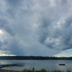
Lakeside view of a little more incoming rain. #Onstorm #Onwx @StormhunterTWN @KMacTWN – at Smith-Ennismore-Lakefield, Ontario

Kirk MacDonald retweeted
#ONStorm #ONwx Wow! Check out this awesome video of the tornado that tracked just north of Lindsay shortly after 1pm today!
The NTP has already confirmed this tornado and it's rating will be established after a damage survey is completed.
Huge thanks to Christine J. and Kelly R. for sharing this video!
- Alannah
Kirk MacDonald retweeted

This video shows you why it is SO important to not be caught inside a vehicle during a tornado. These people were lucky they were inside a building nearby.
@MyRadarWX
#tornado #chicago #ilwx – at East Hazel Crest, IL