Kyle G (@KyleStormChaser) header
Kyle G (@KyleStormChaser) profile picture

NBC KFDX 3/FOX KJTL 18- Storm Chaser | Opinions are my own. Be kind, be respectful and stay humble. You have one life, give it your all!

United States
Joined November 2016
Photo by Kyle G (@KyleStormChaser)Photo by Kyle G (@KyleStormChaser)Photo by Kyle G (@KyleStormChaser)Photo by Kyle G (@KyleStormChaser)Photo by Kyle G (@KyleStormChaser)Photo by Kyle G (@KyleStormChaser)Photo by Kyle G (@KyleStormChaser)Photo by Kyle G (@KyleStormChaser)Photo by Kyle G (@KyleStormChaser)Photo by Kyle G (@KyleStormChaser)
6:12pm- Randlett, Okla (Cotton Co.) #texomawx #okwx @NWSNorman
1
8
727
5:20pm- Electra, Texas (Wichita Co.) #txwx #texomawx @NWSNorman
2
4
456
4:40pm- Wilbarger Co., Texas #txwx #texomawx @NWSNorman
4
13
530
4:32pm- Southern Wilbarger Co., Texas severe storm #txwx #texomawx @NWSNorman
2
11
644
4:26pm- Northern Baylor County/Wilbarger County, Texas line. #txwx #texomawx @NWSNorman
2
13
693
Tornado watch likely coming in the next few hours, as severe weather is likely across portions of the risk areas. Stay weather aware today. #wichitafalls #texomawx
1
3
305
Severe weather likely today, across portions of the risk areas. Note- sunset is around 5:40pm today. #wichitafalls ⛈️ Stay weather aware #texomawx
Portions of north-central OK are now in an Enhanced Risk (level 3/5) for severe weather later this evening. Damaging winds and tornadoes are the main hazards, with a secondary threat for large hail. Make sure to stay weather aware and have a way to get warnings! #okwx #texomawx
5
345
Kyle G retweeted
Elevated threat of tornadoes detected for Monday, November 2nd, 2026. See attached map for details. This forecast initialized on Sunday afternoon. Follow for future forecast updates.
16
72
29
345
32,610
Slight risk for strong to severe storms possible on Monday. Still several days away. Something to keep an eye on. Enjoy the weekend! #wichitafalls #texomawx
4
193
He’s still here. He’s got a fan club. Including us.
19,847
24,336
5,400
231,141
8,363,477
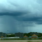
Rain showers are beginning to pop up around NW Texas. Nice shower just south of Wichita Falls. More on the way! #texomawx #txwx #wichitafalls 🌧️
5
312
NE of Randolph, MN! #mnwx @NWSTwinCities
11
110
10
631
73,929
Beautiful Fall day today across NW Texas! #texomawx 🍁 🌞
3
125
Never gets old!
25
107
9
819
33,604
Not even sure what planet I’m on anymore! Winslow, AZ 12:09pm #AZwx
11
44
3
477
11,550
Tornado warned storm coming into Prescott Valley right now #azwx
7
52
4
575
18,436
Felt like April/May on Wednesday here in NW Texas! Much needed rainfall. It’s always good for the soul to get out on the road and soak up some storms.
1
2
12
484
East of Palo Pinto, TX 5:10pm
1
10
1
76
3,240
Lawton—Looks like ya can reach up and touch the clouds at Mt Scott. 🌧️
3
281
Wichita Falls, Texas—Flood Watch in effect. Moderate to heavy rainfall continues this morning, causing some flooding issues. #txwx #texomawx @NWSNorman
5
2
16
762