

@Mike_Clay
Account based inUnited States
About this account
- Account based in
- United States
- Connected via
- United States App Store
Account-level information from X, not a live location or the device used for a specific post.
Chief Meteorologist Bay News 9, Tampa Bay. I have a live radar and I'm not afraid to use it. Follow the whole team @bn9weather
Tampa Bay Area, FL
Joined March 2009
- Tweets9.4K
- Following3K
- Followers4.8K
- Likes6.1K







Mike Clay retweeted

High tide has come and gone for Clearwater Beach, but water levels are not going down. Elevated water levels are possible through tonight with minor coastal flooding.


Mike Clay retweeted
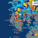
A Flood Watch is in effect through this evening for Citrus, Hernando, Pasco, Pinellas, Hillsborough & Manatee counties. We've had 3 to 9 inches of rain the last few days and more heavy rain is possible today. Wednesday record rainfall: Tampa 2.16", Ruskin 3.68", Brooksville 2.35"

Mike Clay retweeted
Another flood advisory for W. Pasco and N. Pinellas. Some areas have already had over 6 inches of rain since last night. Another 1-2 inches is possible over the next couple of hours. Advisory will expire at 1015 pm. #flwx

Mike Clay retweeted

Annual reminder for the young keyboard hype'rs with access to aggressive and unrealistic model runs.
You are being monitored from above.


Mike Clay retweeted

If you’re seeing political TV ads during 🏈 for elections far away from where you live, that’s because at this stage in the cycle it is likely less expensive to buy a TV ad during a regional/national NFL game than to buy it locally. Or there’s more inventory nationally.
That’s right - more expensive to buy 30 seconds in the Des Moines or Dallas markets - if there’s no air time left there - than to buy it nationwide.
Mike Clay retweeted

Public Intoxication. Men's restroom behind Section 413. Unable to close zipper. Released to sober friend. Ejected. #BTHOarkansas

October 3, 1992:
A significant outbreak of 10 tornadoes struck the Florida Peninsula. The worst damage from the event was seen in Pinellas Park where a devastating F3 ripped apart numerous brick houses & trailer homes. Three people were killed and 75 were injured.
#wxhistory


Mike Clay retweeted

BREAKING NEWS: Auburn University employee accused of leaking athletics trade secrets to rivals wsfa.com/2026/09/29/auburn-u…

Yep I was a DJ in Central Texas in 1981 and one of the tornadoes was visible from the old NWS office at the Waco airport. Many warnings that day.

Yes, certainly on the table! Great catch!!!! Check this out, since your old man was the meteorologist on the Texas State Network back then and remembers it well.
Hurricane Norma was a Category 3 Eastern Pacific hurricane in October 1981. It is a well-known example of a Pacific storm whose remnants crossed Mexico and produced heavy rain, flooding, and tornadoes in Texas
Norma was the strongest storm of the 1981 eastern Pacific season and one of only two hurricanes that year to make landfall in Mexico. Its Texas impacts followed a similar pattern (though wetter and more tornadic) to the later remnants of Hurricane Tico in 1983.On October 13–14 the interaction of tropical moisture with a front spawned about 13 tornadoes across northern Texas and southern Oklahoma. Notable ones included an F2 in McLennan County (near Waco) that injured four people and caused about $25 million in damage to homes, a grocery store, a theater, and churches, and an F3 in Navarro County. Tornadoes also affected the Dallas–Fort Worth area, including the airport. Rain from the system reached as far as Kansas. This upper feature looks even more impressive than Norma


Mike Clay retweeted

Getting struck by lightning is nothing compared to the pain of being a Browns fan
