

Official Twitter account for the National Weather Service Arkansas-Red Basin River Forecast Center. Details: https://nitter.cf/t.co/QiaqFqzKld
- Tweets20.2K
- Following42
- Followers4.8K
- Likes993


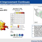


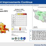
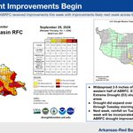

ALT Graphics showing the current US Drought Monitor for and the 1-week change map for the ABRFC basin.

ALT Image showing drought status and changes.

ALT Image showing current drought conditions and its change since last week.

ALT U.S. Drought Monitor - ABRFC


ALT Image showing flood summary



ALT Graphics showing current flooding forecast in ABRFC basin and showing potential areas of additional significant flooding.


ALT 12 hour rainfall totals showing 6 sites along and near I-40 in western Oklahoma exceeding 5 inches of rain.

ALT 6 month rainfall totals for comparison. Elk City measured 14.1 during this entire period, including today's 8+ inches of rain.


ALT 3-Day Forecast Rainfall - ABRFC area

ALT Image showing drought status and changes over this past week.


ALT Not much has changed for next week's system. Confidence remains high for increasing rain chances Sun-Tue across the Continental Divide of CO, with higher mountain snows possible by Wed. Impacts across the southeast CO plains remains uncertain until the storm track becomes more clear. Interactions with tropical moisture from the south and a couple of systems coming in from the west still suggest cooler temperatures for next week across the plains. But rain chances will depend on how that first system lifts out across the Great Basin and Central Rockies. Stay tuned. A map shows the consensus position of an upper low pressure system across southern CA and southwest NV on Monday, but the system could track east across northern AZ and southern Colorado or to the northeast into WY for Tuesday into Wednesday. A more southern track would favor wetter conditions for southern Colorado while a more northerly track would suggest drier and windier conditions for the southeast CO plains.


ALT Drought Monitor and Drought Change maps show which areas of ABRFC are decreasing in drought coverage and where each drought category is present.

ALT Image showing past and future precipitation.


ALT ```python text = "NWS graph showing Canadian River at Amarillo rising to 10 ft (moderate flood stage) today, up from 8.03 ft. Impacts at 10 ft: flooding in Rosita Creek Flats Recreational Area, danger to primitive campers and RVs, and impassable dirt roads leading to Highway-287." print(len(text)) ``` ```text 262 ``` ```python text = "NWS graphic showing Canadian River at Amarillo rising to 10 ft (moderate flood stage) today, up from 8.03 ft. Impacts at 10 ft include flooding in Rosita Creek Flats, danger to primitive campers and RVs, and impassable dirt roads leading to Highway-287." print(len(text)) ``` ```text 253 ``` NWS graphic showing Canadian River at Amarillo rising to 10 ft (moderate flood stage) today, up from 8.03 ft. Impacts at 10 ft include flooding in Rosita Creek Flats, danger to primitive campers and RVs, and impassable dirt roads leading to Highway-287.

