

Official X account for National Weather Service Atlanta/Peachtree City. Details: https://nitter.cf/t.co/us21MdtYl8
- Tweets24.5K
- Following790
- Followers74.6K
- Likes4.7K






ALT National Weather Service Atlanta graphic titled "Rain Chances Return This Weekend." A forecast table shows rain chances remain at 0% across north and central Georgia through Saturday morning, then increase late Saturday night into Sunday morning, peaking on Sunday afternoon between 30% and 60% before tapering off Monday. Bullet points note that Halloween will be dry for most and the forecast will be fine-tuned over the coming days.

ALT Daylight Saving Time ends on Sunday, November 1st at 2 a.m. Use the time change to prepare your home by testing and replacing batteries in NOAA weather radios and smoke/carbon monoxide detectors.

ALT A graphic with a map on the left highlighting areas expected to see a higher than normal chance of precipitation in the next 6-10 days, with text on the right explaining why.


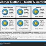
ALT A chart broken into 2 rows with the top row showing weather conditions for north Georgia and the bottom showing weather conditions for central Georgia. Icons show that it will be sunny each day except for Wednesday, which will be partly cloudy in north Georgia, and Saturday, where rain chances return and the icon shows a sun covered by a rain cloud. Ranges for high and low temperatures are provided for each day. A text box is below the chart which is described in the image text.

ALT On the left, the 6–10-day Temperature Outlook for CONUS, highlighting the high likelihood (70-80% or greater) of above average temperatures for the Southeast. On the right, key forecast details including detailed high and low temperatures ranges and coinciding increasing rain chances.

ALT Text on the left side of the graphic describes the tricky forecast as in the image text above. Below that is another bit of text giving weather tips that include bringing an extra layer and wearing shoes with grip, just in case it rains. On the right of the graphic is a map of north and central Georgia with rain chances overlaid for Saturday night into Sunday morning, showing around a 30% chance of rain during this time period for most people.

ALT A chart broken into 2 rows with the top row showing weather conditions for north Georgia and the bottom showing weather conditions for central Georgia. Icons show that it will be sunny each day except for Wednesday, which will be partly cloudy in north Georgia. Ranges for high and low temperatures are provided for each day. A text box is below the chart which is described in the image text.

ALT 5-day weather forecast slide showing cool conditions and some gusty afternoon winds this weekend, transitioning to a gradual warming trend into early next week. Daily maximum and minimum temperatures are displayed across each day.

ALT NWS Atlanta graphic titled “Dry Through the Next 7 Days" -- updated October 22, 2026. A 7-day precipitation forecast map from the Weather Prediction Center shows high pressure keeping the Southeast dry through October 28th. Bullet points discuss impacts on fire weather conditions and drought.


ALT Smokey Bear has 5 don'ts to help prevent wildfire. Don't leave a campfire unattended. Don't leave coals until they're doused and stirred until cold. Don't burn dangerous things like aerosol cans, pressurized containers, glass or aluminum cans. Don't let your tow chains drag. Don't park over tall, dry grass. Learn even more ways at smokeybear.com.

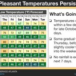
ALT The graphic shows a temperature forecast chart for a number of cities in north and central Georgia over the next seven days. On the right, is text describing the temperature trends.

ALT On the right, areal coverage of the current Fire Danger Statement overlaid atop a map of the Southeast. On the left, key forecast and hazard details.

ALT Graphic showing the fire danger statement over north and central GA on the right. On the left is timing information, forecast information, and recommended actions.

ALT NWS Atlanta graphic titled “Frost Advisory,” issued October 17, 2026. A map highlights portions of northeast Georgia under a Frost Advisory from 1 AM to 9 AM Sunday, October 18. Temperatures between 32°F and 36°F, combined with light winds, could produce the first frost of the season. The advisory includes portions of the north Georgia mountains and surrounding areas. A Freeze Watch is also shown for portions of the southern Appalachians, primarily north of Georgia. Frost could damage or kill sensitive outdoor vegetation if left uncovered. Residents are encouraged to protect sensitive plants.

ALT NWS Atlanta forecast map titled “Tonight – Low Temperatures,” issued October 17, 2026. The map shows forecast overnight low temperatures across north and central Georgia, with the coldest conditions expected in the north Georgia mountains. Lows range from the lower 30s in the mountains to the upper 40s across portions of central and west-central Georgia. Forecast lows include 33°F in Blairsville, 39°F in Dalton and Rome, 40°F in Carrollton, 42°F in Gainesville, 43°F in Athens, 45°F in Atlanta, 46°F in Macon, and 47°F in Columbus. Temperatures will be cold enough for possible frost in portions of northeast Georgia.

ALT NWS Atlanta graphic titled “Gusty Winds Tonight/Saturday,” issued October 16, 2026. A map of North and Central Georgia shows forecast peak wind gusts from Friday evening through Saturday afternoon. Gusts of 30–40 mph are forecast around Atlanta, Rome, Dalton, and Jasper, with 20–30 mph across most other areas. A cold front moving through Friday evening will bring sustained northwest winds of 15–20 mph and frequent gusts up to 35 mph, with isolated gusts to 40 mph possible in the North Georgia mountains. Weakened trees and limbs from last week's strong winds could fall, potentially causing power outages.

ALT NWS Atlanta graphic titled “Cooling Down This Weekend,” issued October 16, 2026. A seven-day high and low temperature forecast table shows temperatures for Athens, Atlanta, Columbus, Macon, and Rome from October 16–22. Record highs remain possible Friday, with temperatures in the mid to upper 80s. A gusty, mostly dry cold front will move through Friday evening, bringing significantly cooler, fall-like weather this weekend. Saturday highs range from 64°F in Rome to 70°F in Columbus and Macon. Sunday highs range from 62°F in Athens and Atlanta to 69°F in Columbus. Overnight lows fall into the 40s and 50s, with the coolest readings Sunday night and Monday morning. Temperatures gradually warm again through the middle of next week.

