

Official X account for the National Weather Service Juneau. Details: https://nitter.cf/t.co/ouonGFtGcp Latest SE Alaska weather #akwx - https://nitter.cf/t.co/n1ly2F3o9i
Juneau, Alaska
Joined August 2012
- Tweets21.2K
- Following137
- Followers9.8K
- Likes3.4K





A wind advisory is in effect for Prince of Wales & Annette Island tonight thru early Wed morning. An incoming gale force front brings strong gusts up to 45mph. Winds will ease as the front moves inland. A gale warning is also in effect for Clarence Strait thru Wed at noon. #akwx

ALT Graphic depicting wind advisory for southern panhandle
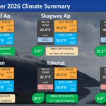
October saw another mixed bag of weather across southeast Alaska. While Juneau and Yakutat saw above normal precipitation, Ketchikan was well below normal for the month.
For more local climate information, go to: weather.gov/wrh/climate?wfo=…

A front moves into the region Tue afternoon, bringing light to moderate rain and elevated SE winds. NE Gulf Coast sees showers starting Tue morning, intensifying later. Rainfall totals ~1.0" or less. A small disturbance Tue night brings extra rain to the south into Wed. #akwx


I spy with my little eye the aurora borealis on the Spuhn Island FAA webcam! Perks of working the midnight shift before clear skies slip away ahead of the incoming front.
Webcam: weathercams.faa.gov
Forecast: weather.gov/ajk
#AKwx #AuroraBorealis #MidnightShift


A Winter Storm Warning has been issued for elevations above 1500 ft on the Klondike Highway starting at 10 am AKDT Saturday and lasting through 9 am AKST Sunday. Total snow accumulations could reach 9 to 14 inches with some gusty winds to 40 mph at times.

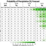
Widespread clear skies and dry conditions are expected through the end of the work week. Precipitation looks to creep back into the forecast on Saturday as a front moves into the northern panhandle, starting with Yakutat.

Uncertainty still remains about whether the ridging currently over the Gulf will hold out for longer, holding the front back from reaching the panhandle as quickly. Check back on our website weather.gov/Juneau for updates to the forecast as we get closer. #akwx
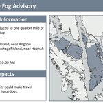
Areas of dense fog are ongoing in parts of the northern and central panhandle, including Hoonah and Angoon. Dense fog will be intermittent at times and is expected to thin out through the morning. Dense fog advisories have been issued through 10 AM Sunday. #akwx


Current satellite imagery is showing mainly clear skies across SEAK this afternoon. Current temps are in the 30s to low 40s across north, with 40s to low 50s across the south. Quieter weather pattern continues through the weekend into next week.


Grab your jackets! Here's a look at this morning's low temperatures.
Much of the northern panhandle is near or below freezing, with the southern half sitting in the mid to high 30s. With clear skies expected again today, low temps tomorrow will be similarly chilly. #akwx


Good afternoon SE AK! Enjoy a sunny start to the weekend as high pressure clears skies across the region. Lows tonight drop into the upper 20s to 30s. Outflow winds pick up tonight with gusts up to 30mph for areas exposed to northerlies, then calming by Saturday afternoon. #akwx


Good morning, SE AK. Cloud cover and some showers remain this morning but things are already changing for the weekend. High pressure returns and we will start to clear out today into tomorrow. With the clearing skies, low temperatures will drop into the 30s for the weekend. #akwx


Hang in there, Juneau! Conditions are steadily beginning to improve with the front having passed almost all the way through. Here are some of the highest wind gusts observed today across Juneau, with most areas at the surface seeing 55 to almost 65 mph gusts this afternoon.

Our observations at higher elevations up to 4000 ft which include Eaglecrest (88 mph), the Tram (79 mph), Lemon Glacier (145 mph), and Sheep Mtn (131 mph) can also give us a great idea of how fast the winds are blowing just above us. #akwx
Curious how gusty it's been since midnight? These are the peak wind gusts we've seen over the last 10 hours across the Panhandle. The front will continue to push eastward through Tuesday, allowing the stronger winds to push into the Southern Panhandle through the afternoon.


Wind speeds will decrease behind the front tonight, but stay elevated into Wednesday for some of the northern inner channels.
To view some of this data yourself, you can go to this website: weather.gov/wrh/hazards
Lightning strikes along the Gulf Coast and near Yakutat are expected to continue through Tuesday, though the possibility of these cells making it further into the interior panhandle again is diminishing. #akwx
Check out our forecast here: weather.gov/Juneau
Good morning Southeast! Active weather continues today as a Gulf low pushes strong fronts across the panhandle. Expect elevated winds and moderate to heavy rain, with a slight chance of thunderstorms off the NE Gulf coast. Check your local forecast: weather.gov/ajk


For those folks in the Icy Strait Corridor area including Juneau. No, you weren't dreaming. That is thunder you have been hearing this morning occurring along the front as it moves in.
A strong system is expected to move into the area tonight, with heavy rainfall across the Northern Panhandle. youtube.com/watch?v=x2LN8BV8…
