

Official X account for the National Weather Service Spokane WA. Details: https://nitter.cf/t.co/aXUBdcUoNd
- Tweets45.6K
- Following328
- Followers34.9K
- Likes12.2K




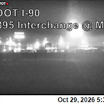


ALT The Dense Fog Advisory was expired at 10:45 AM, and visibilities have improved across the region. Here is I-90 at Arthur St. now, quite the difference! Have a good day, and have a Happy Halloween.

ALT [UPDATE 8:55 AM, 10/31/2026] The Dense Fog Advisory has been extended to last through 11am this morning as we are still seeing webcams and observations showing localized 1/4 mile visibilities, especially near Spokane and Pullman. This screenshot is on I-90 and Arthur St. Stay safe! #wawx

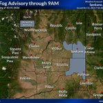
ALT [7:45AM, 10/31/2026] Heads up, folks! A Dense Fog Advisory has been issued for the Spokane and Washington Palouse areas until 9am. There are localized areas of 1/4 mile visibility or less, with many areas 1/2 to 1 mile visibility. If driving, slow down, and stay safe. #wawx

ALT Webcam view of Medical Lake at I-90 of foggy conditions.

ALT Webcam of I-90 at Hwy-2 of foggy conditions.

ALT A Halloween forecast, showing upper 40s to low 50s cooling toward the low to mid 40s through the evening. Limited chances of light rain.


ALT radar image of thunderstorms in the Kettle Mountains.

ALT [Update: 10/27/26 8:30am]: Still seeing visibilities near 1/4 mile in the Moses Lake, Coulee City, Ephrata, Hartline, and Ritzville areas. Remember to turn on low-beams and reduce speed if you encounter fog while driving.


ALT [10/27/26 6:15am] Good morning folks! Webcams and reports show patchy fog with 1/4 mile visibility near Moses Lake, Ephrata, and Ritzville. Be safe and slow down during the morning commute if you encounter fog!
ALT [10/27/26 6:15am] Good morning folks! Webcams and reports show patchy fog with 1/4 mile visibility near Moses Lake, Ephrata, and Ritzville. Be safe and slow down during the morning commute if you encounter fog!


ALT It's beginning to look a lot like snow is falling at Stevens Pass! Doesn't look to be sticking to the roads yet, but we will keep a close eye on the camera. As always, safe travels! Image showing snow falling but not sticking to roads.

ALT Weekly outlook graphic. Depicting cooler conditions with scattered showers.


ALT Map showing wind gusts at 2AM with gusts of 30-44 mph.

ALT Graphic from NWS Spokane warning of gusty winds from Thursday night through Friday. Impacts include elevated fire weather, patchy blowing dust, and airborne unsecured objects like Halloween decorations. A map shows peak gusts of 45-50 mph near Ellensburg, 35-40 mph in Omak and Wilbur, and 10-30 mph across much of eastern Washington and North Idaho.

ALT Map showing the probabilities for a tenth of rain or more. Highest chances are in Idaho and eastern third of Washington.

ALT Weather conditions will transition from mild and dry through Wednesday to wetter and cooler at the end of the week. The cooler temperatures over the weekend will drop snow levels to between 3,500 and 5,000 feet with light snow in the mountains possible.

ALT Observed Sunday morning lows, ranging from low 20s to near 50.

ALT Sunday High Temperature Forecast.

ALT Weekly High and Low Temperature Forecast.

ALT Image of frost on Autumn leaves and words talking about cold temperatures near freezing or below and preparation to take if desired.