

Hi, I'm Nick Finnis, a Forecaster for Netweather - one of the UK's leading independent weather media/news websites. I specialise in severe weather forecasts.
Caterham, Surrey
Joined October 2013
- Tweets16.6K
- Following257
- Followers8.3K
- Likes7.3K




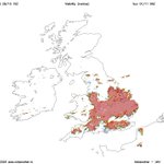


Little or no rain forecast by 12z ECMWF for large parts of the UK for next 15 days, including SW England, where one reservoir, Wimbleball, is only 15% full, with reservoirs in the region 35% full on average. Early November is normally one of the wetter times of the year, building up big problems for next year if we carry on with low rainfall in the coming usually wetter months …


Much colder air arriving from the northeast on 12z GFS for the weekend of 7/8 November, as blocking high that builds near UK from this weekend migrates NW to Greenland - opening up the arctic floodgates, bringing risk of frost and wintry precipitation. But a long way off, so may not happen.


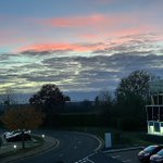
Anticyclonic gloom has set in, trouble with high pressure as we approach the last few months of the year is the sun hasn’t the strength to burn the cloud away now.

Big increase in EPS members going for
a SSW on today’s sub-seasonal forecast since the 23rd, when there was just one or two stragglers going for it.
Unprecedented events seem to happen a lot these days in meteorology and there’s little historical precedent to judge how it might play out weather-wise over the coming weeks following a record early SSW for November.
Widespread fog forecast to develop overnight across central, southern and eastern England at the weekend - could make it suitably spooky for #Halloween


High pressure in late autumn often means fog forming overnight where skies clear and winds fall light - could become widespread in the mornings at the weekend, slow to clear too with the weaker sun.


No major SSW has occurred before November 28th since records began in 1959, so an event in the first week of November would beat the record by roughly three weeks.
The most likely outcome is the vortex elongates and briefly splits but then quickly merges back into one vortex - but a polar vortex that is displaced.
Could lead to high latitude blocking later in November and risk of colder spells in Northern Europe, but depends where the displacement ends up. Since this would be an extremely early event, with the vortex not yet fully set up, there’s little historical precedent to judge how it might play out.


Just by chance from Tesco’s car park in Ashford, Kent late this afternoon a more unusual short rainbow 🌈 within a rain shaft from a shallow shower cloud north of town.

Much needed fresh sea air this afternoon down near Dungeness in Kent after being stuck indoors a lot recently with the wet weather. Fish and chips was had at the Pilot Inn after, recommend it for this if anyone is down that way, don’t have to book but gets very busy.


Nick's Weather Eye retweeted

✈️ Powerful winds from Storm Boelo made for some challenging landings at Birmingham Airport in England as pilots battled gusty conditions to get their planes safely on the ground.
Bored pets on a rainy day, both don’t like going out when it’s wet, the cat just wants sit on me and get my attention at any opportunity I sit down rather than go out and keep cats away from his territory


Almost full moon tonight, very bright on this cold and clear night, love the way it cast shadows outside


Nick's Weather Eye retweeted

Who knows what impact this will have on the actual weather. But for the #SSWE fans, 62% of the 12z EPS members do show a U wind reversal at 10mb at 60 N.
