
Official county government account. Third largest county in the lower 48. From Gabbs to Tonopah to Pahrump. Refer all communication to [email protected]
- Tweets9.7K
- Following205
- Followers2K
- Likes45


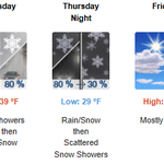








ALT The storm system impacting Nevada today will push further inland to eastern Nevada overnight into Tuesday morning. Much cooler temperatures post front will drop snow levels below 5000 feet, allowing snowfall to reach the valleys. By Tuesday night, the snow levels will drop further to below 4000 feet as the system pushes further east and out of Nevada. Temperatures are expected to be a few degrees below normal Tuesday with highs in the low 40s.


ALT An image depicting a Wind Advisory that has been issued for northern and central NV on Friday, November 13th from 10AM Friday morning until 3AM Saturday morning. Sustained southerly winds of 20-30 mph with gusts up to 50 mph are expected.


ALT The image depicts high temperatures throughout Northern and Central Nevada in the lower 50s this afternoon.


ALT A quick moving storm system will progress through the Great Basin this evening through tomorrow, resulting in cooler temperatures filtering into the region. A warmup will commence Friday as high pressure builds in from the west with highs warming into the 50s and 60s.


ALT A quiet yet breezy day is in store for Wednesday with winds out of the west to SW at 10 to 20 MPH with gusts up to 35 MPH possible. A storm system looks to move in for the end of the week as rain chances increase from 10% Thursday to 60% Friday, with winds shifting to the south at 10 to 20 MPH with gusts up to 30 MPH. Temperatures look to range from the upper 40s to upper 50s through Halloween Saturday.