
Ph.D. | Operational meteorologist at WSP | Canadian weather maps and stats | FR/EN
Montréal, QC, Canada
Joined May 2009
- Tweets4.8K
- Following272
- Followers2.4K
- Likes13.1K





Patrick Duplessis retweeted

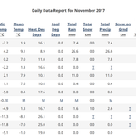
Record mildness in Nunavut 🇨🇦!
🌡️0.7°C Cambridge Bay, NOV. RECORD, breaking 0.0°C in 1931
🌡️0.2°C Gjoa Haven, NOV. RECORD, breaking 0.0°C in 2025
🌡️2.4°C Kugluktuk, 0.4°C from its Nov. record
🌡️2.3°C Arviat, 0.1°C from its Nov. record
🌡️3.8°C Bathurst Inlet
🌡️1.2°C Baker Lake


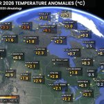
October 2026 was warm in most of Canada, especially in the northwest. Meanwhile, a cooler trend was observed in the Atlantic provinces and parts of Québec.

Patrick Duplessis retweeted
🌡-30.7°C Isachsen, Nunavut, first -30°C of the season in Canada, quite early this year. #NUstorm

While Ottawa only climbed to 7.5°C today, Windsor recorded its latest 30°C on record (prev. Oct 8, 2007)!

🎢 Big contrasts today in Canada!
ONTARIO 🥵
🌡️30.6°C Sarnia
🌡️30.1°C Windsor (Hx 36)
🌡️29.4°C Chatham-Kent
🌡️29.0°C Ridgetown
🌡️28.9°C Harrow
🌡️28.7°C Toronto
🌡️28.6°C London
🌡️28.4°C Hamilton
NUNAVUT 🥶
🌡️-28.5°C Alert (windchill -38)
🌡️-26.7°C Eureka (-36)
#ONstorm #NUstorm


9
380
Patrick Duplessis retweeted
First -20°C of the season in Canada 🇨🇦, a few days later than average.
🌡️-22.0°C Margaret Lake, YT
🌡️-20.9°C Mould Bay, NT

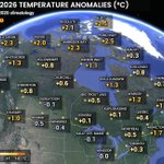
September 2026 was a warm one in most of Canada except Atlantic Canada and BC. Regions around the Hudson Bay recorded temperatures up to 3°C above normal, while parts of the Maritimes saw their coolest September since 2004 or 2009. #wxtwitter

Patrick Duplessis retweeted

September goes into the rear-view with just 3 days reaching 20+°C at St. John’s #YYT. Fewest since 2019.
Year-to-date total 49 days also lowest since 2019 (will see if October nudges that up, though not likely by much).
Quite a contrast to the record 84 days in 2025! 🌡️ #nlwx

Patrick Duplessis retweeted
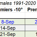
🌡️-14.0°C in Alert, Nunavut 🇨🇦 on September 11, first -10°C of the season in Canada.
This is the lowest temperature that early at the station since 2017 [-14.2°C on Sept. 9; -12.4°C on Sept. 2]. Winter is (slowly) coming... #NUstorm


August was another warmer month than normal in most of Canada, with the warmest anomalies in the north and the Maritimes. It was even the warmest August on record in Halifax.
Southern parts of the Prairies ended up slightly below normal.

July 2026 was generally warmer than normal in Canada, with colder anomalies in the northwest. The warmest anomalies were in the southern Prairies and northwestern Ontario. #wxtwitter

June 2026 was warmer than normal in Canada, with pockets of cooler anomalies here and there. Warmest June on record in Rankin Inlet and Cambridge Bay, and rainiest June on record in Edmonton.


May 2026 was full of temperature swings in #Canada, but overall the warm anomalies slightly outweighed the cold ones. Ontario was cooler than normal while BC, the Prairies, most of Nunavut and Labrador were warmer than normal. #wxtwitter

Patrick Duplessis retweeted
❄️ Unusually late snowfall in Sydney, Nova Scotia 🇨🇦, one of the latest ever recorded [1.0 cm on *June* 9, 1975 and 0.3 cm on May 29, 1974]. #NSstorm


Patrick Duplessis retweeted
Hottest day of the year in Canada! 🥵
SK
🌡️36.3°C Val Marie
🌡️35.6°C Mankota
🌡️35.5°C Coronach
🌡️34.3°C Rockglen
AB
🌡️35.3°C Hilda
🌡️35.1°C Etzikom
🌡️34.9°C Medicine Hat
🌡️34.8°C Masinasin
🌡️34.7°C Bow Island, Gahern & Winnifred
This is just the beginning! #SKstorm #ABstorm


Avec près de 13 cm de nouvelle neige (partiellement fondante) depuis hier à l'aéroport de La Grande-Rivière, près de Radisson à la Baie-James, le total du mois s'élève maintenant à 34 cm! Un nouveau record pour un mois de mai. Données depuis 1977. #meteoqc

6
351
Halifax YHZ airport hit 30.3°C this afternoon!
This is the earliest date to hit 30°C at the station, beating May 22, in 1992 (32.6°C).
Normal high is 16°C.

12
427
April 2026 was another cold month in most of Canada. Above-normal temps were observed in the Quebec City-Windsor corridor, and BC was overall near normal. #wxtwitter

Patrick Duplessis retweeted