

Maps, mapping, geoviz. No politics. Fellow @RGS_IBG Past board member @wmsmapsociety
Joined January 2020
- Tweets2.3K
- Following487
- Followers8.6K
- Likes2.6K




Pinned Tweet
My new wall map "East Asia and the Pacific: Viewed from Eurasia" is now available for free (CC BY-NC 2.0) as a high-resolution download. Prints well at 20"x30" or larger. Thanks to everyone who provided helpful comments during many revisions.
thinkinginspace.net/latest-m…

Rhodes Cartography retweeted

During WWII, the British solved the nightmare of fueling the invasion of Europe by secretly laying hundreds of miles of pipelines directly across the seabed of the English Channel.
It was called Operation PLUTO.
To hide it from the Luftwaffe, high-pressure pumps generating 1,500 psi were disguised inside seaside bungalows, garages, and fake ice cream parlors. Welded 3-inch steel pipe was unspooled from floating drums the size of ferris wheels called "Conundrums."
At peak, PLUTO pumped over 1,000,000 gallons of fuel a day directly to frontline Allied tanks across France, Belgium, and into Germany, completely immune to U-boats and Channel storms.
One of the greatest, weirdest engineering triumphs in military history. 🇬🇧⛽️


Rhodes Cartography retweeted

Greatest regular season home run of the 80s? It might be this one right here.
An unusual military history map from WWI: A cyanotype riverine Navy chart... "Overview map of the area of the Austro-Hungarian Vistula Flotilla (Übersichtskarte des Bereiches der K. u. K. Weichselflotille)" From @bn_org_pl
polona.pl/item-view/295f0ca6…

Rhodes Cartography retweeted

Finie! Elle part demain avec sa compère chez l'imprimeur pour être ensuite mise en ligne !
Quelques détails 🗺️
Si vous voulez la précommander (en 42x60cm ou en 60x85cm), vous pouvez me mp!
#map #bretagne #bzh


A 1944 classic from Erwin Raisz. See high resolution at @DavidRumseyMaps:
davidrumsey.com/luna/servlet…

Map of the northern part of the Red Sea rotated to fit a horizontal frame. Good use of the page and lots of fine detail. @LOCMaps
lccn.loc.gov/2006635246

Rhodes Cartography retweeted

Big Developments! @NavalWarCollege/@ChinaMaritime Studies Institute Quarterly Review 1.8 (Fall 2026)—New Multimedia Webpage, PiX Account & 2027 Conference Info!
digital-commons.usnwc.edu/cm…
From CMSI Director @ChrisHSharman, @USNavy (Ret.):
Where is CMSI’s research making an impact & how is CMSI supporting the education of the next generation of military leaders?
The Fall 2026 CMSI Quarterly Review offers a snapshot of the Institute’s latest scholarship, research impact & educational engagement.
Take a look at what CMSI has been up to by downloading our latest issue of the Review!
CMSI’s research reaches well beyond our own publications. The Fall issue provides links to where CMSI scholars are cited in external journals & reports, featured in leading media outlets & contributing to discussions of #China’s #military #maritime developments.
It also showcases our latest China Maritime Reports, CMSI Notes, original Chinese-language translations & other scholarship advancing understanding of the People’s Liberation Army Navy & China’s military maritime power.
Equally important, CMSI translates its research into education & engagement in support of the U.S. Naval War College & the broader @DeptofWar. Through teaching, professional military education, briefings & engagement with U.S. & international partners, CMSI helps equip military officers, students & defense professionals with the knowledge needed to understand China’s maritime capabilities.
This issue also commemorates CMSI’s 20th anniversary.
With this issue, we are pleased to announce the launch of CMSI’s new multimedia webpage + our presence on PiX & we look ahead to our May 2027 biennial conference in Newport at the Naval War College.


In response to popular demand, all of the mapmaking tools on my site have been updated with unit selectors for miles, kilometers and nautical miles.
thinkinginspace.net/tools.ht…


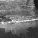
Amazing aerial photograph of Utah Beach from @USNatArchives. This perspective really highlights the beach exits and causeways.
catalog.archives.gov/id/2210…

Thanks to @simongerman600 for sharing my map with his many map-loving followers.

The Baltic Sea from a different angle. Perspective matters. This looks vastly different and more involved than a standard map of Europe. Source: buff.ly/PvqiVck

Rhodes Cartography retweeted

I mapped every airport, airline, and flight in the world.
flights.theojaffee.net
Rhodes Cartography retweeted

For a while during the Northern Hemisphere’s summer, the sun sets in Eastern Brazil before it does in Ireland. Now you know.


Rhodes Cartography retweeted

A little Polish joy. These panoramic sketches weren’t created during the Battle of Monte Cassino - they were drawn afterwards by Second Lieutenant Zdzisław Brunne and Officer Cadet Jan Bisiński, serving in 12 Kompania Geograficzna (12th Geographical Company), 2nd Polish Corps.


Rhodes Cartography retweeted

This is a sad day. Prof Symonds gifted us with some of the most agile and thoughtful texts on the US navy and its history. Sober, balanced, insightful, his writing inspired many of us in the business and guides - and will continue to guide - generations of students. RIP.

The U.S. Naval Institute mourns the passing of Dr. Craig L. Symonds, distinguished naval historian, award-winning author, and professor emeritus of history at the U.S. Naval Academy. Through three decades of teaching and a lifetime of scholarship, he helped generations of naval officers and readers understand the people, decisions, and sacrifices that shaped our naval history.
In May 2023, Dr. Symonds addressed the Naval Institute’s 150th Annual Meeting, reflecting on the enduring relationship between the Navy and its independent forum. His remarks became his most recent Proceedings article, “A Two-Way Street: The Navy–Naval Institute’s 150-Year Relationship.” In it, he described the Institute as “a sounding board and not an echo chamber”—a reminder of the value of thoughtful debate in advancing the naval profession.
We honor his lasting contributions to naval history and extend our deepest condolences to his family, friends, colleagues, and former students. His legacy lives on in the people he taught and the history he brought to life.
Read his article and revisit his 2023 remarks.
usni.org/magazines/proceedin…


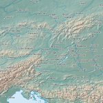
Have just finished Patrick Leigh Fermor, A Time of Gifts. Should have read this remarkable book long ago. But I constantly needed a reference map to follow along his rambles, so I quickly made this Rotterdam to Constantinople map. No borders, only natural features.

Much of Fermor's book talks about the many names that different towns have gone by over the centuries. This map uses the Natural Earth English defaults, which will probably dissatisfy everyone slightly.