

Official account of the Southwest Florida Water Management District. Follow ≠ endorsement. View our social media policy: https://nitter.cf/t.co/MKKbWhqwdh
- Tweets5.9K
- Following126
- Followers4.3K
- Likes110




ALT A vertically split promotional graphic reminding residents to adjust their lawn watering timers for the autumn time change: • Left Side: Over a background of fallen autumn leaves on rustic wood planks, bold text reads: "DON'T FORGET! Set your timers BACK an hour in the FALL." Below the text is the "Water 101 Southwest Florida Water Management District" logo. • Right Side: The top section shows a close-up of a digital/mechanical irrigation control dial with options like "SET CURRENT TIME," "SET WATERING START TIMES," and days of the week. Below the timer dial, a lawn sprinkler head sprays water over green turf grass.

ALT Infographic titled "Scary Good Water Habits: List of 5 'Scarily' Easy Water Conservation Habits" by the Southwest Florida Water Management District, illustrating five simple water-saving tips: taking shorter showers, checking for leaks, turning off the tap while brushing teeth, running full loads of laundry, and checking the weather forecast before watering.

ALT Five septic system maintenance tips: Shield Your Field (divert water, avoid parking/planting on drainfield), Don't Overload the Commode (flush only toilet paper), Think at the Sink (limit use of garbage disposal, avoid fats/solids/harsh chemicals), Don't Strain Your Drain (use water efficiently, stagger water use), Protect It and Inspect It (get tank inspected/pumped every 1-3 years), and Keep It Clean (test well water regularly). It shows the underground septic tank, drainfield, and nearby well.

ALT Graphic titled "Governing Board Officers" showing headshots and names for Jack Bispham (Chair), Ashley Bell Barnett (Vice Chair), John Hall (Secretary), and Dustin Rowland (Treasurer) against a blue background.

ALT The square logo for the Water Matters Podcast by the Southwest Florida Water Management District. The text is large, white and centered, overlaid on a photograph that is split between the sky and green trees above and extremely clear blue-green water with aquatic vegetation below.

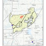
ALT Title: Green Swamp Wilderness Preserve - East Tract, Burn Unit: GS2027F2, Acres: (+/-) 253. Map Details:Preserve Boundary: Highlighted in light yellow with a solid black outline, stretching across portions of Pasco, Sumter, Polk, and Lake counties. Burn Unit: A red-hatched polygon located in the western portion of the preserve, just east of Highway 471 and north of Blue Lake and the Withlacoochee River Swamp. Surrounding Features & Roads: Includes State Road 471 running north-south, Highway 98 and Route 54 near the southwestern boundary, Gator Creek, Gator Hole Slough, and Rock Ridge. Footer Information: Includes a legend for the Burn Unit and Preserve Boundary, a 0–2 mile scale bar, a North arrow, and the Southwest Florida Water Management District logo.

ALT Map of Lower Hillsborough Wilderness Preserve highlighting a 178-acre prescribed burn unit (LH2027F2) cross-hatched in red near the north-central section of the preserve. The yellow-shaded preserve boundary is situated east of Interstate 75 and Bruce B. Downs Boulevard, positioned northwest of Thonotosassa.

ALT Map of Green Swamp Wilderness Preserve - East Tract highlighting a large 1,061-acre prescribed burn unit (GS2027F1) marked in red cross-hatching near the Sumter and Lake county border line. The yellow-shaded preserve sits east of State Road 471 and Cumpressco, with the Withlacoochee River Swamp running south of the burn area.

ALT Map of Lower Hillsborough Wilderness Preserve highlighting a 130-acre prescribed burn unit (LH2027F1) filled with red cross-hatching near its upper-central boundary. The yellow-shaded preserve lies east of Interstate 75 and Bruce B. Downs Boulevard, bounded to the southeast by US Highway 301 and north of Thonotosassa.

ALT Map of Conner Preserve showing a 100-acre prescribed burn unit (CP2026F1) marked in red cross-hatching in the northeastern area of the preserve. The yellow-shaded preserve boundary sits south of State Road 52 and east of US Highway 41, near Connerton and Ehren.

ALT Infographic titled "Check for Leaks Using Your Water Meter" by the Southwest Florida Water Management District, outlining a four-step process to detect household water leaks.

ALT Map of Starkey Wilderness Preserve depicting a 155-acre prescribed burn unit (ST2026W6) filled with red cross-hatching in the upper portion of the preserve. The yellow-shaded preserve boundary spans south of State Road 52 and west of the Suncoast Parkway, positioned north of Odessa and Trinity.