
#Millwright #Canadian #StormChaser #WX watcher for #EnvironmentCanada, former traveling #BMX Rider. weather, music, cars and handle bars
Kananaskis, Alberta
Joined September 2011
- Tweets54.2K
- Following1.3K
- Followers2.8K
- Likes62.4K




Pinned Tweet
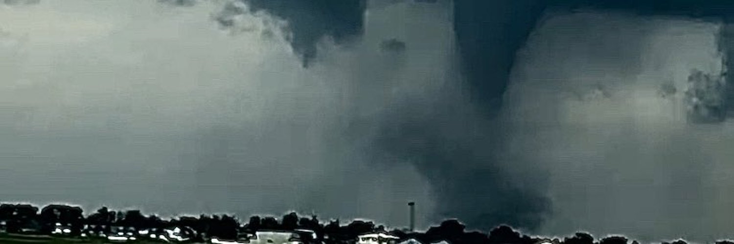
Some more edits from the #tornado by #Didsbury and #Carstairs yesterday #abstorm #ShareYourWeather #July1st2023 – at Kananaskis, Alberta


Tom Graham retweeted

El Niño is doing its thing across Western Canada this week. We know what that means... or do we?
At Rural Roots Canada, we break down a remarkably mild, snow-free week ahead for the Prairies. ruralrootscanada.com/prairie…


Tom Graham retweeted

Saturday's forecast high temperatures & sky conditions for October 31st. For your specific hourly forecast for trick or treating, you can find that on our website, theweathernetwork.com
Tom Graham retweeted
I could say "Will the weather for Halloween be a trick or a treat?", but that would be cheesy.
Nonetheless, the answer is in the midweek weather update for the Canadian prairies at Rural Roots Canada. ruralrootscanada.com/prairie…


Tom Graham retweeted

For your viewing pleasure...
youtube.com/live/MGKJlITiEZA…

Tom Graham retweeted
#Windy day from the southern tip of Baffin Island to the Gulf of St. Lawrence & the snow is flying as well. #Flurries for the higher elevations in western NFLD, up the Labrador coast, across northern Quebec & into eastern Nunavut. A late October bluster. @weathernetwork
Tom Graham retweeted

🚨 New PolarWx Model Viewer is live 🚨
It's been a while since my PolarWx model page got an upgrade - so today I'm releasing a new model viewer with a fully interactive and customizable layout, many more plots & models, and many new features.
polarwx.com/models/

Tom Graham retweeted

You liked the low elevation Snowfall this weekend for Vancouver's Mountains? Well buckle up for an even better shot this week. Wednesday overnight into Thursday morning is looking quite interesting much lower in elevation. We may see Snowflakes mixing down to 300m elevation. Which means SFU, Westwood Plateau, and the British Properties may be seeing some Wintery Weather mixing at times right before, *checks calendar* *does a double take and checks again* Um...Halloween??? 🤨 You may actually see a Special Weather Statement issued for a slight chance of Snowfall for the highest inhabited hills of Metro Vancouver if the forecast verifies. Super El Nino does not mean cold storms are impossible. Our winter is by no means a write off at all. #bcstorm

Tom Graham retweeted

Get ready, Alberta. For the first time since April, daytime highs may not climb above freezing by the middle of the week. ow.ly/Zhvl5100Q2G

Tom Graham retweeted

WOW! Kelvin-Helmholtz clouds seen earlier this year from Elmira, New York. These rare clouds form on windy days when two different layers of air move at different speeds. Photo courtesy of Alexis Stoner. #NYwx

Tom Graham retweeted

Models are finally coming into agreement with an upper level #PolarVortex moving into #BC next week. Expect a cool/unsettled pattern, coastal mountain snow and frosty overnights around the South Coast.
#BCWx #BCCold #BCStormwatch #PNW #Halloween 👻🎃🥶


Tom Graham retweeted
Winter driving conditions are here for the season. Get those winter tires on and be prepared for slippery roads. #abstorm

Tom Graham retweeted
Several vehicles have slid into the ditch along HWY1A between Cochrane and Calgary, Alberta #abstorm

Tom Graham retweeted

10/23/26: 7 am. #SNOW! 2C. It was a lovely warm week; cool at night. A chance to get out and hike in the #harvieheights wildfire guard. Access roads were made impassable. We knew “this” was coming #ShareYourWeather #Canmore We’ll see Sunday if shove, shove, shovelling is needed.


Mid mountain @SkiNakiska and decently #snowing 10-15cm on the ground #Kananaskis valley #abstorm #ShareYourWeather #October2026


