

Your 24/7 source for Minnesota Weather! * https://nitter.cf/t.co/gOGcSRDdi3 * https://nitter.cf/t.co/cR7fFsvQXl
Minnesota
Joined July 2025
- Tweets920
- Following104
- Followers2K
- Likes16






Pinned Tweet
Why dontcha scooch on over to our YouTube channel and hit that subscribe button? And while you’re at it, our website has all the weather info for your neck of the woods.
Links are right here, real handy-like: 👇
🎬 youtube.com/@WeatherLoon?sub…
🌐 weatherloon.com/


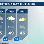
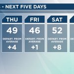
Thursday is dry but also cloudy, breezy, and cooler. Overall, we have a nice weekend with sunshine and temps turning milder by Sunday. Next week is warmer and dry.

We are FINALLY drying out tomorrow, but the clouds stay with us and it'll be fairly gusty with winds from the north. Highs are down to the 40s, which is normal for this time of the year, we have just been pretty spoiled.

This weekend is the 2026 Minnesota Deer Hunting Opener. Weather is a big factor for many heading to the woods. AM Saturday temps will drop into the 20s, so bundle up! Meteorologist Todd Nelson has more on the wknd forecast. Good luck hunters and be safe! f.mtr.cool/ijwt9cn62n
MONTHLY RECORD PRECIP: Hibbing's November precipitation record of 3.58" set in 1977 has been exceeded by noon on the 4th of the month, and the number will continue to rise with additional rainfall today. #WeatherLoon #mnwx

Looking at the rest of the week, today will stay wet but we will slowly dry out with just a few showers possible Thursday and some sunshine by Friday!

Do not put your umbrella away yet! We continue to track wet weather for your Wednesday. #mnwx
Another soggy day tomorrow with low pressure over eastern Minnesota and western Wisconsin. Highs end up in the 40s and 50s with some strong north winds.

We are feeling more of a November chill towards the end of the week once the low pressure system pulls away and brings the rain with it. Temps rebound through the weekend.

🌧️Monday’s rain broke records across northern Minnesota. Hibbing picked up 2.18", the wettest November day ever recorded there. At least it's not snow!
Show us a picture of your rain gauge total - reply here or submit on our website: weatherloon.com/submit
#mnwx #WeatherLoon

Another round of showers spreads across the state today however totals will stay lighter than yesterday. #mnwx
Plan on another soggy but mild day tomorrow. In fact, rain showers are likely through Wednesday before tracking out on Thursday.


Will this be one of Minnesota's Top 3 warmest winters on record?
Paul Douglas looks at how a historic "Super-Duper" El Niño is hijacking the jet stream with possible 50s in December, midwinter thaws, and delayed snow until late January.
Full Video: youtu.be/VKeIFOjVykA

1.20" in Park Rapids and counting! Several daily records have already been achieved by 1 pm Monday. Dry breaks are settling in for some, but periods of rain will continue through the middle of the week. #WeatherLoon #mnwx

This week: rain. Multiple rounds today, Election Day, and through midweek. Rainfall may be heavy at times (potential totals shown over next 5 days). #Weatherloon #mnwx


🎃🌧️ A FEW RAINDROPS IN THE HALLOWEEN FORECAST! A little rain could continue to dampen parts of Minnesota tonight. Grab an umbrella along with those costumes! 👻🍬

Happy Halloween! Forecast for today calls for showers, more impactful rain settles in to kick off the new workweek. #mnwx
A few showers look possible for the weekend with a mild and partly cloudy Sunday on tap. We get a bit of déjà vu with the storm system early next week as strong breezes warm us up to unseasonable levels along with more rain and some storms Monday into Tuesday.

This year is the 35th Anniversary of the famous 1991 Halloween Blizzard that brough nearly 30" of snow to the Twin Cities. Meteorologist Todd Nelson takes a look back at the historic event and why many snow records still stand today. f.mtr.cool/h3pfo11zx0