

NCSU Meteorology
Raleigh, NC
Joined January 2020
- Tweets5.2K
- Following153
- Followers1.3K
- Likes167K


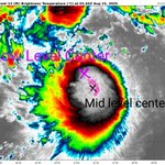




After a period of intense RI last night #Erin has cleared a pinhole eye only seen in the most extreme storms. It will continue to strengthen rapidly until choked off by the secondary eyewall, which is becoming apparent on radar, but is not as organized as the primary eyewall yet.


#Erin has undergone some structural changes overnight that poise it to begin strengthening quicker. A convective blob displaced to the SE side of the LLC was replaced by a small but concentrated band of storms around the LLC/MLC, aligning the storm and forming a true core.


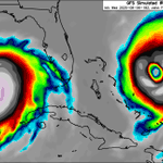
Models are starting to bump #Erin closer to the east coast as the 50/50 low weakens, allowing for the Bermuda high to try and bridge the gap with the CONUS ridge. Landfall threat is still highest for Bermuda but folks along the Outer Banks might need to watch this one.
Brendan Weathers retweeted
5pm EDT 8/11: Tropical Storm #Erin is forecast to gradually intensify as it moves westward across the tropical Atlantic. Please read the key message below, and see hurricanes.gov for more details.

Brendan Weathers retweeted
NHC will initiate advisories on Tropical Storm Erin, located in the Eastern Tropical Atlantic, just west of the Cabo Verde Islands, at 1100 AM EDT (1500 UTC).
Brendan Weathers retweeted

Invest 97L forecast to transcend dimensional boundaries and make landfall on weathermodels.com

IMO, the most likely solution atp for #97L is a recurve. Ensembles show a weakness between subtropical ridges and an active jet stream with many chances to grab 97L. The best chance for it to sneak further west is if it struggles to organize and is blown west by sfc trade winds.


I can't not post this. This has to be one of the most ridiculous model outputs I've ever seen. Like what are we doing 😂


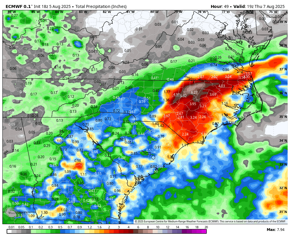
Another push of heavy rain on approach to areas already under a flash flood warning. Some areas have already surpassed 5" with more coming.



Dawg what 😭😭


Tornado Warning including Tribune KS and Horace KS until 5:00 PM MDT

ALT This graphic displays a tornado warning plotted on a map. The warning is in effect until 5:00 PM MDT. The warning includes Tribune KS and Horace KS. This warning is for Central Greeley County in west central Kansas. The threats associated with this warning are a radar indicated tornado and baseball sized hail. There are 846 people in the warning along with 2 schools and 1 hospital.
Please don't listen to engagement-bait slop like this. This person is perhaps the furthest thing possible from an expert.

What an absolutely amazing start to the day! Can't remember the last time it felt this good outside 😍

Brendan Weathers retweeted

Thermal wind balance is an incredibly important concept in meteorology. I have put together an animation to explain how it works visually.


Brendan Weathers retweeted

This has been a long time coming. NWS is finally exempt, and the positions are classified as public safety. Meteorologist jobs are expected to be posted soon. I appreciate everyone fighting for this. Thank you, @NC_Governor and @NCAGO, who have been working with me to advocate!!

NWS is hiring! The first of several top-priority, mission-critical positions posted Friday on USAJobs.gov!
Others will follow soon. Visit USAJobs.gov and search “NWS” to learn more.

ALT Image of the NWS logo. Cloud with a lightning bolt and the lettering "National Weather Service"