

Central Florida Hurricane Center @ https://nitter.cf/t.co/EyXybvEy5j. Hurricanes without the Hype since 1995 - Florida focused commentary. See NHC for official info
Orlando, FL
Joined June 2009
- Tweets11.5K
- Following445
- Followers2.7K
- Likes1.1K

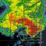
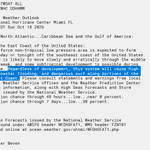


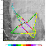

Rainfall event for East Florida this week, with certain areas along the coast getting a lot of rain. Hybrid system could form off the coast later in the week, marginal chance for anything purely tropical, but impacts likely regardless.

4
495
🌀 Flhurricane 🌀 retweeted

The generational Pacific Hurricane Season continues, as it has now eclipse an incredible 350 units of ACE. This season has shattered the previous record of 318 units.
VANCE also makes 2026 tied with 2015 for the most major hurricanes in a single season (at 11). It might be a very long time before we see a season like this again.


🌀 Flhurricane 🌀 retweeted

The area of low pressure well off the Mid-Atlantic Coast has acquired enough subtropical characteristics that it is now considered a Subtropical Storm, named Subtropical Storm Josephine. The latest track from the National Hurricane Center as of 5 PM EDT on October 21st is shown.

We are monitoring the non-tropical storm-force low forming east of NC. While most models do not favor a track back towards the coast for landfall, it is worth keeping in mind that regardless of classification or track, impacts along the coast and offshore are still likely

3
371

🌀 Flhurricane 🌀 retweeted

#Hurricane #Isaias has made landfall near Destin, Florida as a Category 2 hurricane with max winds of 105 mph. Isaias is the 4th October Florida landfalling hurricane since 2000. The other three are: Wilma (2005), Michael (2018) and Milton (2024).

🌀 Flhurricane 🌀 retweeted

STRONG WINDS and Power Flashes here in the Okaloosa Island, Florida area as Hurricane Isaias closes in!
LSC/Mike Killian
🌀 Flhurricane 🌀 retweeted

Dynamics folks — tornado on the inner edge of the eyewall? Or aliasing?
During Idalia (similar strength and similar timing of dry air entrainment), a tornado likely occurred in Perry, Florida. Lots of chasers experienced it.
Something wonky at play here:


🌀 Flhurricane 🌀 retweeted

We did at the *very last* minute get rapid core collapse in Hurricane #Isaias as extreme wind shear finally began ventilating the eye. Central pressure rose 13mb in 2 hours between the last two aircraft measurements, and the eyewall structure on radar fully opened up.
However, highly dangerous conditions are ongoing on the ground as Isaias nears imminent landfall in the vicinity of Destin, #Florida. Hope everyone stays safe tonight.


The well-advertised tornado risk is now here with a 95% chance of a Tornado Watch coming very soon.


3
273

Recon is still finding lower pressures, thus a stronger hurricane this morning, and Isaias is likely to become a major hurricane later this morning before hitting shear. Isaias is now forecast to be a category 2 at landfall near Pensacola.
2
339
🌀 Flhurricane 🌀 retweeted
Hurricane #Isaias continues to gradually gain strength tonight, with the eye now reappearing in satellite imagery, albeit mostly cloud-filled. Max winds are now estimated at 105 mph based on hurricane Hunter aircraft data. While vertical shear is increasing, it is not yet disrupting the storm core in a significant way.
Isaias remains forecasted to be an intense hurricane at landfall Friday night in the far western #Florida panhandle. The exact severity of wind-related hazards will depend on whether rapid weakening begins just prior to landfall due to the onset of extreme wind shear. Regardless, dangerous hazards are expected from storm surge, wind, and flash flooding.


🌀 Flhurricane 🌀 retweeted
Eye of Hurricane Isaias now forming -- rapidly. Dangerous next 24 hours ahead as the hurricane sits over the deep and warm "Loop Currrent" and the same area that powered history's most intense storms.
We can only hope for wind shear to retard the intensification.
🌀 Flhurricane 🌀 retweeted
🌀 Thursday video update: Hurricane #Isaias intensifying as it begins to turn toward the Gulf Coast