CONTOURS (@contou_rs) header
CONTOURS (@contou_rs) profile picture

Sharing mountain routes, adventures world wide.. visit our site to discover your next adventure.

Joined August 2012
Photo by CONTOURS (@contou_rs)Photo by CONTOURS (@contou_rs)Photo by CONTOURS (@contou_rs)Photo by CONTOURS (@contou_rs)Photo by CONTOURS (@contou_rs)Photo by CONTOURS (@contou_rs)Photo by CONTOURS (@contou_rs)Photo by CONTOURS (@contou_rs)Photo by CONTOURS (@contou_rs)Photo by CONTOURS (@contou_rs)
A new update has dropped, refreshing the Activity and Route screens with interactive details and a photo slideshow to help you navigate along a route.
1
20
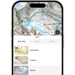
By request, you can access National Base Maps. Our base map styles contain most of the data you will ever need, but National Maps can add another layer of information.
1
22
Lifetime foundation memberships were created to kickstart Contours. Now that we’ve added high-resolution terrain layers, offline maps, and route planning, we’re retiring the lower-tier lifetime offer. This is your last chance to lock in lifetime access at this price. €39.99
1
1
65
NEW! Custom terrain overlays now available - highlight areas by elevation, aspect, and gradient. Designed to visualise avalanche bulletin details and to plan your adventures. Lifetime memberships are just €39.00 - but only until January 30th. Built on @expo modules and @Mapbox
1
1
21
Need an app that gives you the data you need for safe ski touring or backcountry planning? With our high-resolution map overlays, you'll know the terrain you are getting into - Lifetime memberships from €39.99
1
2
47
Been a nice journey in understanding the alpine reports from the Mountain Safety Collective in Australia to include them in the app. Tailored to their environment. Worth the look at how these reports are different from your normal avalanche bulletins. mountainsafetycollective.org…
1
2
66
Contours is really happy to be helping support avalanche information and training from Centro de Información de Avalanchas (CIAV) and the Asociación Argentina de Guías de Montaña. As requested Bariloche and El Chaltén bulletins quick links are now available in the app.
1
56
3D rendering for Contours from open LiDAR data opens up some detail to help with exploration and planning.
1
20
When you need that extra detail for route planning.
1
17
Dynamic map layers coming soon to the Contours app
77
How much detail can we get into our slope angle layers compared to other apps ?
52
🔴 Avalanche danger is HIGH for all of our forecast regions tomorrow. Avoid all avalanche terrain. Learn more about why conditions are so dangerous in our blog 💻 avalanche.ca/blogs/warmup-wo… or podcast 🎧 bit.ly/AvCanPodMar13
3
22
2
26
5,058
You might have heard of 'division of labour', but our newest forecaster blog is about the labour of division! Find out how we created the subregions we use for our flexible forecasting system, and why it was far less simple than it seemed. Read it now 👇 avalanche.ca/blogs/how-we-cr…
1
4
556
So excited to get this out to everyone - play.google.com/store/apps/d…
1
21
We are looking for beta testers for our iOS and Android apps.
35
Still some touring to be had in Austria
42
With 65"+ of snow up the canyons this morning it seems like a good time to reiterate that I'm selling these posters to raise money for the Utah Avalanche Center. 100% of profits go to the UAC.
17
41
4
496
75,562