
New types of free maps for rapid transit networks. Main dev: @topobyte
Berlin, Germany
Joined June 2017
- Tweets11
- Following0
- Followers52
- Likes3


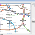
With the new 49€ ticket for all regional public transport in Germany now available, it would probably make much sense to create a schematic map that includes all nationwide regional trains. Has anybody tried doing that?
90
We're looking for a co-founder / colleague. We're applying to the German EXIST program to work on open metro maps but also open city data and its applications in general. Please get in touch: [email protected]
Is there any public transport company anywhere in the world that publishes its schematic network map under a free license? We're looking for a map that's free to imitate using our open technology! Please get in touch if you have any suggestions
U3 now running to Warschauer Straße. In OpenMetroMaps the change of the line network is represented in this simple, human-readable diff:
github.com/OpenMetroMapsData…

3
Building a Berlin metro map with station nick-names: demo.openmetromaps.org/nickn…
Tweet your suggestions with #OpenMetroMaps or submit a pull request: github.com/OpenMetroMapsData…
#berlin #prototypefund @bvg_kampagne #weilwirdirchlieben


3 months, 350h work, 600 commits.
First demo is online: openmetromaps.org/demo
Since we're developing a desktop software that's directed at non-developers,
its crucial to make installation as easy as possible.
Anyone got a Windows or Mac box to lend for testing?
#prototypefund


