

LiDAR maps: hillforts, barrows, Roman roads and lost villages. Scheduled Monument warnings in England. On iPhone, iPad, Android, Mac and Windows.
- Tweets38
- Following0
- Followers96
- Likes1



ALT LiDAR terrain shading of Knowlton, Dorset. Look for an oval bank-and-ditch ring about 106m by 94m around the church, with a large round mound to its north-east.

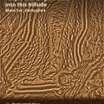
ALT LiDAR terrain shading of the slopes of Mam Tor, Derbyshire, with the ground enhanced to show small features. Long curving lines of rampart and ditch run down the slope beside rows of small scoops, the hut platforms.

ALT LiDAR terrain shading of British Camp, Herefordshire. Look for the long bank and ditch running round the two hilltops, four entrance gaps, the ringwork in the northern half and small hut circles inside.

ALT LiDAR terrain shading of Sutton Hoo, Suffolk. Look for a cluster of low, worn-down burial mounds, with one, Mound Two, rebuilt to its original height in 1992.

ALT LiDAR terrain shading of Cissbury Ring, West Sussex. An oval rampart and ditch encloses a hilltop, with a dense patch of small round hollows in the western part of the oval.

ALT LiDAR terrain shading of Wandlebury Ring, Cambridgeshire. A circular ring of bank and ditch, almost 320m across, surrounds a landscaped interior with a small round hollow near its centre.

ALT LiDAR terrain shading of an unnamed henge complex in North Yorkshire. Three ring-shaped earthworks run in a line from the upper left of the frame towards the lower right, among fields and tracks. The answer comes tomorrow.

ALT LiDAR terrain shading of part of Fyfield Down, Wiltshire, with the ground enhanced to show small features. Faint rectangular field boundaries cover the frame.

ALT LiDAR terrain shading of Grimspound, Devon. Look for an oval walled enclosure of about 1.45ha in the saddle between two tors, with a gap in its south-east side.

ALT LiDAR render of Maiden Castle, Dorset: rings of banks and ditches around an oval hilltop. Text: Maiden Castle, Dorset, Iron Age hillfort. Scheduled Monument: look, don't detect or dig. LiDAR © Environment Agency 2022, OGL v3.0.

ALT LiDAR render of Maiden Castle, Dorset: rings of banks and ditches around an oval hilltop. Text: Maiden Castle, Dorset, Iron Age hillfort. Scheduled Monument: look, don't detect or dig. LiDAR © Environment Agency 2022, OGL v3.0.

ALT LiDAR terrain shading of Cissbury Ring, West Sussex. Look for the oval rampart, ditch and counterscarp bank with gaps on the south and east, and a dense pock-marked patch of round flint-mine hollows.

ALT LiDAR terrain shading of Housesteads Roman Fort, Northumberland. Look for the outline of the fort lying east to west, the Wall and the vallum with the low bank of the Military Way between them, and terraces along the contours to the south and west.

ALT LiDAR terrain shading of Uffington Castle, Oxfordshire. Look for the single oval ring of bank and ditch with its outer counterscarp bank, and the one entrance on the west side.

ALT LiDAR terrain shading of a hillfort in Oxfordshire, unnamed. Look for the single oval ring of bank and ditch with its outer counterscarp bank, and the one entrance on the west side. The answer comes tomorrow.

ALT LiDAR terrain shading of Gainsthorpe, Lincolnshire. Look for building footings and walled yards divided by sunken tracks, with two small circular bases thought to be dovecotes and a small rectangular fishpond beside what was probably the manor.

ALT Sepia LiDAR marketing render of Maiden Castle in Dorset, not an app screenshot. Several rings of banks and deep ditches wrap an oval hilltop, with stepped entrances at both ends and field boundaries all around. Title: Maiden Castle. Subtitle: Dorset · Iron Age hillfort. A north arrow and a 250 m scale bar sit at lower right. Warning: Scheduled Monument: look, don't detect or dig. Credit: LiDAR © Environment Agency 2022, OGL v3.0.

ALT LiDAR terrain shading of Old Sarum, Wiltshire. Look for the oval line of inner bank, deep ditch and outer bank, and the big round castle mound and ditch at the centre.

ALT LiDAR terrain shading of West Kennet Long Barrow, Wiltshire. Look for a long wedge-shaped mound about 104m long, broader at its east end, with a quarry ditch along each side.

ALT LiDAR terrain shading of Hambledon Hill, Dorset. Look for the hillfort's three ramparts on the main hill, the footprints of roundhouses inside, and the long mound of the barrow.