





Pinned Tweet
The Earth Intelligence Lab at MIT has openings! Join us to use machine learning, satellite imagery & novel data to advance sustainable development. 🌍🤗
More info: sherriewang.github.io
(1/2)
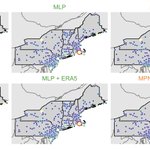
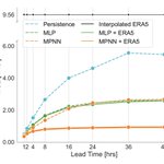
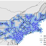
🚢🌊 Our latest paper introduces ORCA (Observation-informed Real-time Correction with Attention), a transformer for correcting numerical weather prediction (NWP) over the ocean.
🧵

Excited to see this published in JGR: Machine Learning and Computation!
Congratulations to lead author Matteo Peduto, who completed this work during his Master's thesis, and thanks to co-authors @qidong_yang, @JoGiezi, and @devistuia for a wonderful collaboration.

We’re particularly interested in generative approaches that produce forecasts that are both accurate and well-calibrated, with applications in energy systems and disaster response. There is substantial flexibility to shape direction and collaborate across ML and Earth science.
📄 Apply here: academicjobsonline.org/ajo/j…
Please share or reach out if you or someone you know may be a good fit!
Happy to share that our paper on how to obtain reliable statistical inferences from satellite-based maps is now published in Remote Sensing of Environment!

This makes it possible to use remote sensing maps in regression studies without fear of drawing incorrect conclusions, reducing barriers to their use across environmental science, economics, and policy.
Congratulations to my student Kerri Lu and postdoc Dan Kluger for leading this effort!
Preprint link: arxiv.org/abs/2407.13659
Publication link: sciencedirect.com/science/ar…

I'm co-organizing this AGU session on AI and remote sensing again this year -- submit your abstracts by Wednesday!

Working on transfer learning and foundation models in remote sensing? We invite you to submit abstracts to our session IN005 at #AGU25 (agu.confex.com/agu/agu25/pre……) organized by @sherwang (MIT),@hannah_kerner (Arizona State), Siddharth Sachdeva, and me (Stanford).

Two more days to submit AGU abstracts! Consider our session if you work on remote sensing for agriculture 🙂

Working on remote sensing of agriculture? Please consider our #AGU session “Remote Sensing for Sustainable Agriculture”. agu.confex.com/agu/agu25/pre… We have invited speakers Dr. Xiangzhong Luo @xiangzLuo and Dr. Hamed Alemohammad @HamedAlemo. Please join us! @sherwang @JillDeines

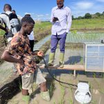
📢 We are hiring a postdoc to work on remote sensing of soil carbon and land degradation! 🌱🗺️ The position will be hosted by the Earth Intelligence Lab & @mitenergy, with an earliest start date of April 2025.
To apply: forms.gle/9iDJRX4nG7odXJLa9
If you're incorporating machine learning predictions into an analysis, you might find our new work useful! Predict-Then-Debias keeps the analysis unbiased while taking advantage of the vast sample sizes of ML outputs.
Led by postdoc Dan Kluger @mitidss

