Storm_101 (@tystorm101) header
Storm_101 (@tystorm101) profile picture

Weather Enthusiast that Makes Forecasts for the State of Kentucky. Trained Storm Spotter for NWS Louisville. Photographs Weather in my Backyard.

The Bluegrass Region in KY
Joined February 2012
Photo by Storm_101 (@tystorm101)Photo by Storm_101 (@tystorm101)Photo by Storm_101 (@tystorm101)Photo by Storm_101 (@tystorm101)Photo by Storm_101 (@tystorm101)Photo by Storm_101 (@tystorm101)Photo by Storm_101 (@tystorm101)Photo by Storm_101 (@tystorm101)Photo by Storm_101 (@tystorm101)Photo by Storm_101 (@tystorm101)
(1/2) Mother Nature put on an Incredible Lightning Show Tonight Including Rare Upward Moving Lightning in Mercer County! #kywx @Kentuckyweather @jloganwxguy @Kentucky_WX @I65WxSils
5
9
13
1,488
(1/2) Since the NAM Family retires today, let's look at them one last time. TONIGHT: A Weakening Squall Line rolls through from West to East. Since we'll have a Moderate LLJ, some Strong Wind Gusts will be possible, but the lack of Instability should keep them in check. #kywx
1
3
1
18
1,857
(2/2) Even outside of the Squall Line, Wind Gusts up to 40mph is a possibility. Also, it does slow down a little bit as it gets towards Central KY which can bring swaths of 1-3 Inches of Rain. Localized Flooding cannot be ruled out. RIP NAM and thank you for your service.
2
143
Yeah, I'm not a big fan of this decision at all. I would much rather just add RRFS and REFS rather than replacing the NAM Models and etc. While this makes a big impact on Severe Weather Forecasting, I'm curious to see how these models will handle Winter Weather Forecasting.
We're only about a week away from the full operational debut of the RRFS and REFS models and the retirement of the NAM, HRW, SREF, and HREF models. Currently working on a video that will discuss what's changing, why NOAA is making these changes, the timeline behind how we got here, and some nuances of the RRFS/REFS that might be useful when forecasting in the future. Stay tuned.
1
6
545
NAM Models does an excellent job on Ice/Mixed Precipitation Events in the Lower Ohio Valley. I'm not sure how the RRFS and REFS are going to handle those difficult setups or just Winter Weather Setups in general. I guess we'll find out soon.
2
92
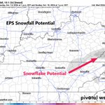
Could Far SE KY see their First❄️of the Season Sunday Morning? The EPS says that there is a chance. I would say Temps will likely be Cold Enough for Flakes, but it comes down to moisture. There is a possibility of a Coastal Low that can throw Moisture our way. We shall see. #kywx
2
2
8
449
#WPC_MD 1494 affecting upper OH Valley into the central Appalachians, #pawx #mdwx #wvwx #ohwx #kywx #inwx, wpc.ncep.noaa.gov/metwatch/m…
1
12
3
19
8,789
Tomorrow: Scattered Storms and perhaps Multicellular Clusters of Storms will be out there as a Shortwave Trough Rolls Through. The Environment would be more like Summer than Fall (Higher CAPE Low Shear). A Few Strong Storms and Localized Flooding are Possible. #kywx
2
3
21
1,986
LET'S GO KENTUCKY!!!
3
350
While Kentucky and LSU go Overtime in Lexington, Gusty Showers is on the way from the South. #kywx
1
514
The HRRR does reflect this, and it does show a decent amount of Instability in the Mid-levels for Tonight. While we won't have Surface Based Instability which should keep the 🌪️ Risk off the table, we could still see Strong Winds and Perhaps some Hail in the Strongest Cells #kywx
Something that is interesting is that we have some clearing in South-central into SE KY moving northward. This can lead to some Stronger Wind Gusts although this is drier look for the UK Football Game Tonight. But this can increase chances for Strong Storms Later On. #kywx
2
6
526
Something that is interesting is that we have some clearing in South-central into SE KY moving northward. This can lead to some Stronger Wind Gusts although this is drier look for the UK Football Game Tonight. But this can increase chances for Strong Storms Later On. #kywx
3
1
7
1,006
Although Isaias is a shell of its former self it will still bring widespread rain later today along with winds gusting 25-35 mph. Isolated places could see gusts up to 40 mph! Rainfall totals by Sunday night will generally be under an inch although a few places could see 2-3".
13
46
6,887
My thoughts haven't changed in terms of impacts for Kentucky. We'll see periods of Showers and even a couple of Storms that would bring Heavy Rain and Strong Wind Gusts. Wind Gusts would generally be 20-30mph though Convective Bands will likely contain Stronger Wind Gusts. #kywx
4
1
10
2,204
Rainfall Amounts will generally be 0.50 - 1.5 inches of rain though there will be swaths of 2-3 Inches of rain where convective bands would train over the same areas and that's where the Minor Flooding Risk comes into play.
209
In terms of how this can impact the UK Football Game in Lexington, it won't rain during the whole game but if one of these Convective Bands were to roll through with the chance of ⚡, it can create delays. With the Windy Conditions, it'll definitely make the game more interesting
As Isaias approaches KY Saturday, we'll have to watch for Convective Bands that would roll through. These bands can contain Heavy Rain+ Strong Wind Gusts as they'll be able to tap into the Strong LLJ. Localized Flooding could occur if these bands train over the same areas. #kywx
1
6
424
As Isaias approaches KY Saturday, we'll have to watch for Convective Bands that would roll through. These bands can contain Heavy Rain+ Strong Wind Gusts as they'll be able to tap into the Strong LLJ. Localized Flooding could occur if these bands train over the same areas. #kywx
3
2
9
4,964
🌀Remnants of Hurricane Isaias will move north after making landfall on the northern Gulf coast. Heavy rainfall and gusty winds are to be expected Saturday evening through most of Sunday.
1
13
2
31
5,533
🌀Remnants of Tropical Storm Isaias is expected to impact the area late Saturday through Sunday. 🌧️Expected impacts include some much needed heavy rainfall and gusty winds.
7
1
16
3,608
Isaias will make a run towards KY this Weekend bringing Light to Moderate Rain + Gusty Winds. Depending on how quickly is gets to us Impacts can be a little greater. However, Isaias is still disorganized which brings some uncertainty. Something to watch. #kywx
2
8
629
#WPC_MD 1370 affecting West of Southern Appalachians, #wvwx #vawx #tnwx #kywx #ohwx #ncwx, wpc.ncep.noaa.gov/metwatch/m…
1
7
25
10,463