

RCARES RCGMRS MTEARS SKYWARN NCS Covering Middle Tennessee since 2023 #tspotter
Nashville, TN
Joined June 2023
- Tweets4.5K
- Following126
- Followers953
- Likes7.8K




The Storm Prediction Center continues to highlight portions of Middle Tennessee under a Marginal Risk level (1/5) for Wednesday November 11. One thing has changed and that’s a 2% tornado risk across portions of Middle TN. These cities include Clarksville, Nashville, Columbia.
As of right now my worry scale is at about a 1/10. Continue to monitor trends. But I think if any storms do go *severe* it will most certainly be isolated. The damaging wind threat has stayed the same at a 5% chance. This will also be isolated in some cases.
I will continue to provide updates as necessary.


1
149
Lenny Mac W4QLC retweeted

WEDNESDAY ⛈️ Chance still possible. Been mentioning it several days ago. More details below but here’s “future radar” look along with it. More details below 👇
Can we see a Spinny 🌪️? It’s very low but thermos have slowly increased within today’s data.

WEDNESDAY PM Storm Chance:
The SPC since yesterday has shifted the Level 1/5 a little farther East to include the I-65 Corridor. It’ll be a warm day with lots of sun and Temps in lower 70°s for South Central and Western KY. Humidity will be low during the day but moisture will increase once the line begins to form out West. Storm Juice has increased in data slightly as storms storms will tap into that along with Low Level Wind energy into the early evening. It’s *not* a Widespread Storm event but some pockets will have chance to see a Strong Storm or two. Timing looks to be from 2PM-9PM from Paducah/Evansville and points EAST toward I-65 for strongest storm chances, for now.
*Also* it is Not Zero, but a Low End Tornado spinup can’t rule out in this area of the marginal risk outlined due to the increasing mid/low level winds coupled with the Storm Energy (CAPE). We will break down more tonight in a LIVE Video Forecast as well.


The Titans are the most useless franchise in the history of the NFL. Sell the team Amy. - the people of Tennessee
6
231
Remember watching The Weather Channel back in the day? It’s been out for awhile but I was today years old I can see the retro version of Local on the 8s! weather.com/retro/ #tnwx
1
1
122
Severe Thunderstorm Warning for... Northern White County in Middle Tennessee... Central Putnam County in Middle Tennessee...
* Until 930 PM CDT.
* At 841 PM CDT, a severe thunderstorm was located 7 miles southeast of Baxter, or 7 miles southwest of Cookeville, moving east at 15 mph.
HAZARD...60 mph wind gusts and penny size hail.
SOURCE...Radar indicated. #tnwx

2
119


Lenny Mac W4QLC retweeted
A severe thunderstorm watch has been issued for parts of Kentucky and Tennessee until 6 AM CDT

ALT This graphic displays Severe Thunderstorm watch number 603 plotted on a map. The watch is in effect until 6:00 AM CDT. The watch includes parts of Kentucky and Tennessee. The threats associated with this watch are a couple tornadoes possible, scattered hail up to two inch size possible and scattered gusts up to 70 mph possible. There are 2,010,639 people in the watch along with 440 schools and 42 hospitals.
Lenny Mac W4QLC retweeted

OHX issues Severe Thunderstorm Warning [wind: 60 MPH (RADAR INDICATED), hail: 0.75 IN (RADAR INDICATED)] for Maury, Rutherford, Williamson [TN] till 5:30 PM CDT mesonet.agron.iastate.edu/vt…


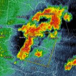
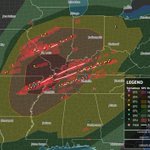
We are getting close to the fall season, but this is just a reminder that Mother Nature likes to play games around November and December. I’ve listed some pictures below of recent events that has happened here in Tennessee/Kentucky.
December 10, 2021 and December 9, 2023
Both days were known for violent tornadoes
This isn’t to scare anyone by any means, it’s just a reminder we do experience severe weather here in the south at any given time if Mother Nature provides ingredients for severe weather. As you may here it all the time,
Don’t be scared. Be prepared #tnwx #kywx


3
185