

Beautiful weather maps, data, and professional viewing tools for affordable price. Tweets by @es5nhc (TT) [email protected]
Joined December 2017
- Tweets4.2K
- Following115
- Followers10.7K
- Likes762





Pinned Tweet
You're working in a team? Then go get a weathermodels.com commercial subscription and add up to 9 subusers to your parent account. Every user has their own dashboard, login and password that can be managed by one parent account. Only the parent account controls billing.


Big upgrade coming for our commercial customers: soon your multi-user subscription will allow you to add up to 9 subusers. So, instead of 2, you get 9 for the SAME price. Perfect for small businesses and TV station weather teams. 😊 #weathermodels #TVweather
A heavy rain event is likely in the Four Corners region on Sunday with the WPC highlighting a level 3 out of 4 risk for excessive rainfall near San Juan River, which just had major flooding a week ago. Shown is a total precipitation forecast from NWS NDFD.
TT
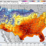
Shown is a forecast from NWS NDFD of maximum temperature today across the continental USA. In weather news, Super Typhoon In-fa is set to impact far northern Marianas on Friday with typhoon warnings in effect in Alamagan, Pagan, and Agrihan.
TT

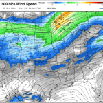
Shown is a scenario of 500 hPa wind speed from 13 UTC HRRR run valid at 6 PM EDT. The SPC has highlighted a level 2 out of 5 risk area for parts of Minnesota and Wisconsin, as there is a possibility of isolated tornadoes, damaging winds and large hail this afternoon.
TT

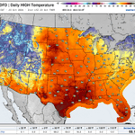
Shown is a forecast from NWS NDFD of maximum temperature across the continental USA today. In weather news, the SPC has highlighted a level 2 out of 5 severe weather risk area for parts the Southwest, with hail, damaging gusts and a tornado or two possible today into tonight.
TT

Shown is a GFS scenario of sea level air pressure and precipitation type through Friday morning. Standing out is a nor'easter off the eastern coast, which is expected to bring significant coastal and marine impacts to parts of Mid-Atlantic through mid-week.
TT
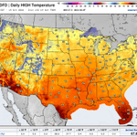
Here's a look at forecast maximum temperature across the continental USA today according to the NWS NDFD. In weather news, a nor'easter will be bringing hazards to the Mid-Atlantic coast and marine areas through mid-week.
TT

A typhoon warning has been issued for Rota and Guam as strengthening Severe Tropical Storm Champi is headed toward Guam and could impact it this weekend as a typhoon. Shown is a scenario of precipitation and sea level air pressure from GFS.
TT
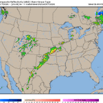
Another active weather day today. There are already plenty of thunderstorm activity in the southern Plains this noontime with the SPC highlighting a level 2 out of 5 risk for this afternoon and evening. Severe wind gusts and some tornadoes could be possible.
TT
Severe thunderstorms could be a concern in parts of the country with the SPC highlighting a level 2 out of 5 risk area from central and southern Plains into Lower Missouri Valley. Shown is a scenario from HRRR of what the radar composite could look like tonight.
TT

Hurricane Isaias is heading towards landfall in Florida Panhandle this evening with tropical storm conditions already beginning along the Gulf Coast. According to the latest update from the NHC, Isaias has maximum sustained winds to 120 mph.
TT
Shown is a forecast from the NWS NDFD of maximum temperature today across the continental USA. Meanwhile, in weather news, the NHC may soon initiate advisories on a developing system in the Gulf, which could bring impacts to the Gulf Coast this weekend.
TT


Excessive rainfall risk continues in the Southern Plains today amid a slow-moving front combined with tropical moisture. Shown is a scenario of precipitation and sea level pressure from HRRR for the coming hours.
TT
Southern Plains could have both severe weather and excessive precipitation today and tonight. Of severe weather risk, the main concerns are severe winds and a few tornadoes. Shown is a simulated radar scenario from HRRR through tonight.
TT
Radar in New Mexico and Arizona is lit up with activity this morning as the WPC has highlighted a level 3 out of 4 risk of excessive precipitation from the Southwest into the central High Plains.
TT
Moisture from the tropical activity ongoing in the East Pacific could set the stage for a heavy rain event this week. Flood watches have already been issued in the Southwest. Shown is a forecast from NDFD of total precipitation for the next 3 days across the continental USA.
TT

Shown is an MRMS Radar composite of Hawaii as the time to finish preparations in the Big Island is now ahead of Hurricane Nolo. Even if the eye stays offshore, there is a risk of tropical storm and hurricane conditions, catastrophic flooding and mudslides.
TT
Shown is a scenario of 120 hour precipitation for Hawaii from the 12 UTC GFS run as the Big Island could experience significant rain and flood impacts this weekend from currently Tropical Storm Nolo. Nolo could make its closest approach to the Big Island as a major hurricane.
TT
