

OU Meteorology | Former @FOX26Houston @weatherchannel @OKCFOX ☈
- Tweets5.1K
- Following2.7K
- Followers4.8K
- Likes35.6K







ALT Explanation of ensemble forecasting


ALT klahoma Climatological Survey map titled “11/11/11: A Palindrome to Remember!” shows daily high temperatures in red and low temperatures in blue across Oklahoma on November 11, 1911. Oklahoma City, circled in red, recorded a high of 83°F and a low of 17°F on the same day, setting both its daily record high and record low temperatures. The remarkable 66-degree temperature range highlights an extraordinary weather event on the memorable palindrome date of 11/11/11.


ALT The Climate Prediction Center 8 to 14 Day Precipitation Outlook issued November 9, 2026, and valid for November 17 to November 23, 2026. Chances for above-normal precipitation are indicated across the majority of the country, including California, the Southwest, the Great Basin/Intermountain West, the Rockies, the Plains, the Mississippi Valleys, the Great Lakes, and the Southeast. The highest probabilities (60 to 70 percent) are centered over the Central and Southern Plains. Near-normal precipitation is forecast for the northernmost parts of the Northwest Pacific, Northern Great Basin, and Northern Rockies, along with a secondary band stretching across parts of the Ohio Valley, Tennessee Valley, and southern Middle Atlantic. Below-normal precipitation is forecast for the Northeast and the northern Middle Atlantic with probabilities reaching 40 to 50 percent over northernmost parts of New England, and 33 to 40 percent chances over the rest of the Northeast and Middle Atlantic.


ALT Why "Super El Niño" is Not an Official Term NOAA's official classification scale caps intensity at Very Strong El Niño (RONI values +2.0°C or higher). There is no recognized meteorological category for "Super El Niño" in official NWS or Climate Prediction Center operations. RONI (Relative Oceanic Niño Index) is a three-month average of how much warmer or cooler than normal the central tropical Pacific is. Categories: NOAA Climate Prediction Center. Forecast issued September 2026



ALT WHAT WE KNOW: A wave of low pressure is likely to develop across the Ohio Valley late Wednesday and then track eastward to off the Mid-Atlantic coast Friday while strengthening. This low pressure will cause expanding precipitation, with rain and high elevation snowfall possible. Much cooler than normal temperatures will accompany this system Friday and through next weekend. WHAT WE DON’T KNOW: The exact placement of the storm — small shifts in the track will greatly change impacts. The amount of snow that may occur, and whether lower elevations will receive any accumulation. The impacts to coastal regions due to gusty winds and onshore flow. BOTTOM LINE: Confidence in storm development is higher than confidence in specific impacts. Forecast details will change over the next several days. Keep up to date with the latest at weather.gov


ALT Severe storm timing

ALT This graphic displays Tornado Watch watch number 701 plotted on a map. The watch is in effect until 10:00 PM CST. The watch includes parts of Kansas, Oklahoma and Texas. The threats associated with this watch are a couple strong tornadoes possible, scattered hail up to two inch size possible and scattered gusts up to 75 mph possible. There are 3,311,529 people in the watch along with 1504 schools and 152 hospitals.


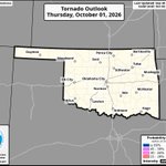
ALT Oklahoma tornado outlook for Monday, November 2, 2026, with the headline “Strong Tornadoes Possible Today.” The map shows a 10–14% tornado probability across portions of north-central Oklahoma, including Enid, Stillwater and Ponca City. A broader 5–9% probability area extends across much of central, eastern and southern Oklahoma, including Oklahoma City, Norman and Tulsa. Hatched areas indicate the potential for strong tornadoes of EF2 intensity or greater this afternoon and evening.
