

Citizen Scientist (22) | Author of SDI-BI-CI-EI Suite | Scienza libera: la conoscenza non ha prezzo
Galway, Ireland
Joined July 2022
- Tweets419
- Following602
- Followers67
- Likes681





Alexander Renășteanu retweeted

This El Niño is coming with much more ocean heat than the biggest events that came before it.
There's a much broader area of extreme warmth near South America as well as warmer waters near California and in the Gulf — factors that could add to extreme winter weather.

Alexander Renășteanu retweeted

I was trying to move faster than NOAA, the attached forecasts anomation suggested the early birth of Lanina probably as early as April to June 2027.although the cold SST could have been uncovered in better way using the @pyreweather settings, the decay of Elnino can become fast.

🌊 ENSO 2026–2027 Outlook: A Possible Transition from El Niño to La Niña
Based on a 21-year analog composite, incorporating some of the strongest historical El Niño events since 1950, using the @pyreweather interface and NOAA CORe data, our latest ANN-based tropical Pacific SST forecast suggests a classic post-peak ENSO transition.
📊 Key Takeaways (November 2026 – October 2027)
1️⃣ November 2026: Persistent warm SST anomalies across the central and eastern equatorial Pacific, consistent with mature El Niño conditions. Gradually fading out through February 2027.
2️⃣ Spring 2027 Transition: A rapid weakening of the warm SST anomalies and a gradual breakdown of the El Niño signal are projected after April 2027.
3️⃣ Second Half of 2027: A developing La Niña-like cold SST pattern may emerge by mid-to-late 2027.
🚦Note
The post-February appearance of cold anomalies in the western pacific equatorial region marks the onset of the discharge phase of the ENSO cycle, serving as the structural trigger for El Niño's decay and the subsequent transition toward La Niña. During mature El Niño events, weakened trade winds allow upper-ocean heat to accumulate and discharge poleward; once this heat content is depleted, cold anomalies emerge in the west and propagate eastward as upwelling oceanic Kelvin waves along the thermocline. As these subsurface cold waters lift toward the surface across the central and eastern Pacific, they erode the remaining warm surface pool while driving atmospheric convection back toward the Maritime Continent. This atmospheric shift reinstates and strengthens low-level easterly trade winds—reversing the Bjerknes feedback mechanism—which accelerates surface cooling and sets the stage for a La Niña imprint to emerge by mid-to-late 2027.
🔬 Latent Structural Evolution & Atmospheric Lag
Although tropical Pacific SST anomalies are projected to shift toward neutral or negative territory by mid-2027, the atmospheric response may not change at the same pace. Atmospheric coupling parameters and associated teleconnections can retain an El Niño imprint for several months, potentially extending into July 2027, before the global circulation gradually adjusts to a developing La Niña background state.
The Spring Predictability Barrier remains an important source of uncertainty in ENSO forecasting. The transition across spring can make it difficult to determine the eventual ENSO state with confidence. This animation illustrates the projected evolution of tropical Pacific SST anomalies across the analog composite, but the spring barrier may affect the reliability of the transition timing. Consequently, the lingering atmospheric influence of El Niño could persist longer than the SST animation alone suggests.
Although older super-El Niño seasons are represented in my climatic reconstruction, which extends back to 1645, incorporating them into the current analysis was not feasible because the present model relies on modern datasets with more consistent observational coverage.
However, using multivariable climatic indicators and broader structural analog contexts, I have identified at least 14 potential super-El Niño events before 1948 back to 1642. These candidates are part of the longer historical reconstruction, although they were not included in the current 21-analog composite.
📈 Baseline: CORe monthly climatology, 1991–2020
Data: NCEP CORe Reanalysis / Mercator.
This is an interim statistical outlook and remains subject to revision later in winter 2026 as additional observations and model data become available.
Statistical Structural Model by Mr. M @Statisticizer
#ENSO #ClimateForecast #ElNino #LaNina #Weather #WxTwitter #PyReWeather
Alexander Renășteanu retweeted
Good morning!
Even when WQBO started in February 2026, it was a premature transition from late 2025 EQBO . I remember forecasting this back in autumn 2025, pointing to an early shift from easterly to westerly QBO. Many were skeptical then. Will share the link if I find it.
Alexander Renășteanu retweeted
🔁 On “Super El Niño” overestimation & what models may be missing
There is an important point being raised here by Sebastian @Stysz about systematic overestimation of SST anomalies in current ENSO projections.
One possible contributing factor for the over-weighting in those models predicting super Enino—not a primary driver, but a meaningful modulator—may lie in the QBO structure and its representation.
Based on my analog-based QBO kernel projection (30mb & 50mb) :
We are likely heading into a strong westerly QBO phase in May . The projected anomaly approaches or exceeds the climatological ceiling (~+0.8 SD) derived from ~74 years of data . This suggests unusually strong stratospheric westerlies early in the season. Latest observations show the QBO firmly in a westerly (West) phase and descending across the vertical column (Singapore RAOB).
However, what follows is equally important:
a. A rapid vertical and temporal transition is projected after May.
b. The signal weakens and reverses toward easterly phases by mid-summer (especially at 30mb)
Why this matters
c. Also, a rapid QBO weakening ( easterly QBO) post June suggests possible slowness of Westerlly winds into Easterly phase ( negative QBO values imply easterly winds) which may affect those models at later stage ( during summer) and this was confirmed using other analysis forecasts for ENSO i have shared recently( links in the comments). Note the proximity between the 30mb and 50mb QBO Values in August, they almost Kiss each others!
This type of high-amplitude, short-lived QBO pulse can:
/Disrupt tropical atmospheric coherence
/Alter MJO propagation and persistence
/Reduce the efficiency of westerly wind bursts (WWBs) over the Pacific
/All of which are critical for sustained ENSO amplification
A possible implication from QBO forecast:
If models are Over-smoothing atmospheric drivers, or
Underrepresenting rapid QBO transitions and vertical structure then they may be implicitly assuming a more stable and supportive atmospheric background than what may actually occur.
This could contribute ( #indirectly ) to overestimation of ENSO growth rates , especially beyond the spring barrier.
Bottom line:
This is not about QBO driving ENSO. But rather:
📉 A volatile QBO evolution may act as a limiting factor
📈 While models may be leaning toward over-persistent coupling, this coupling tends to speed up in May but weaken thereafter until August.
Verification / Potential falsification point:
If my projected QBO (30mb & 50mb) estimates are correct, we should observe a rapid acceleration into positive anomalies (WQBO) over the coming weeks peaking in May above the climatological Norm. Such a shift would imply strong westerly zonal winds in the tropical stratosphere, approaching the upper range of climatological variability. Failure to observe this acceleration would challenge the projection and effectively nullify this component of the framework I have shared tonight.
Warmest Regards
@Statisticizer .


Alexander Renășteanu retweeted
This decline in westerly winds was predicted as early as April 2026. using a statistical SARIMAX forecast, nitter.cf/Statisticizer/status/2… .So it isn't a surprise there is a decline in upper levels >50mb WQBO,while the lower QBO levels might continue to be in a positive weakening phase.
🔁 On “Super El Niño” overestimation & what models may be missing
There is an important point being raised here by Sebastian @Stysz about systematic overestimation of SST anomalies in current ENSO projections.
One possible contributing factor for the over-weighting in those models predicting super Enino—not a primary driver, but a meaningful modulator—may lie in the QBO structure and its representation.
Based on my analog-based QBO kernel projection (30mb & 50mb) :
We are likely heading into a strong westerly QBO phase in May . The projected anomaly approaches or exceeds the climatological ceiling (~+0.8 SD) derived from ~74 years of data . This suggests unusually strong stratospheric westerlies early in the season. Latest observations show the QBO firmly in a westerly (West) phase and descending across the vertical column (Singapore RAOB).
However, what follows is equally important:
a. A rapid vertical and temporal transition is projected after May.
b. The signal weakens and reverses toward easterly phases by mid-summer (especially at 30mb)
Why this matters
c. Also, a rapid QBO weakening ( easterly QBO) post June suggests possible slowness of Westerlly winds into Easterly phase ( negative QBO values imply easterly winds) which may affect those models at later stage ( during summer) and this was confirmed using other analysis forecasts for ENSO i have shared recently( links in the comments). Note the proximity between the 30mb and 50mb QBO Values in August, they almost Kiss each others!
This type of high-amplitude, short-lived QBO pulse can:
/Disrupt tropical atmospheric coherence
/Alter MJO propagation and persistence
/Reduce the efficiency of westerly wind bursts (WWBs) over the Pacific
/All of which are critical for sustained ENSO amplification
A possible implication from QBO forecast:
If models are Over-smoothing atmospheric drivers, or
Underrepresenting rapid QBO transitions and vertical structure then they may be implicitly assuming a more stable and supportive atmospheric background than what may actually occur.
This could contribute ( #indirectly ) to overestimation of ENSO growth rates , especially beyond the spring barrier.
Bottom line:
This is not about QBO driving ENSO. But rather:
📉 A volatile QBO evolution may act as a limiting factor
📈 While models may be leaning toward over-persistent coupling, this coupling tends to speed up in May but weaken thereafter until August.
Verification / Potential falsification point:
If my projected QBO (30mb & 50mb) estimates are correct, we should observe a rapid acceleration into positive anomalies (WQBO) over the coming weeks peaking in May above the climatological Norm. Such a shift would imply strong westerly zonal winds in the tropical stratosphere, approaching the upper range of climatological variability. Failure to observe this acceleration would challenge the projection and effectively nullify this component of the framework I have shared tonight.
Warmest Regards
@Statisticizer .
Alexander Renășteanu retweeted

Oh ooooo. Those who were banking on a strong W Qbo , could be rubbing their eyes the forecast is for a weaking W Qbo starting in early December. This could be a game changer.

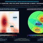
Here is the culprit destroying the W-QBO core. Look at the white EP-Flux vectors bending straight into the equator (EQ–15°N) from Nov 16 to Dec 2:
massive planetary waves dumping easterly momentum directly onto the 20–50 hPa positive island, erasing it by early Dec.
#PolarVortex


Alexander Renășteanu retweeted

It's not just all El Niño all the time but the influence of the large #PolarVortex (PV) disruption on the weather heading into Dec is evident. Apropos, I present my unique perspective on how El Niño & the PV interact to influence the weather. Blog updated: published.aer.com/aoblog/aob…

Alexander Renășteanu retweeted

Tonga Underwater Volcanic Eruption, Water Vapour Update, the WV dispersal in the stratosphere looks likely to be completed in the early 2030’s. That’s assuming the current El Niño doesn’t change anything in respect of further WV development in the atmosphere.


Alexander Renășteanu retweeted

The polar vortex is taking over the ENSO Blog. How could warming high above the Arctic raise the odds of colder weather farther south? And where does El Niño fit in? buff.ly/L6ttagK #PolarVortex #ElNiño #ClimateScience #COP31
Alexander Renășteanu retweeted

QBO Dive: It will be interesting to diagnose various global phenomena more eQBO, but also if it has implication on early arctic wave-2 lobes in Dec, whilst then becoming milder - flat jet after in Jan/Feb instead which could correspond to active CONUS svr weather - potentially?


I was analyzing QBO data, including that from 2016 and 2020, and I made a shocking discovery... 2026 is heading toward another QBO disruption, just like 6 years ago. A QBO E phase combined with a Mega Niño a truly destructive combination.
#Winter
#ElNiño
#PolarVortex
#Cold


Alexander Renășteanu retweeted

谷歌悄悄开放了 Gemini 4 Hydrogen 免费 API,又有羊毛可以薅了!😂
支持直接接入各种 Agent 客户端,日常开发又多了个免费模型可用。
📌 核心参数与免费额度:
1、上下文:100 万 Token
2、RPM:每分钟最多 15 次请求
3、RPD:每天最多 1,500 次请求
4、额度按 Project 计算,同一项目下的多个 API Key 共享配额。
获取方法:
1、打开 aistudio.google.com 登录
2、创建 API Key,复制密钥
3、在支持 Gemini API 的客户端中配置密钥,模型 ID 填写 gemini-4-hydrogen
免费额度拿来跑跑日常 Agent 任务,还是挺香的。


Alexander Renășteanu retweeted

Il est probable que la propagation du réchauffement stratosphérique dans la haute et moyenne troposphère, n'ait que peu d'effets du moins sur l'Europe.
On pourrait retrouver à l'approche de décembre, des hautes pressions surtout sur le continent et en allant vers l'est de la Scandinavie et la mer de Kara. L'activité dépressionnaire parfois assez intense, persisterait sur l'Atlantique, alimentée par l'EPO-/PNA+ nord américaine et un fort courant jet subtropical sur le sud des USA. Donc il est de plus en plus probable qu'on reste dans un flux dominant d'ouest à sud-ouest doux et humide, même si on ne peut pas exclure non plus des poussées anticycloniques notamment sur le sud et l'est du pays.
En gros clairement, le mode atmosphérique El Nino qui est pleinement opérationnel au vu des placements des centres d'action, devrait l'emporter très largement sur les effets du réchauffement stratosphérique. C'était prévisible !
Prédominance douce et humide en somme jusqu'à début décembre pour nous même si ça n'exclut pas quelques journées plus anticycloniques et plus sèches. C'est des tendances plutôt bonnes pour nos nappes phréatiques et la nature avec une sécheresse se résorbant, à contrario elles sont mauvaises pour la basse et moyenne montagne avec une limite pluie-neige souvent bien trop haute. Pour l'heure, vraiment "aucune surprise" avec cette "saison humide" qui est en marche dans une grande douceur, défavorable aux montagnes.
A voir si les choses pourraient évoluer courant décembre, je suis bien sceptique, c'est la tendance générale de l'hiver de toute manière.


Alexander Renășteanu retweeted

The 10 hPa zonal mean wind at 60°N, having briefly touched 0 m/s on Nov. 6th, has now properly reversed into easterly flow over the past few days.
As mentioned in previous updates, this is the earliest such reversal on record. Previously, the earliest occurrences were during the 1968/69 and 2025/26 winters, both on Nov. 28th.
Models are still struggling to resolve this unprecedented evolution and its interaction with the tropospheric circulation, so significant run-to-run changes are to be expected. It will certainly be interesting to follow!
Looking at the recovery, the vortex at 10 hPa is forecast to return towards seasonal-average strength. GFS and GEFS show a faster recovery, while ECMWF and AIFS are more conservative.
However, the multi-level charts suggest that weaker-than-normal winds could persist lower down in the stratosphere. This is consistent with the signals in the zonal GPH charts, where some downward progression of the anomalies and potentially renewed stratosphere-troposphere coupling remains possible.


