Da'Vel Johnson (@Da_VelJ) header
Da'Vel Johnson (@Da_VelJ) profile picture

#NOLA Native & Meteorologist. I'm into: Science | Politics | Economics | Finance I Data | Photography | Capoeira | Français | Español +more. Enjoy life. ⚜

Washington, DC
Joined June 2009
Photo by Da'Vel Johnson (@Da_VelJ)Photo by Da'Vel Johnson (@Da_VelJ)Photo by Da'Vel Johnson (@Da_VelJ)Photo by Da'Vel Johnson (@Da_VelJ)Photo by Da'Vel Johnson (@Da_VelJ)Photo by Da'Vel Johnson (@Da_VelJ)Photo by Da'Vel Johnson (@Da_VelJ)Photo by Da'Vel Johnson (@Da_VelJ)Photo by Da'Vel Johnson (@Da_VelJ)Photo by Da'Vel Johnson (@Da_VelJ)
Da'Vel Johnson retweeted
Strong El Niño winters see about 3x more *total* severe weather reports than neutral winters here in South Florida. Note: Severe weather can happen in any winter. El Niño raises the odds but it doesn't guarantee the outcome. #Day2 #FloridaElNiñoAwarenessWeek
7
56
9
265
108,754
Da'Vel Johnson retweeted
Last night a 1 in 1000 Year Rainfall Event occurred over Blue Ridge, GA. Both the 12-hour rainfall amount of 11.19 in and the 6-hour rainfall amount of 10.28 in exceeded the 1 in 1000 year rainfall event mark during their respective time frames per the NOAA Atlas 14. #gawx
24
167
13
839
111,377
Close to downtown McCaysville, Ga this morning in Fannin County. It is not good @NWSAtlanta
12
45
3
244
15,743
Da'Vel Johnson retweeted
NEW RECORD 18.05' Highest since 1990. Downtown MaCaysville, GA and Copperhill, TN are underwater. 7-10' of catastrophic flooding. Water coming down slowly. We have had FLASH FLOOD EMERGENCIES since Saturday in seperate locations across the country.
2
10
1
29
8,501
Da'Vel Johnson retweeted
The river through Copperhill, Tennessee went higher this morning than it has ever been measured, cresting just over 18 feet and beating the 1990 record. This is a rescue boat crossing downtown McCaysville, Georgia, right across the state line. Video: 511GA.ORG traffic camera
25
192
10
1,195
69,619
Da'Vel Johnson retweeted
RIVERS SURGE TO RECORD LEVELS AMID FLASH FLOOD EMERGENCY ALONG GEORGIA-TENNESSEE BORDER: A Flash Flood Emergency remains in effect across Polk County, Tennessee, and Fannin County, Georgia. The Toccoa River in Georgia and the Ocoee River in Tennessee are in major flood stage and have set new record heights, with evacuations still underway. Watch FOX Weather for LIVE coverage of the ongoing Flash Flood Emergency: foxweather.com/weather-news/…
2
17
1
44
2,870
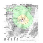
Here's a 3-day loop of Hurricane Isaias and its transition to a post-tropical system. In addition to devastating winds and storm surge along the Gulf Coast, Isaias was responsible for flooding in western North Carolina and a number of tornadoes across central and eastern NC today
8
87
5
487
57,378
Da'Vel Johnson retweeted
Significant damage after a tornado impacted the town of Candor, North Carolina in Montgomery and Moore County. Several structures were damaged, and a restaurant was destroyed along Hurricane Drive. Photo below courtesy of Dylan Allen on Facebook, which I will link below. #NCwx
7
156
6
532
37,654
Da'Vel Johnson retweeted
Preliminary data continues to be assessed at NWS Mobile, seeing a distinct corridor of enhanced winds (80–110+ mph) WEST of where Hurricane Isaias made landfall. Data review and quality control will continue, with a final post-storm assessment expected in the coming days.
5
46
7
190
38,497
HUGE SURGE hitting in Destin, FL! #FLwx
55
376
44
2,794
389,049
Da'Vel Johnson retweeted
I’m seeing some pretty significant damage between #Navarre and #GulfBreeze #Isaias #flwx
14
126
10
568
41,470
Da'Vel Johnson retweeted
The wind is getting ludicrous. Inner eyewall is closing in. Destin, Florida 6:20pm @MaxVelocityWX @WxFront #flwx #isaiah
89
525
69
4,704
346,568
Da'Vel Johnson retweeted
An ominous view of Hurricane Isaias nearing the Gulf Coast early Friday, with thunderstorms erupting in its eyewall and along its eastern flank. Isaias is forecast to reach Category 3 strength before becoming the first hurricane to make landfall in the U.S. in exactly two years.
15
101
10
414
59,018
Da'Vel Johnson retweeted
Forget models and spaghetti plots. This should be your number one tool when looking at #Isaías weather.gov/srh/tropical Threats and Impacts tool that shows threats can and WILL happen outside of the cone
5
33
4
148
33,404
Da'Vel Johnson retweeted
When looking at ensemble means for TD 9, especially of multiple ensembles blended together, you'll notice the ensemble mean track is west of most of the ensemble members. This isn't a calculation error - it's a major limitation of using ensemble mean to forecast hurricane track:
9
33
2
282
25,923
Da'Vel Johnson retweeted
View of the U.S. Capitol as the storm hit Washington D.C. last night.
211
1,354
582
14,818
5,015,210
Da'Vel Johnson retweeted
It appears from the most recent Landsat 9 set of images that, as I suspected, a massive glacial collapse on Langtang Lirung (99th highest peak in the world) looks likely to be the cause of yesterday’s terrible tragedy in Nepal. Image 1 shows what the scene looked like a few days back, and image 2 shows the scene yesterday afternoon. A huge loss of glacial ice at about 5,248 metres, coordinates 28°17'10.74"N 85°32'04.70"E. Such a massive collapse would have allowed little time for large-scale evacuation downstream. It almost looks like half the mountain disappeared.
13
213
14
1,449
96,835
Da'Vel Johnson retweeted
Catastrophic flash flooding on the big island of Hawaii’s southern coast. Hurricane Lala brushed by and did this! #hurricane #lala #hawaii
3
36
1
171
9,503
WPC is issuing storm summaries for tropical cyclone Lala across the Hawaiian islands. Attached is a map of preliminary rainfall totals associated with the storm. wpc.ncep.noaa.gov/discussion…
6
124
22
588
115,149
Da'Vel Johnson retweeted
Widespread smoke and haze-filled skies remain over the Pacific Northwest as wildfires continue to burn in the region.
1
27
1
72
6,166