
I'm always watching the weather
TRI CITIES TENNESSEE
Joined April 2022
- Tweets1.6K
- Following409
- Followers199
- Likes5.9K





Weather man jack retweeted

⚠️Important Winter Weather Update❄️
• Scattered showers and cooler conditions are expected with highs only in the 50s. Gusty winds up to 30 mph are possible at times.
• Rain showers will change to snow showers in portions of the higher elevations tonight. That will increase Friday into Friday night before tapering off Saturday. À Winter Weather Advisory is in effect for accumulating snowfall above 3,000 feet and wind gusts up to 35 mph. Slick travel and reduced visibility from blowing snow is possible at times.
• The lower elevations will see mostly rain, but there is a chance some of us see snow showers Friday, particularly late into Friday night and Saturday morning. Accumulation looks like a dusting at max and not even that for many of us outside of the mountains. If there is an uptrend in moisture I will adjust the forecast accordingly.
• Temperatures this weekend will only be in the 40s for highs and 20s and 30s for lows! Wind chills may drop into the 20s at times and teens in the higher elevations. Dress warm.


Weather man jack retweeted

2:02pm CST #SPC Day1 Outlook Slight Risk: across parts of central/southern Indiana, western Kentucky, and far southeastern Illinois spc.noaa.gov/products/outloo…

Weather man jack retweeted

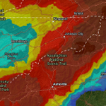
Here's my preliminary snow map for Thursday night through Saturday morning.
Locally more is possible on the mountain tops.
I'll look over the latest data and update this map for News 5 on FOX (10pm) and News 5 at 11.
Forecast video and details: [Link in bio]


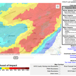
Chances have gone up ^ for the likelihood of winter weather impacts!
@TrackerSacker @SCweather_wx @weathermandan10 @DrcrawfishWx #snow #Winterstorm #wx #tn #nc #va
(this shows the chance of winter weather area Impacts)

for about 5 seconds thought this was @TrackerSacker 😂

Cold, wind and rain ruin a day outside, and most hoodies handle one. The BÆRSkin Hoodie 5.0 is 340gsm MicroFleece warm to 30°F, seals at the hood, waist and cuffs, and zips into a 20,000mm rain shell. Buy 2 Hoodies, Get 1 Rainjacket Free. Shop now →
1
23


Bro what are we doing @SCweather_wx @SeqSevereWx @weathermandan10 @TrackerSacker @DrcrawfishWx #wx #wxtwitter #Trending

PEAK FALL COLOR IS FINNALLY HERE IN BRISTOL,TN! @ExploreFall @SCweather_wx @TrackerSacker @weathermandan10 @netnwx


Weather man jack retweeted

Hi guys
I was tired of missing cool sunsets so I made a bot and website to show sunset quality forecasts.
SkyGrade compares several recent runs of a high resolution weather model to grade every spot's sunrise and sunset from A+ to F, based on how much high cloud there is to catch the color, whether lower clouds block the light, and how much smoke or haze is in the air.


Weather man jack retweeted

This will be really cool. Instead of individual warnings being issued for a storm, the polygon will follow the storm so everyone gets equal warning times.

It’s been in development a long time, but finally, “threats-in-motion” likely to come in 2028 as new software is implemented across the National Weather Service. Severe storm warnings will move with the storm. @nwas
Some pictures and a video this morning of the freeze at the time of this recording it was 28 degrees! 10/18/26
📍BRISTOL, TN
@TrackerSacker @SCweather_wx @weathermandan10 @DrcrawfishWx @NWSMorristown @netnwx #wx #TNWX


3
6
304