FLWX_TropicalTracker_✝️ (@flimpct) header
FLWX_TropicalTracker_✝️ (@flimpct) profile picture

Matthew 5:15-16 Joshua 1:8 ✝️ Husband, Storm Chaser ⛈️🏃‍♂️(3) Sports ⚾️🏉⛳️ Surveyor 👷‍♂️ All of which are my passions. Please let's discuss 🧐🌩

St Cloud, FL
Joined August 2020
Photo by FLWX_TropicalTracker_✝️ (@flimpct)Photo by FLWX_TropicalTracker_✝️ (@flimpct)Photo by FLWX_TropicalTracker_✝️ (@flimpct)Photo by FLWX_TropicalTracker_✝️ (@flimpct)Photo by FLWX_TropicalTracker_✝️ (@flimpct)Photo by FLWX_TropicalTracker_✝️ (@flimpct)Photo by FLWX_TropicalTracker_✝️ (@flimpct)Photo by FLWX_TropicalTracker_✝️ (@flimpct)Photo by FLWX_TropicalTracker_✝️ (@flimpct)Photo by FLWX_TropicalTracker_✝️ (@flimpct)
Replying to @Support
@Support Can we please fix the many bugs and issues within the chat feature of this app? I am noticing so many problems and this is all because of the latest updates which actually destroyed something that was working SO well! - some of the members in my group chat cannot see GIFS or videos -unable to rename the group name - also having the group disappear on some of the group members for no reason Those are just a few of the problems I'm noticing. Would anyone like to chime in on any issues they are experiencing within the application?
1
2
3,105
Verbiage is everything. Perhaps we get something tropical. – at Holden Heights, FL
Something to watch perhaps as a new frontal low develops off the Florida coast and pulls north for the weekend. Euro and EuroAI over the last 6 runs below. This model is the most bullish on this today.
65
FLWX_TropicalTracker_✝️ retweeted
The WPC has now issued moderate risks (level 3/4) of flash flooding for Wednesday, Thursday and Friday for portions of the FL east coast. Wow. Northern Brevard County (including Cape Canaveral) is included in all 3.
3
10
1
69
6,774
Welp, you know things are getting serious when Jim is in Florida for a non hurricane event! – at Edgewood, FL
Couple pictures flying into Melbourne today. This is west of i95. No place for additional rain to go. Sooooo wet!
8
272
FLWX_TropicalTracker_✝️ retweeted
CENTRAL FLORIDA: If you were wondering what an El Niño winter 7-day looks like... here it is. Sunshine not seen again until Saturday PM, maybe Sunday for many of us.
9
1
40
4,513
Why does it feel like Tampa NWS puts out low resolution pixel charts relative to some other NWS affiliates. Lol. Time for some upgrades! – at Rio Pinar, FL
Scattered light to moderate showers have began moving into the Tampa Bay area. More rain is in the forecast today through Saturday. The current forecast is up to 1 in. across West-Central FL, though localized higher amounts are possible, especially inland. #FLwx
1
225
FLWX_TropicalTracker_✝️ retweeted
This Florida mess eventually settles over the Atlantic in a few days. Nothing 'tropical' on NHC outlooks, but low pressure nonetheless could deepen. Depending how close to the coast determines any impacts. Timing this weekend is when we could see something try and lower. But rains/winds/waves for the eastern seaboard seems possible on its escape. Latest EURO/Google ensembles showing 46% chance yes of something under 1000mb (76/167 members). spaghettimodels.com
7
61
7,541
FLWX_TropicalTracker_✝️ retweeted
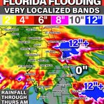
NEW: Flood Watch now in effect for over 10.6 million Floridians along the East Coast due to expected rain ahead. 3–6" on average within the Flood Watch area through Saturday, with isolated totals 10"+ in harder hit areas. Not everyone will see extreme rainfall and exact locations are harder to predict, but right now Brevard County does have a greater potential than others. I'm also watching the South Florida Metro and Daytona to St Augustine for an enhanced flood threat. Considering how much rain they've had over the past couple of weeks, it's one of those forecasts you actually hope is wrong. Stay weather aware this week and keep it here for no hype, just the facts weather 24/7. - Matt Devitt Weather
6
36
7
195
12,328
FLWX_TropicalTracker_✝️ retweeted
11/17/26 | Increasing coverage of showers and storms begins today, with the east central Florida coast outlooked in a Slight Risk (2/4) of excessive rainfall. Localized flooding will be possible, especially along the coast, with a chance for some spots to see 4" and greater.
1
22
3
59
4,339
Sandbags available in Okeechobee
Okeechobee County will begin offering sandbags to residents at 8 AM tomorrow, November 17. Limit of 10 per vehicle.
1
4
324
💯⬇️ – at Conway, FL
People always ask still "what's your fav model?" or "Which is best?" It's the Euro AI handily for everything non-hurricane related. Been consistent for this Florida flood event later this week with low pressure forming off our east coast. What it's doing now is slowing the system down some. That means even higher chance for major rain in some part of east-central FL. These type of weak lows are notorious for producing mega rain.
4
381
FLWX_TropicalTracker_✝️ retweeted
I'm having El Nino 97/98 in FL flashbacks
3
6
3
43
4,863
Light rain beginning to move in over portions of Central Florida. The moisture working off of the Gulf is more upper level induced and the energy we see coming off the Atlantic is in the lower levels. Eventually the two pieces of energy will collide creating trailing rain bands. – at Conway, FL
1
13
714
FLWX_TropicalTracker_✝️ retweeted
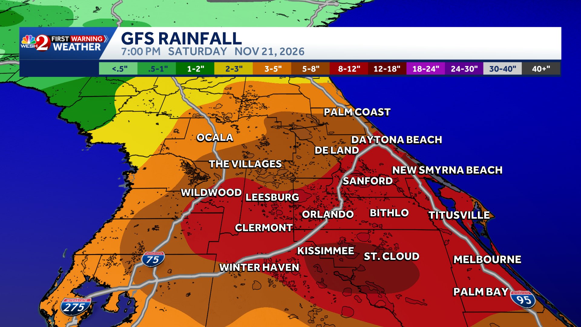
With regards to the heavy rainfall forecast it's important to remember that the models will fluctuate on amounts and location so keep checling back in for updated information. The take-a-way is that a heavy rain signal is there so we all need to monitor this carefully. #weshwx
1
1
9
1,301
👀🫠 – at Conway, FL
Afternoon #GFS model run is much more widspread with 8-12+" of rainfall...don't like this trend. The previous run can be seen on our rainfall comparison map that had the heavier amounts up north. Latest #Euro is coming in now. Stay with #weshwx for updates.
1
8
1,380
And models continue to follow suit to what we've been seeing in real time. Credit to @WeatherProf
The energy off of Palm Bay is a convergence zone. These typically attract weak surface lows. Totals will likely be highest around this area and northward. Could see some areas south where totals are limited due to dry air mixing in and where the low tracks.
1
8
719
Glad I started sounding the alarm yesterday. Pretty incredible change of tune over the last 24 hours. #WxUpdate #FLWX🌴 #CentralFLWX 📡✝️⛈️ – at Conway, FL
A multi-day heavy rainfall event is likely to result in scattered instances of flash flooding along the Florida East Coast from Miami to Jacksonville. Rainfall totals of 3-6 inches with isolated higher amounts of 6-10 inches are possible by the end of this week.
8
491
FLWX_TropicalTracker_✝️ retweeted
Forecast has trended wetter 🌧️thru the end of the week, with periods of showers & downpours bringing increased flooding potential daily starting Tuesday. Only 6 inches of water can wash a person away & 1-2 feet of water will carry away most 🚗vehicles. Turn Around Don’t Drown!
1
5
2
28
5,257
FLWX_TropicalTracker_✝️ retweeted
Not to get too carried away and cart before the horse, but there's another system in the cards behind this week's flood for Florida. All models showing a strong Gulf low around Thanksgiving end of next week. Given track and setup, would be more a severe weather (tornado) threat than flooding. Details very far from knowing for sure. Just putting on your radar. Again, as I have said now 300x, near record El Niño is going to make this winter season pretty wild in Florida. Basically a storm a week.
8
21
2
142
9,828
‼️‼️‼️
Where is this water going to go?
3
252