

Jamie. BSc EnvSci Student @ UoR. Communications Director @TorroUK. Weather mad, mainly focused on SE England. Aurora/space weather. Occasionally a photographer!
Reading/Herne Bay
Joined May 2016
- Tweets43K
- Following646
- Followers10.4K
- Likes36.4K




MetJam retweeted

🟦 CLEAN FEED | The post-Newsnight weather bulletin has now been discontinued, as part of the BBC cuts.
Chris Fawkes presented the final bulletin last Friday evening at 7.30pm on BBC Two.
MetJam retweeted

Largely clear skies across England & Wales gave a unique chance to study the temperature response to the 12th Aug 2026 solar eclipse — a rare evening eclipse ☀️🌗🌍
Screen temp reached a mean anomaly of –1.8°C ~16 mins after max eclipse 📉
@RMetS paper: rmets.onlinelibrary.wiley.co…

I feel like we are in pretty dire times when we are assessing the atmospheric transport of any contaminants from a nuclear weapon being potentially deployed 😵💫

🌍 ☢️ Multi-Layer Wind Anomaly Analysis | 5–15 November .
ترجمة للعربية بأول تعليق . توقعات شدة و اتجاهات الرياح و الملوثات في حال ضربة نووية لايران .
With the possibility of nuclear weapon use over Iran remaining uncertain, I wanted to examine how the atmospheric circulation during 5–15 November might influence the potential transport of dust and other airborne contaminants should such an event occur.
I have attached zonal wind (U) anomalies from the surface to 700 hPa, with the corresponding meridional wind (V) anomalies for the same atmospheric layers in the comments. The Zonal winds depict west-east wind and meridional wind anomalies depict the North-South winds.
The objective is to examine the full atmospheric column and compare the prevailing wind patterns with historical analogs, rather than relying on surface wind direction alone.
Key regional areas of concern:
🔴 Pakistan and Afghanistan & India – Primary downstream areas of interest
Their eastern and northeastern position relative to Iran makes them important areas to monitor, particularly in relation to the 850–700 hPa wind patterns and possible eastward or northeastward transport.
🟠 Oman and southern Gulf states ( UAE and Saudi Arabia SE) – Conditional low-level transport
The 925–850 hPa meridional wind patterns could help identify potential transport towards the Gulf of Oman and surrounding coastal areas.
🟡 Western and northern India – Possible longer-range transport.
The upper-level circulation, particularly around 300 hPa, deserves attention when assessing the possibility of longer-range transport, depending on plume altitude and vertical atmospheric mixing.
Why use Analog Ensemble methods?
Historical analogs can help identify previous atmospheric situations with comparable multi-level wind patterns and assess the range of possible circulation developments.
I am particularly interested in examining wind direction, speed, vertical differences and the consistency of these patterns across atmospheric layers.
These are potential meteorological transport pathways, not predictions of nuclear weapon use, Actual contamination or actual exposure, they should be used as qualitative probabilistic views of how aerosol may transport and how far incase of nuclear weapon was employed. Any real assessment would require dedicated atmospheric dispersion modelling and radiation monitoring.
#Meteorology #AtmosphericDynamics #AnalogEnsemble #Reanalysis #SynopticScale #DataAnalysis #PyreWeather


MetJam retweeted

November
Plenty high pressure, more unsettled late on
High pressure to 9th, maybe something a touch unsettled 10-13th before more high pressure, particularly in the South
More widely unsettled possible late on, small chance of colder air, especially in North
#UKweather #LakeDistrict



MetJam retweeted

After recent swings between near-record highs and lows, the atmosphere has settled down again, with 1044.2 hPa at Tulloch Bridge on Monday marking the UK's highest November pressure since 1999
High pressure is now set to dominate through much of this week


Showers trailing into eastern England this morning - a more defined convergence zone is running into east Kent from the North Sea but some lighter showers are moving into Norfolk.

There's the dystopian twist - convinced this ad break might not be real either 🤣. #millionpoundshot
Million Pound Shot looks to be the fakest quiz show ever at the minute - the anti-gambling ad is being setup already, mentions of credit cards and overdrafts already 🥴
Tomorrow is expected to join the 31-day collection at Manston since 1961, where the 09 UTC mean sea-level pressure exceeds 1035 hPa at the start or end of each rain day (09-09 UTC). A tighter threshold yields only 7 days that exceed 1035 hPa in both observations.


MetJam retweeted

Today marks exactly 10 years since Hacker T. Dog delivered the greatest unscripted line in British television history.
"We're just normal men... We're just innocent men."
MetJam retweeted

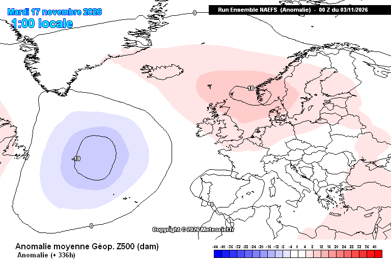
Small Shortwave upper trough will dive South during the next 24 hrs around the Atlantic Ridge with a vorticity filamant associated with it, this will run into the rear of the existing 500mb trough over Central Europe and extend it west a little. This will serve to deepen the boundary layer over the SE of England and East Anglia with an increasing wind, more turbulant cloud base and showers in the SE. Despite the high pressure over Scotland by this time 1044mbs A Dover Strait shower train and Showers into Coastal East Anglia.
During Tuesday a further filament of vorticity will run west from Jutland and the flow will veer Easterly over much of the South. Feeling colder in the wind and fog will become more of a CuST problem with a mix of Cu St and breaks leading to some sunshine.
By Wednesday a large rex block will have established with 500mb ridge over Scotland and Cut off Low to the south of the block over Biscay.
The ridge sinks ESE into Europe thereafter and the vortex will round and move N so threat of showers and rain returning to the SW later in the week into the weekend but beyond that into next week there is great ensemble spread in solutions depending on how developments in the SW Atlantic develop and how much sub tropical moisture surges NE.


A gap in the clouds here in Herne Bay that wasn’t forecast - North Sea cloud is notoriously hard to forecast, probably one of the most painful things to forecast in the UK.


A likely minimum relative humidity of 5.8% (±2.5%) at the University of Reading observatory on the 25th of April this year is the lowest reliably documented on record in lowland England - from a new research article by Burt and Harrison (2026).
doi.org/10.1002/wea.70153
